Download
Preview
Add to list
More
169.3 km
~8 days
4281 m
Multi-Day
“Embark on the Cleveland Way to journey through England's moorland blooms and coastal splendors, steeped in rich history.”
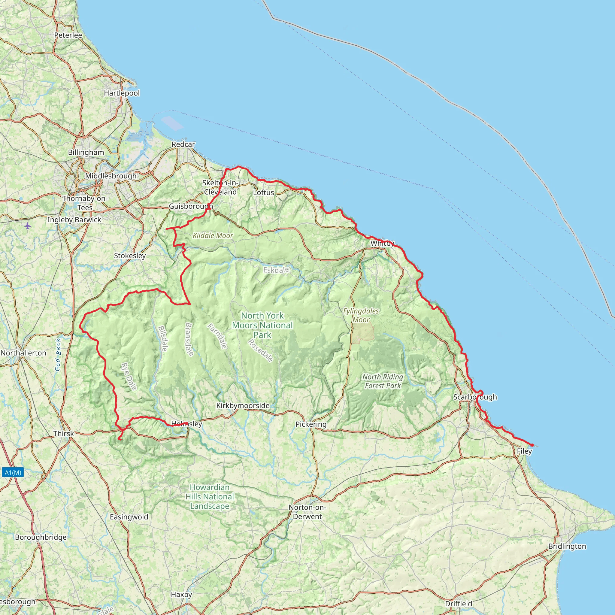
The Cleveland Way unfurls across the heather moorland and rugged coastline of North Yorkshire, offering hikers a diverse trekking experience. Spanning approximately 169 kilometers (105 miles) with an elevation gain of around 3100 meters (10,170 feet), this point-to-point trail is a medium-difficulty adventure that takes you through a tapestry of historical landscapes and natural beauty.
Starting the Journey
Your trek begins near the market town of Helmsley, which is accessible by car or public transport. If you're driving, Helmsley is situated on the A170 road, with ample parking available to leave your car. For those relying on public transport, buses run regularly from York and Thirsk, which have train stations connecting to the wider UK rail network.
Through the Moors to the Sea
From Helmsley, the trail ascends through the North York Moors National Park, a haven for wildlife and home to the largest continuous expanse of heather moorland in England. The path weaves through woodlands and past the ruins of Rievaulx Abbey, a 12th-century Cistercian monastery, before reaching the high moorland. Here, the trail offers expansive views across the rolling purple moorland, especially striking during the late summer bloom.
Coastal Wonders
After approximately 70 kilometers (43.5 miles), the Cleveland Way meets the coastline at Saltburn-by-the-Sea. From this Victorian seaside town, the trail follows dramatic cliffs, providing stunning vistas of the North Sea. The coastal section is rich with birdlife, and you may spot kittiwakes, guillemots, and even puffins nesting on the cliffs.
Historical Highlights
The trail is dotted with historical landmarks, such as the Whitby Abbey, which inspired Bram Stoker's "Dracula," and the Scarborough Castle, which offers a glimpse into the region's turbulent past. The trail's endpoint is the fishing village of Filey, where you can admire the natural rock formation of Filey Brigg.
Navigating the Trail
While the Cleveland Way is well-signposted, carrying a reliable navigation tool like HiiKER is advisable to ensure you stay on track. The app can also provide detailed information about the trail, including waypoints and nearby facilities.
Preparation and Planning
Before setting out, ensure you have suitable hiking gear for variable weather conditions, as the moors can be exposed and the coastal winds brisk. Plan for accommodations along the way, as the hike typically takes around 9-11 days to complete. There are plenty of charming villages with guesthouses and B&Bs, as well as designated camping spots for those who prefer to sleep under the stars.
Wildlife and Nature Conservation
As you traverse this designated National Trail, remember to respect the wildlife and natural habitats. Stick to the marked paths to protect the moorland vegetation and avoid disturbing nesting birds along the coast.
Access and Amenities
The trail is well-served by local amenities, with shops, pubs, and cafes found in the towns and villages along the route. Public transport options are available at various points for those who wish to tackle the trail in sections.
By preparing adequately and respecting the natural environment, hikers can fully enjoy the rich tapestry of landscapes and history that the Cleveland Way has to offer.
What to expect?
Activity types
Surfaces
Unknown
Dirt
Asphalt
Gravel
Concrete
Cobblestone
Grass
Paved
Comments and Reviews
User comments, reviews and discussions about the Cleveland Way, England.
4.83
average rating out of 5
36 rating(s)

