Download
Preview
Add to list
More
9.5 km
~2 hrs 30 min
370 m
Loop
“The Wavering Down and Crook Peak Circular offers stunning views, historical intrigue, and moderate hiking challenges.”
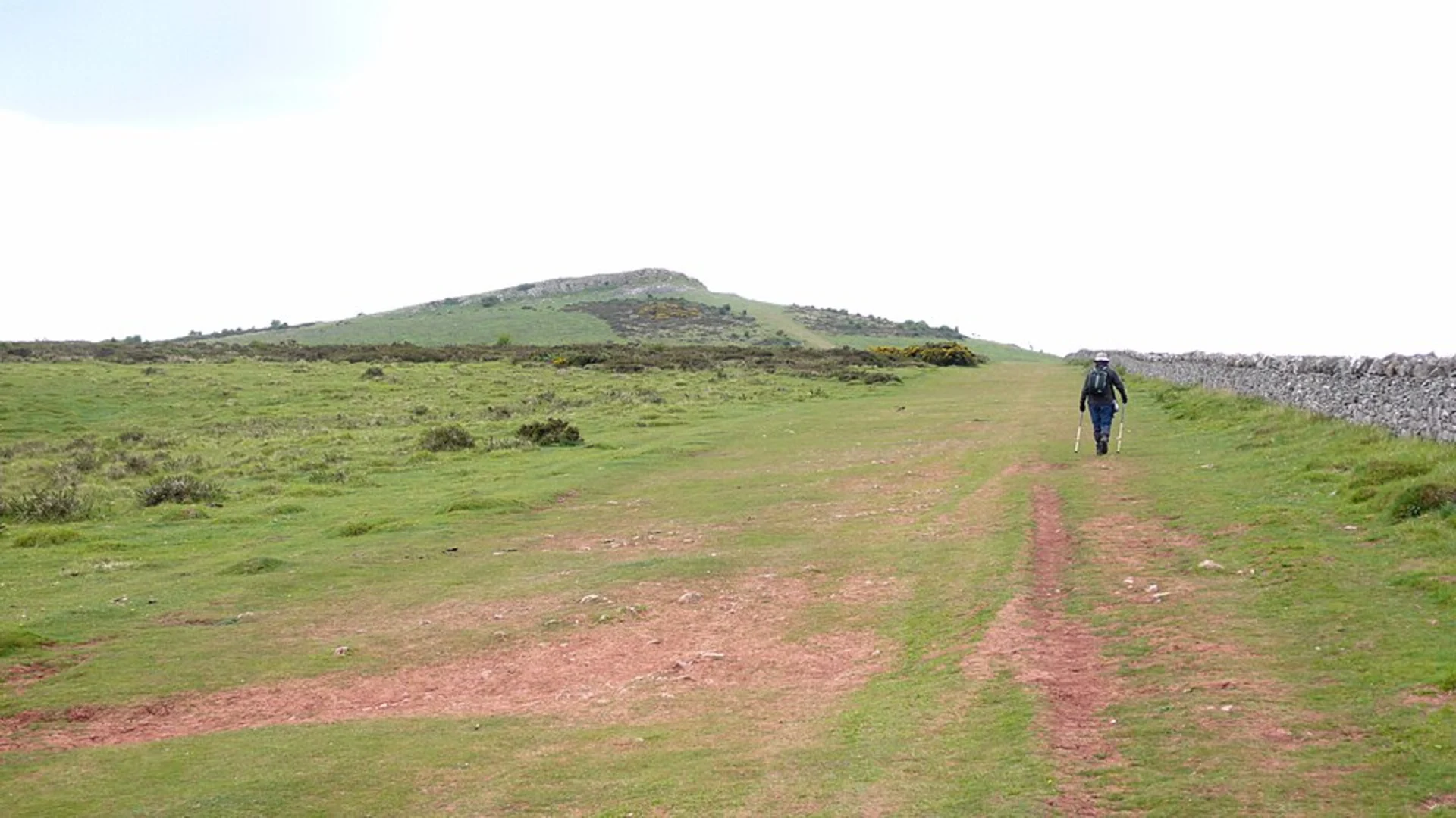
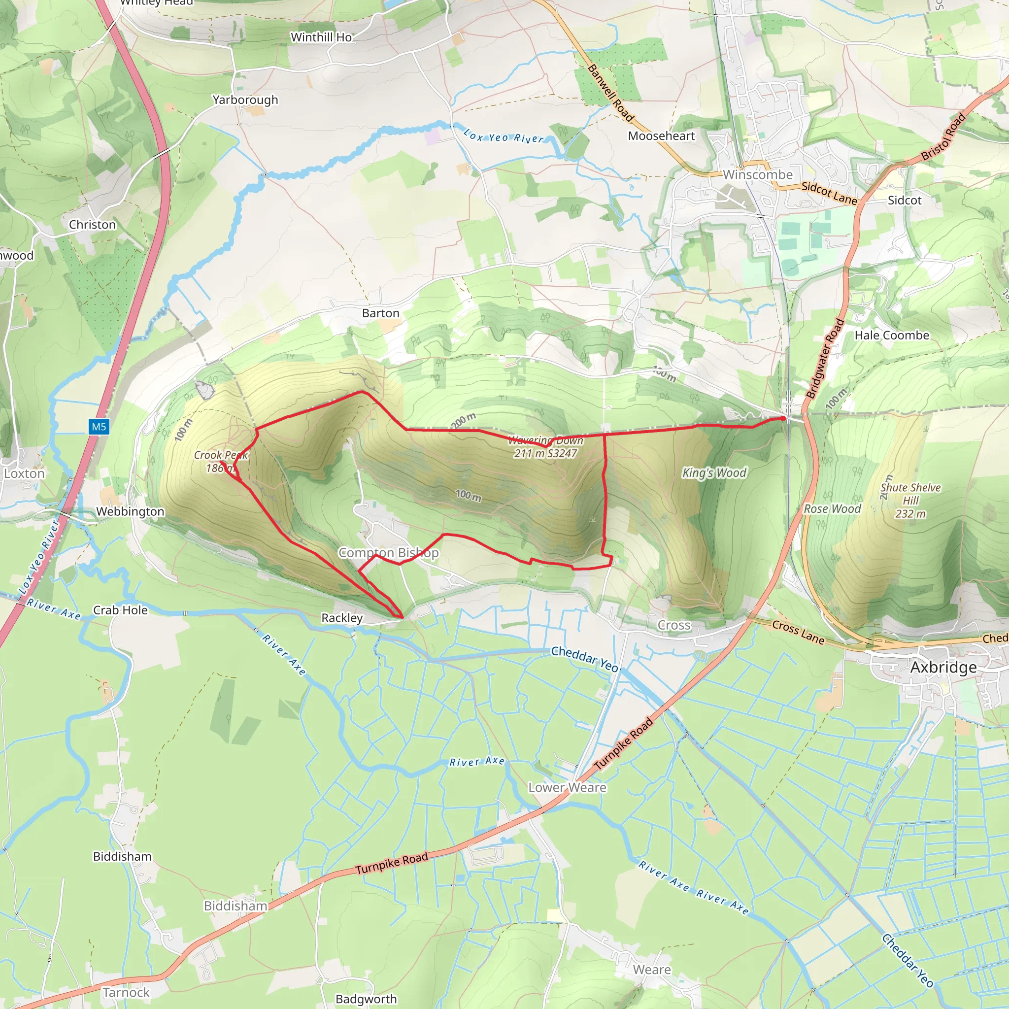
Starting near North Somerset, England, the Wavering Down and Crook Peak Circular is a captivating loop trail that spans approximately 9 km (5.6 miles) with an elevation gain of around 300 meters (984 feet). This medium-difficulty hike offers a blend of natural beauty, historical landmarks, and panoramic views, making it a rewarding experience for hikers.
Getting There To reach the trailhead, you can drive or use public transport. If driving, set your GPS to the village of Compton Bishop, near Axbridge, Somerset. There is limited parking available near the church in Compton Bishop. For public transport, take a train to Weston-super-Mare and then a bus to Axbridge. From Axbridge, it's a short taxi ride to Compton Bishop.
Trail Overview The trail begins near the church in Compton Bishop, a quaint village that offers a glimpse into the region's historical past. As you start your hike, you'll ascend gradually through lush meadows and woodlands. The initial part of the trail is relatively gentle, making it a good warm-up for the more challenging sections ahead.
Wavering Down At approximately 2 km (1.2 miles) into the hike, you'll reach Wavering Down. This section offers stunning views of the surrounding countryside, including the Mendip Hills and the Bristol Channel. The elevation gain here is about 100 meters (328 feet), providing a moderate challenge. Keep an eye out for local wildlife such as deer and various bird species.
Crook Peak Continuing along the trail, you'll approach Crook Peak at around the 4 km (2.5 miles) mark. This is the highest point of the hike, with an elevation gain of another 100 meters (328 feet). The peak offers 360-degree views, including the Somerset Levels, the Quantock Hills, and even the coast of South Wales on a clear day. This is a perfect spot for a break and some photography.
Historical Significance The area around Crook Peak has a rich history, with evidence of ancient settlements and Roman activity. The nearby town of Axbridge is known for its medieval architecture and historical landmarks, including King John's Hunting Lodge, a National Trust property.
Descent and Return After enjoying the views from Crook Peak, the trail descends gradually through open fields and woodlands. At around the 7 km (4.3 miles) mark, you'll pass through the charming village of Cross, where you can see traditional English cottages and perhaps stop for a refreshment at a local pub.
Navigation and Safety The trail is well-marked, but it's always a good idea to have a reliable navigation tool. HiiKER is an excellent app for this purpose, offering detailed maps and real-time tracking. Wear sturdy hiking boots, as some sections can be rocky and uneven. Bring water, snacks, and a first-aid kit, and be prepared for changing weather conditions.
Flora and Fauna Throughout the hike, you'll encounter a variety of flora, including wildflowers, ferns, and ancient trees. The area is also home to diverse wildlife, such as rabbits, foxes, and numerous bird species. Spring and summer are particularly vibrant, with blooming flowers and active wildlife.
This trail offers a perfect blend of natural beauty, historical intrigue, and physical challenge, making it a must-visit for any hiking enthusiast.
What to expect?
Activity types
Comments and Reviews
User comments, reviews and discussions about the Wavering Down and Crook Peak Circular, England.
4.38
average rating out of 5
8 rating(s)

