Download
Preview
Add to list
More
124.1 km
~6 days
828 m
Multi-Day
“Explore Angles Way: a historical hike through Norfolk and Suffolk's stunning, wildlife-rich landscapes.”
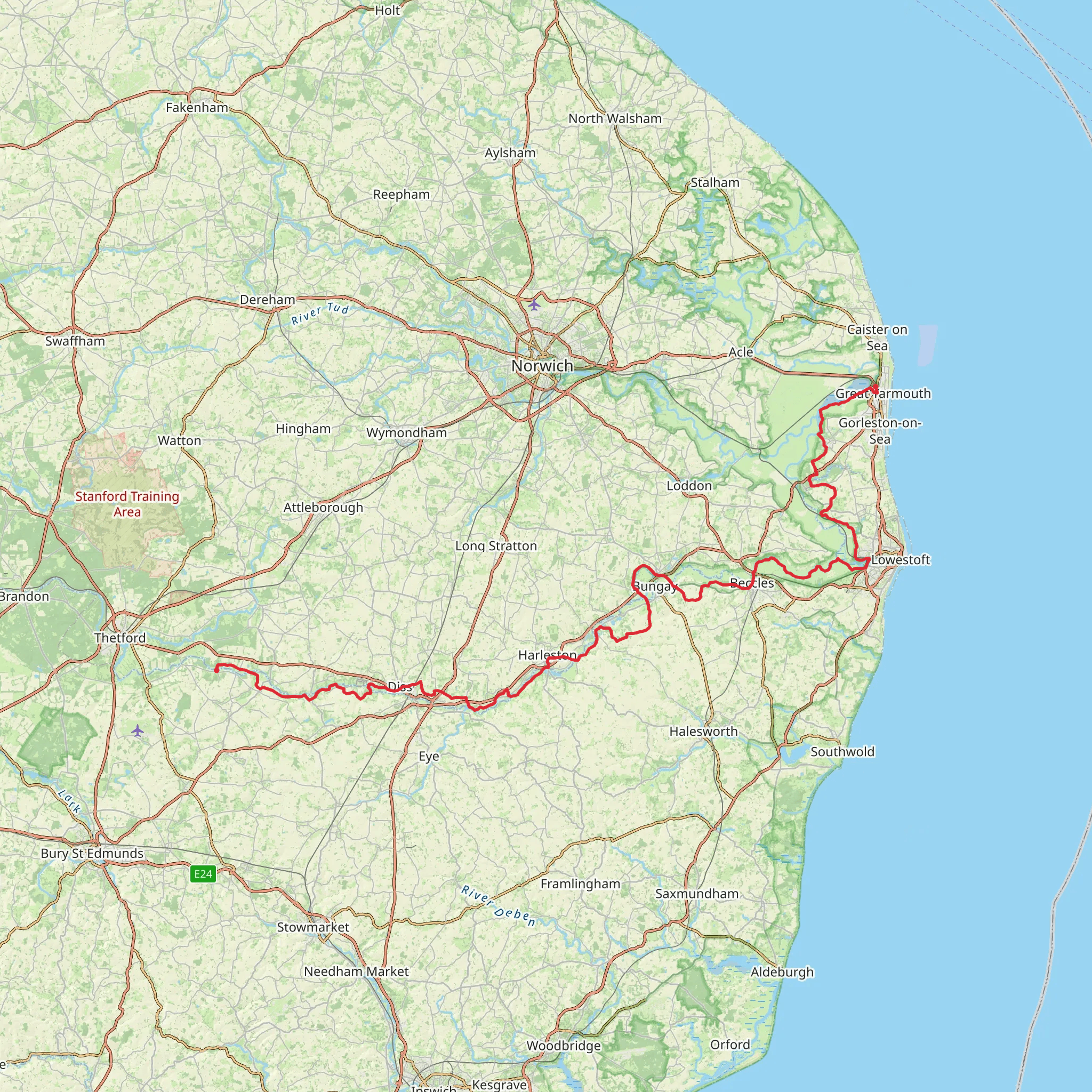
Angles Way is a captivating long-distance footpath that meanders through the scenic landscapes of Norfolk and Suffolk, offering hikers a unique blend of natural beauty, wildlife, and historical intrigue. Spanning approximately 124 kilometers (77 miles) with an elevation gain of around 800 meters (2625 feet), this trail is a medium-difficulty adventure suitable for walkers with some experience.
Getting to the Trailhead The trailhead for Angles Way is conveniently located near the historic market town of Thetford, Norfolk. For those arriving by car, Thetford is accessible via the A11 from Norwich or the A134 from Bury St Edmunds. Public transport users can take advantage of the regular train services to Thetford station from Norwich, Cambridge, and London. From the station, the trailhead is just a short walk, allowing hikers to begin their journey with ease.
Navigating the Trail As you embark on Angles Way, the use of a reliable navigation tool like HiiKER will be invaluable in keeping you on the right path. The trail is well-marked, but having a digital map can help ensure you don't miss any of the fascinating detours or viewpoints along the way.
Natural Highlights and Wildlife The trail offers a rich tapestry of landscapes, from the serene river valleys of the Waveney and Yare to the lush woodlands and expansive fens. Birdwatchers will delight in the variety of species that can be observed, including kingfishers, marsh harriers, and the rare bittern. The changing seasons bring different flora and fauna to the forefront, making Angles Way a trail that can be enjoyed year-round.
Historical Landmarks Angles Way is steeped in history, taking hikers through areas that have been significant since Roman times. One of the early highlights is the Thetford Priory, the ruins of a Cluniac priory that dates back to the 12th century. As you progress, you'll encounter the market town of Beccles, with its charming streets and historic buildings, and the remains of Burgh Castle, a Roman fort that stands guard over the surrounding landscape.
Trail Sections and Elevation The trail can be tackled in sections, with each offering its own unique experience. The initial stretch from Thetford to Diss covers about 30 kilometers (18.6 miles) and is relatively flat. The middle section, leading to the market town of Beccles, introduces gentle undulations and covers approximately 50 kilometers (31 miles). The final stretch to Great Yarmouth introduces the most elevation gain, with stunning views over the Norfolk Broads as a reward for the climb.
Preparation and Planning Hikers should prepare for a variety of terrains, including footpaths, bridleways, and occasional road walking. Sturdy walking boots, weather-appropriate clothing, and sufficient water and food supplies are essential. Accommodation options along the route include campsites, B&Bs, and hotels, allowing for a comfortable rest between hiking days.
Conclusion Angles Way is a trail that offers more than just a walk; it's an exploration of England's rich natural and historical heritage. With careful planning and a spirit of adventure, hikers will find this trail to be a rewarding experience that encapsulates the beauty of the English countryside.
What to expect?
Activity types
Comments and Reviews
User comments, reviews and discussions about the Angles Way, England.
4.67
average rating out of 5
9 rating(s)

