Download
Preview
Add to list
More
169.7 km
~9 days
2253 m
Multi-Day
“Embark on the Leicestershire Round, a scenic hike weaving through history, nature, and charming English villages.”
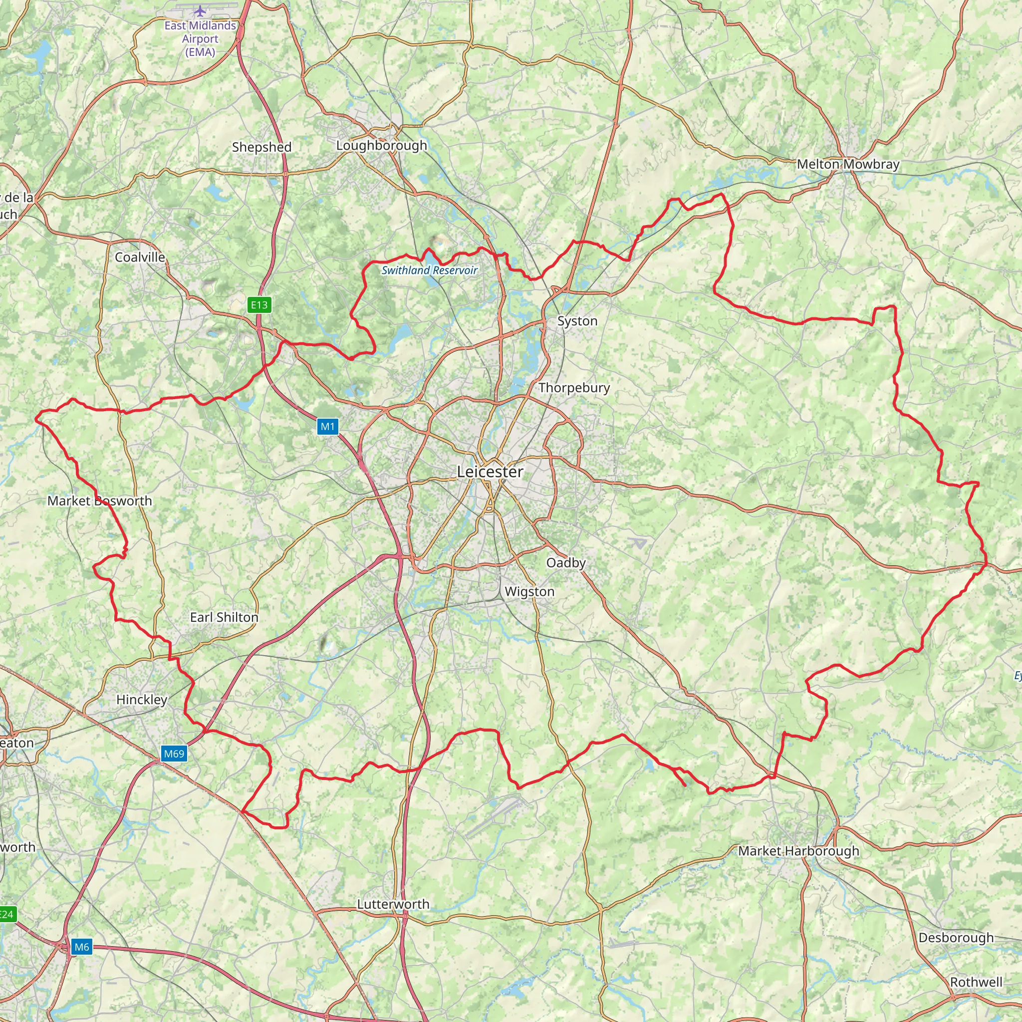
Spanning approximately 170 kilometers (about 105 miles) with an elevation gain of around 2200 meters (approximately 7220 feet), the Leicestershire Round is a loop trail that offers a medium difficulty rating, making it accessible to hikers with a reasonable level of fitness. The trail head is conveniently located near Leicestershire, England, and can be reached by public transport or car. For those opting for public transport, buses and trains serve the area, with the nearest significant landmarks being the city of Leicester and the town of Market Harborough, both of which provide good access points to the trail.
Getting Started
Upon embarking on the Leicestershire Round, hikers will find themselves traversing a variety of landscapes, including rolling countryside, picturesque villages, and sections of canal towpaths. The trail is well-marked, but carrying a reliable navigation tool like HiiKER is advisable to keep track of progress and ensure you remain on the correct path.
Historical Significance and Landmarks
The region is steeped in history, with the trail passing near the site of the Battle of Bosworth Field, where King Richard III was defeated in 1485, marking the end of the Wars of the Roses. Hikers can also explore the historic market town of Market Bosworth, which is a few miles off the trail but worth the detour.
Natural Beauty and Wildlife
As you meander through the Leicestershire countryside, expect to encounter a diverse range of flora and fauna. The trail offers the chance to see British wildlife in its natural habitat, including foxes, badgers, and a variety of bird species. The changing seasons bring different highlights, from bluebell-carpeted woodlands in spring to the rich golden hues of the fields in autumn.
Navigating the Trail
The trail is divided into several sections, allowing hikers to tackle it in stages or as a continuous journey. The terrain includes flat stretches along the Grand Union Canal, moderate climbs through the Charnwood Forest, and gentle hills in the Vale of Belvoir. Hikers should be prepared for the British weather, which can be unpredictable, and ensure they have suitable clothing and equipment.
Access Points and Amenities
There are numerous villages and towns along the route where hikers can find accommodation, refreshments, and supplies. These include Swithland, Foxton, and Hallaton, each offering a glimpse into rural English life. Public transport options are available in many of these locations, providing flexibility for those who wish to hike sections of the trail rather than the entire loop.
Conclusion
Overall, the Leicestershire Round is a trail that offers a rich tapestry of English countryside, historical sites, and wildlife. It is a journey that can be tailored to suit individual preferences, whether one seeks a challenging hike or a leisurely walk with plenty of stops to soak in the local culture and history.
What to expect?
Activity types
Comments and Reviews
User comments, reviews and discussions about the Leicestershire Round, England.
4.44
average rating out of 5
9 rating(s)

