Download
Preview
Add to list
More
10.2 km
~2 hrs 8 min
63 m
Loop
“Discover diverse landscapes and historical charm on the accessible 10 km East Midlands Airport Loop Trail.”
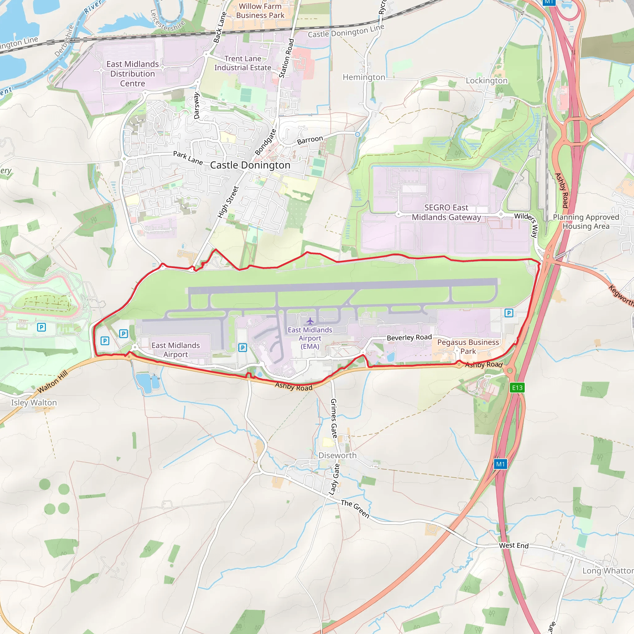
Starting near Leicestershire, England, the East Midlands Airport Loop Trail offers a unique hiking experience with a distance of approximately 10 km (6.2 miles) and minimal elevation gain, making it accessible for a wide range of hikers. The trailhead is conveniently located near the East Midlands Airport, which can be reached by car or public transport. If you're driving, parking is available at the airport or nearby designated areas. For those using public transport, the East Midlands Parkway railway station is the closest, and from there, local buses or a short taxi ride can get you to the trailhead.
Trail Overview
The East Midlands Airport Loop Trail is a loop trail, meaning you'll start and finish at the same point, making logistics simpler. The trail is estimated to be of medium difficulty, primarily due to its length rather than any challenging terrain, as the elevation gain is negligible.
Points of Interest
#### Nature and Wildlife
As you embark on the trail, you'll traverse a variety of landscapes, including open fields, small wooded areas, and sections that run parallel to the airport's perimeter. The diverse habitats support a range of wildlife. Keep an eye out for local bird species such as kestrels and skylarks, especially in the open fields. The wooded sections may offer sightings of small mammals like rabbits and foxes.
#### Historical Significance
The region around Leicestershire is steeped in history. While the trail itself is relatively modern, the surrounding area has historical landmarks worth noting. The nearby village of Castle Donington, approximately 3 km (1.9 miles) from the trail, is home to the Donington Park racing circuit, which has a rich history dating back to the early 20th century. Additionally, the village itself has historical buildings and a charming atmosphere that reflects its long-standing heritage.
Navigation and Safety
Given the proximity to the airport, the trail is well-marked and maintained. However, it's always wise to have a reliable navigation tool. HiiKER is an excellent app for this purpose, providing detailed maps and real-time tracking to ensure you stay on course.
Getting There
To reach the trailhead, if you're driving, set your GPS to East Midlands Airport. Ample parking is available, but do check for any parking fees or restrictions. For those using public transport, the East Midlands Parkway railway station is your best bet. From there, local buses or a short taxi ride will get you to the starting point of the trail.
Trail Experience
The trail offers a mix of open and shaded sections, providing a pleasant balance for hikers. The flat terrain makes it suitable for those looking for a leisurely hike, while the length ensures it's a good workout. The loop nature of the trail means you can enjoy different scenery throughout your hike without retracing your steps.
Final Tips
- Wear comfortable hiking shoes, as the terrain can vary from grassy fields to compacted dirt paths. - Bring water and snacks, especially if you plan to take your time and enjoy the surroundings. - Check the weather forecast before heading out, as the open sections can be quite exposed to the elements.
This trail offers a unique blend of natural beauty and historical context, making it a rewarding experience for those who choose to explore it.
What to expect?
Activity types
Comments and Reviews
User comments, reviews and discussions about the East Midlands Airport Loop Trail, England.
4.5
average rating out of 5
8 rating(s)

