Download
Preview
Add to list
More
11.4 km
~3 hrs 4 min
476 m
Loop
“Experience the historic and scenic splendor of Lancashire on the Pendle Hill from Downham Long Trail.”
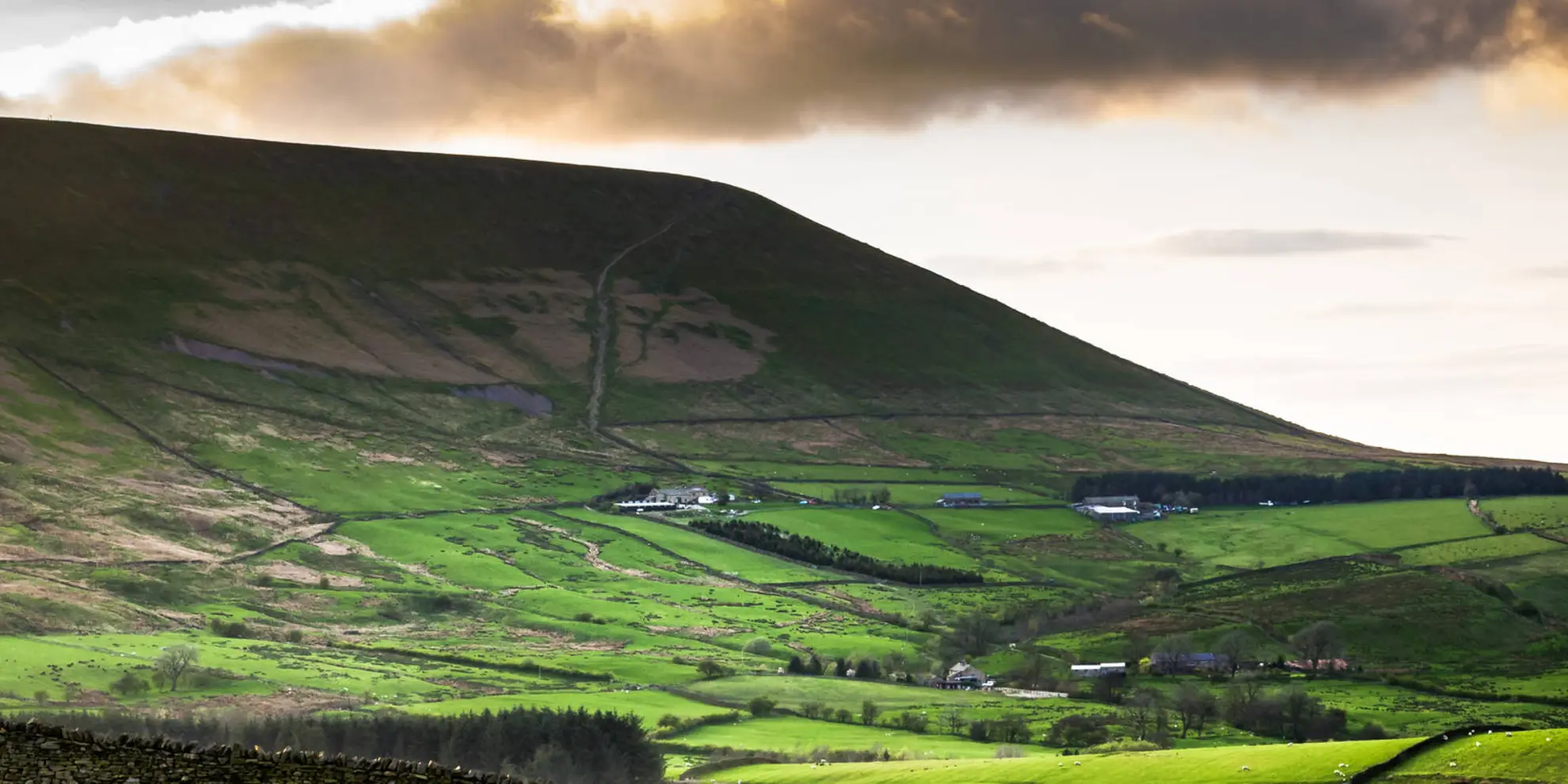
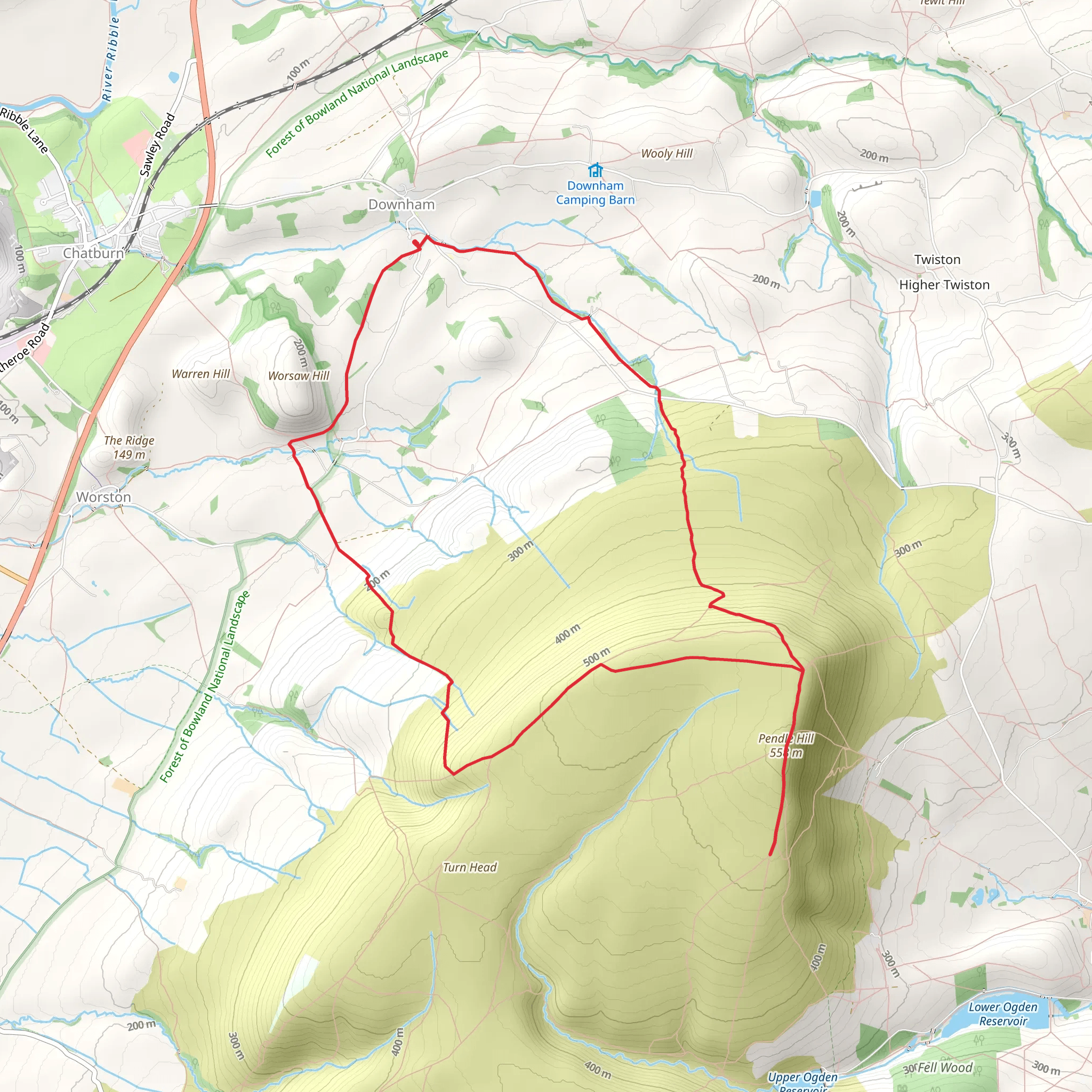
Embarking on the Pendle Hill from Downham Long Trail, hikers will experience a journey through the picturesque landscape of Lancashire, England. This 11 km (approximately 6.8 miles) loop trail offers an elevation gain of around 400 meters (roughly 1312 feet), providing a moderately challenging hike suitable for those with some experience.
Getting to the Trailhead
The trailhead is conveniently located near the quaint village of Downham, Lancashire. For those arriving by car, Downham is accessible via the A59, with parking available in the village. Public transport users can catch a bus to Chatburn or Clitheroe and then take a short taxi ride to Downham.
The Trail Experience
As you set out from the village, the trail takes you through charming farmland and along meandering streams. The initial section is relatively flat, allowing hikers to warm up before the ascent begins. Approximately 2 km (1.2 miles) in, the path starts to rise, leading towards the base of Pendle Hill.
The climb up Pendle Hill is steady, and as you ascend, you'll be rewarded with increasingly impressive views of the Ribble Valley. The hill itself is steeped in history, most famously known for the Pendle Witch Trials of 1612. As you reach the summit, at an elevation of 557 meters (1827 feet), take a moment to reflect on the area's rich past and enjoy the panoramic vistas.
Flora and Fauna
Throughout the hike, keep an eye out for the diverse wildlife and plant species that call this area home. The surrounding fields and woodlands are habitats for birds such as curlews and lapwings, while the heather-clad moorland atop Pendle Hill is a haven for grouse. The changing seasons bring different flora, with bluebells in spring and vibrant heather blooms in late summer.
Descent and Return
After soaking in the views from the summit, the trail descends along the opposite side of the hill, offering a different perspective of the landscape. The descent is gradual, leading back towards Downham. The final stretch of the trail is a leisurely walk through the fields, completing the loop back to the village.
Navigation
For navigation purposes, hikers can utilize the HiiKER app to ensure they stay on the correct path. The app provides detailed maps and trail information, which can be particularly useful in areas where the trail may be less defined.
Preparation and Safety
Before setting out, ensure you have appropriate footwear and clothing for the conditions, as the weather can change rapidly. It's also advisable to carry water, snacks, and a map or navigation device. Always let someone know your plans and expected return time when heading out on a hike.
By preparing adequately and respecting the natural environment, hikers can fully enjoy the beauty and history that the Pendle Hill from Downham Long Trail has to offer.
What to expect?
Activity types
Comments and Reviews
User comments, reviews and discussions about the Pendle Hill from Downham - Long Trail, England.
4.33
average rating out of 5
3 rating(s)

