Download
Preview
Add to list
More
12.8 km
~3 hrs 12 min
388 m
Point-to-Point
“Traverse historical landmarks and scenic landscapes on the moderately challenging 13 km Hapton to Burnley walk.”
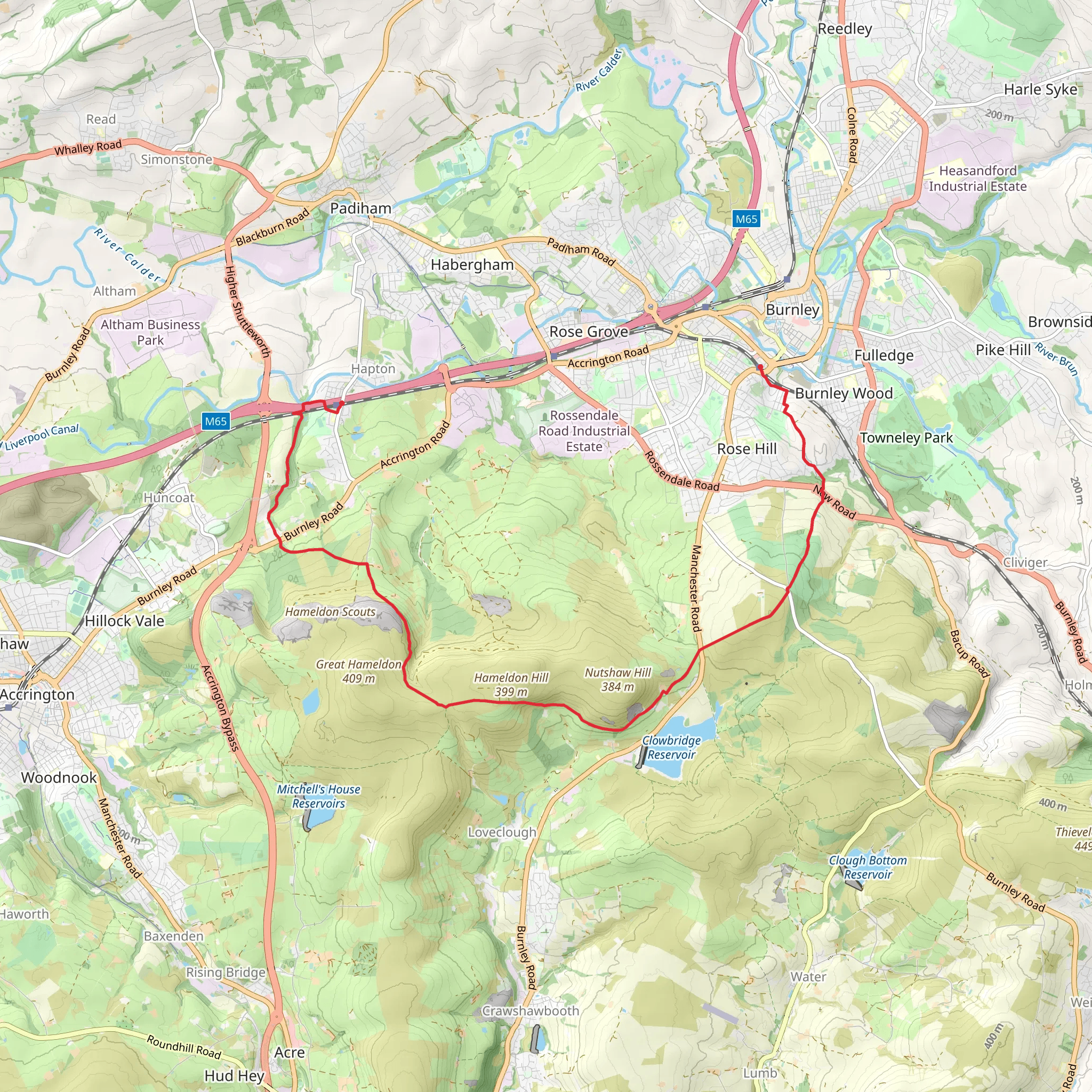
Starting near the village of Hapton in Lancashire, England, the Hapton to Burnley Manchester Road Walk spans approximately 13 kilometers (8 miles) with an elevation gain of around 300 meters (984 feet). This point-to-point trail is rated as medium difficulty, making it suitable for moderately experienced hikers.
Getting There To reach the trailhead, you can either drive or use public transport. If driving, you can park near Hapton Railway Station, located at Station Road, Hapton, Burnley BB12 7LQ. For those using public transport, Hapton Railway Station is well-connected and serves as a convenient starting point.
Trail Overview The trail begins in Hapton, a village with a rich history dating back to the medieval period. As you set off, you'll traverse through a mix of rural landscapes, including open fields, woodlands, and moorlands. The initial part of the trail is relatively flat, allowing you to ease into the hike.
Significant Landmarks and Nature Around the 3-kilometer (1.9-mile) mark, you'll come across the remnants of Hapton Tower, a historical site that dates back to the 16th century. This tower was once part of a larger manor house and offers a glimpse into the region's feudal past.
Continuing on, you'll enter the Hapton Woods, a serene area filled with native trees like oak and ash. This section is particularly beautiful in autumn when the leaves change color. Keep an eye out for local wildlife, including deer, foxes, and a variety of bird species.
Elevation Gain and Terrain As you approach the halfway point, the trail begins to ascend more steeply. The elevation gain is gradual but steady, reaching its peak around the 8-kilometer (5-mile) mark. Here, you'll be rewarded with panoramic views of the surrounding countryside, including the Pennine hills in the distance.
Historical Significance The trail also passes close to the Leeds and Liverpool Canal, a significant waterway completed in the 18th century. This canal played a crucial role in the industrial revolution, facilitating the transport of goods between the two cities. You might want to take a short detour to walk along the canal towpath and observe the historic locks and bridges.
Final Stretch As you descend towards Burnley, the landscape transitions back to a mix of fields and suburban areas. The final stretch of the trail takes you through Scott Park, a well-maintained public park with beautiful gardens and a small lake. This is a great spot to take a break and enjoy the scenery.
Ending Point The trail concludes near Burnley Manchester Road Railway Station, located at Manchester Road, Burnley BB11 1JZ. From here, you can easily catch a train back to Hapton or continue your journey to other destinations.
Navigation For navigation, it's highly recommended to use HiiKER, which provides detailed maps and real-time updates to ensure you stay on track.
This trail offers a blend of natural beauty, historical landmarks, and moderate physical challenge, making it a rewarding experience for those looking to explore the Lancashire countryside.
What to expect?
Activity types
Comments and Reviews
User comments, reviews and discussions about the Hapton to Burnley Manchester Road Walk, England.
average rating out of 5
0 rating(s)

