Download
Preview
Add to list
More
306.0 km
~15 days
1321 m
Multi-Day
“Embark on the Cumbria Coastal Way, a journey through diverse landscapes, rich history, and stunning wildlife.”
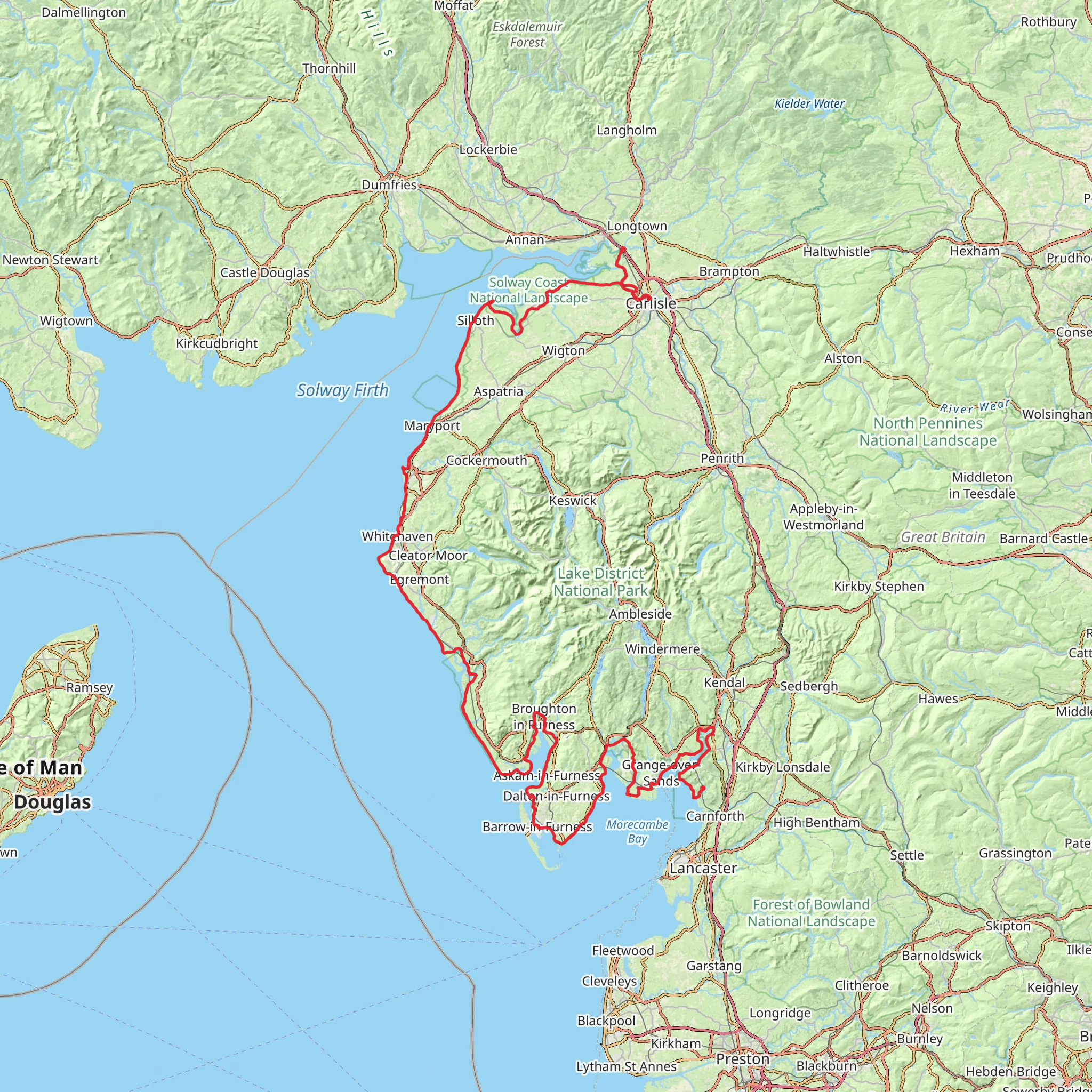
The Cumbria Coastal Way is a scenic long-distance path that stretches approximately 306 kilometers (190 miles) along the western edge of Cumbria, from Silverdale, near the border with Lancashire, to Gretna, just over the Scottish border. With an elevation gain of around 1300 meters (4265 feet), the trail offers a medium difficulty rating, providing a mix of flat walks, gentle hills, and occasional steep sections.
Getting to the Trailhead
To begin your journey on the Cumbria Coastal Way, you can reach the starting point near Silverdale by car or public transport. If driving, you can navigate to Silverdale using a GPS device, with the trailhead being easily accessible from the M6 motorway. For those preferring public transport, trains frequently run to Silverdale station from major cities like Lancaster, which is well-connected to the rest of the UK. From the station, it's a short walk to the official start of the trail.
Navigating the Trail
As you embark on the Cumbria Coastal Way, it's essential to have a reliable navigation tool. HiiKER is an excellent resource for downloading maps and tracking your progress along the route. The app provides detailed maps that can be used offline, ensuring you stay on the right path even in areas with limited mobile reception.
Landmarks and Scenery
The trail takes you through a variety of landscapes, from the rugged cliffs and sandy beaches of the coastline to the rolling countryside inland. Notable landmarks include the historic town of Whitehaven, with its rich maritime history, and the impressive St. Bees Head, the most westerly point of Cumbria, offering stunning views and a chance to spot seabirds like the puffin during breeding season.
As you continue north, you'll pass through the industrial heritage of Workington and Maryport, before reaching the Solway Coast Area of Outstanding Natural Beauty. This stretch is particularly rich in wildlife, with opportunities to see a diverse range of birdlife in the estuary habitats.
Historical Significance
The region is steeped in history, with ancient sites such as the Roman fort at Maryport and the remnants of Hadrian's Wall near Bowness-on-Solway. The trail also passes through the medieval city of Carlisle, where you can explore Carlisle Castle and the city's cathedral.
Preparation and Planning
When planning your hike, consider the time of year, as the weather can be unpredictable. Waterproof gear is essential, and layers are recommended to adapt to changing conditions. Accommodations along the trail range from campgrounds to bed and breakfasts, so plan your stops according to your preferred level of comfort.
Wildlife and Nature
The Cumbria Coastal Way is a haven for nature enthusiasts. The trail's diverse ecosystems support a wide array of flora and fauna. In addition to seabirds, keep an eye out for the natterjack toad and rare plants like the Lancashire whitebeam.
Conclusion
Remember to respect the environment and follow the Leave No Trace principles to preserve the beauty of the Cumbria Coastal Way for future hikers. With careful preparation and a sense of adventure, this trail promises an unforgettable experience along one of England's most picturesque coastlines.
What to expect?
Activity types
Comments and Reviews
User comments, reviews and discussions about the Cumbria Coastal Way, England.
4.5
average rating out of 5
4 rating(s)

