Download
Preview
Add to list
More
14.9 km
~3 hrs 48 min
498 m
Point-to-Point
“Embark on a scenic 15 km hike blending lush woodlands, historical canals, and picturesque reservoirs near Kirklees.”
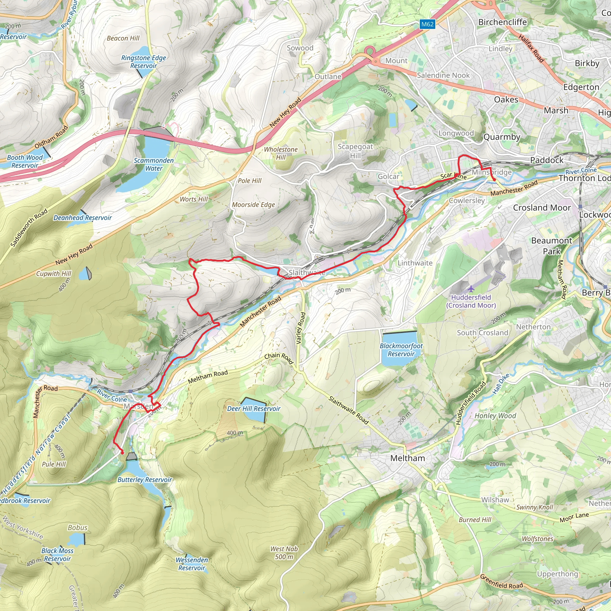
Starting near Kirklees, England, this 15 km (approximately 9.3 miles) point-to-point trail offers a medium difficulty hike with an elevation gain of around 400 meters (about 1,312 feet). The trailhead is conveniently accessible by both public transport and car. If you're driving, you can park near the village of Marsden. For those using public transport, Marsden Railway Station is a short walk from the trailhead, making it an ideal starting point.### Initial Stretch: Scar Wood The hike begins with a gentle ascent through Scar Wood, a serene woodland area known for its lush greenery and diverse birdlife. As you navigate through the forest, you'll encounter a variety of native trees, including oak, ash, and birch. The forest floor is often carpeted with bluebells in the spring, adding a splash of color to your hike. Keep an eye out for local wildlife such as deer and foxes, which are commonly spotted in this area.### Huddersfield Narrow Canal After exiting Scar Wood, the trail leads you to the Huddersfield Narrow Canal. This section is relatively flat and offers a peaceful walk along the canal towpath. The canal itself is a marvel of 19th-century engineering, originally constructed to facilitate the transport of goods during the Industrial Revolution. As you walk along the canal, you'll pass by several historical landmarks, including old mills and lock gates, which provide a glimpse into the area's industrial past.### Slaithwaite Reservoir Continuing along the trail, you'll reach the Slaithwaite Reservoir, a picturesque body of water surrounded by rolling hills. This is a great spot to take a break and enjoy the scenic views. The reservoir is home to various waterfowl, including ducks, swans, and herons. If you're lucky, you might even spot a kingfisher darting across the water. The path around the reservoir is well-maintained, making it an easy and enjoyable walk.### Elevation Gain and Terrain The trail features a mix of terrains, from woodland paths and canal towpaths to open fields and rocky inclines. The most significant elevation gain occurs as you leave the canal and head towards the reservoir, with a steady climb that offers rewarding views of the surrounding countryside. The total elevation gain of around 400 meters (1,312 feet) is spread throughout the hike, making it manageable for those with a moderate level of fitness.### Navigation and Safety For navigation, it's highly recommended to use the HiiKER app, which provides detailed maps and real-time updates. The trail is well-marked, but having a reliable navigation tool can help ensure you stay on track. Be sure to wear sturdy hiking boots, as some sections can be muddy or uneven, especially after rain. Carry enough water and snacks, as there are limited facilities along the route.### Historical Significance The Huddersfield Narrow Canal and the surrounding area are steeped in history. The canal was completed in 1811 and played a crucial role in the industrial development of the region. Many of the mills and warehouses you pass by are remnants of this era, offering a fascinating insight into the area's heritage. The village of Slaithwaite itself has a rich history, with records dating back to the Domesday Book of 1086.This trail offers a blend of natural beauty, historical landmarks, and diverse wildlife, making it a rewarding experience for hikers of all levels. Whether you're a history buff, a nature enthusiast, or simply looking for a scenic walk, this trail has something to offer.
What to expect?
Activity types
Comments and Reviews
User comments, reviews and discussions about the Scar Wood, Huddersfield Narrow Canal and Slaithewaite Reservoir Walk, England.
4.5
average rating out of 5
2 rating(s)

