Download
Preview
Add to list
More
14.1 km
~3 hrs 9 min
211 m
Point-to-Point
“Experience Kent's rolling hills, historic trails, and coastal splendors on the Aldington-Sandling hike.”
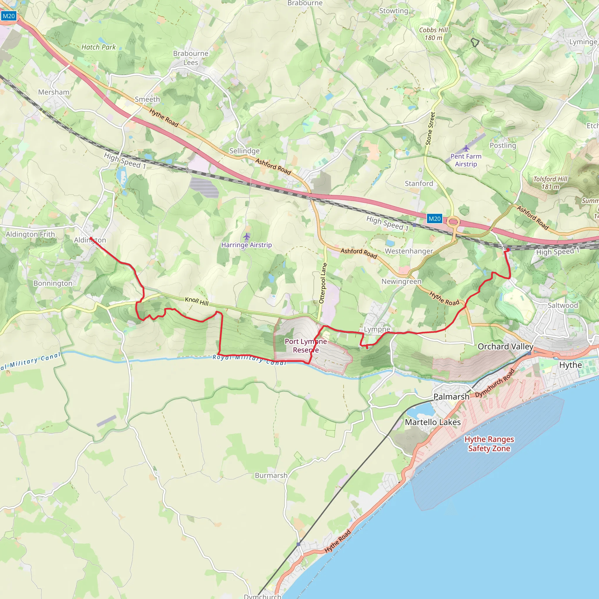
Embarking on the Aldington to Sandling trail via the Saxon Shore Way, hikers will traverse approximately 14 kilometers (about 8.7 miles) through the picturesque landscapes of Kent, England. With an elevation gain of around 200 meters (656 feet), the journey is a delightful medium-difficulty hike that offers a blend of coastal views, rolling countryside, and historical intrigue.
Getting to the Trailhead
The trailhead is conveniently located near the village of Aldington, which is accessible by car or public transport. For those driving, parking is available in the vicinity of the village. Public transport users can take a train to the nearby Westenhanger Station and then a short taxi ride to Aldington.
The Journey Begins
Setting out from the heart of Aldington, hikers will be greeted by the charm of this rural village before quickly finding themselves amidst open fields and farmland. The trail meanders through the Kent Downs Area of Outstanding Natural Beauty, offering panoramic views of the surrounding countryside.
Historical Pathways
As you follow the Saxon Shore Way, you're treading a path steeped in history. This long-distance footpath traces the coastline once defended by the Romans against Saxon invaders. Along the route, you may encounter remnants of ancient settlements and fortifications that whisper tales of the past.
Coastal Vistas and Wildlife
Approaching the halfway mark, the trail descends towards the coast, where the landscape shifts to a stunning shoreline walk. Here, the fresh sea breeze accompanies hikers as they enjoy views across the English Channel. Birdwatchers will delight in the variety of seabirds, while the spring and summer months bring an array of wildflowers to the coastal heathland.
Climbing to Sandling
The final stretch includes a gentle climb towards Sandling. This section offers a change of scenery as you ascend through wooded areas and might catch glimpses of local wildlife such as foxes or badgers. Upon reaching Sandling, hikers will find themselves at the end of the trail, with the option to return to Aldington by foot or arrange for transportation back from Sandling Station.
Navigation and Preparation
For navigation, the HiiKER app is a reliable tool to guide you along the trail, ensuring you stay on the right path and can anticipate upcoming changes in terrain or elevation. It's advisable to check the weather forecast before setting out and to pack accordingly, with plenty of water, snacks, and suitable clothing for the varied conditions you may encounter.
Local Amenities
Both Aldington and Sandling are small communities with limited amenities, so it's wise to bring necessary supplies with you. However, there are opportunities to enjoy local hospitality at the beginning and end of your hike, with a few cozy pubs and eateries where you can refuel and reflect on the journey.
This trail offers a rich tapestry of natural beauty, wildlife, and a glimpse into England's storied past, making it a rewarding experience for hikers looking to explore the Kentish landscape.
What to expect?
Activity types
Comments and Reviews
User comments, reviews and discussions about the Aldington to Sandling via Saxon Shore Way, England.
4.0
average rating out of 5
3 rating(s)

