Download
Preview
Add to list
More
4.7 km
~1 hrs 8 min
118 m
Loop
“Discover the scenic Wye Valley Walk, a moderately challenging 5 km loop with breathtaking views and rich history.”
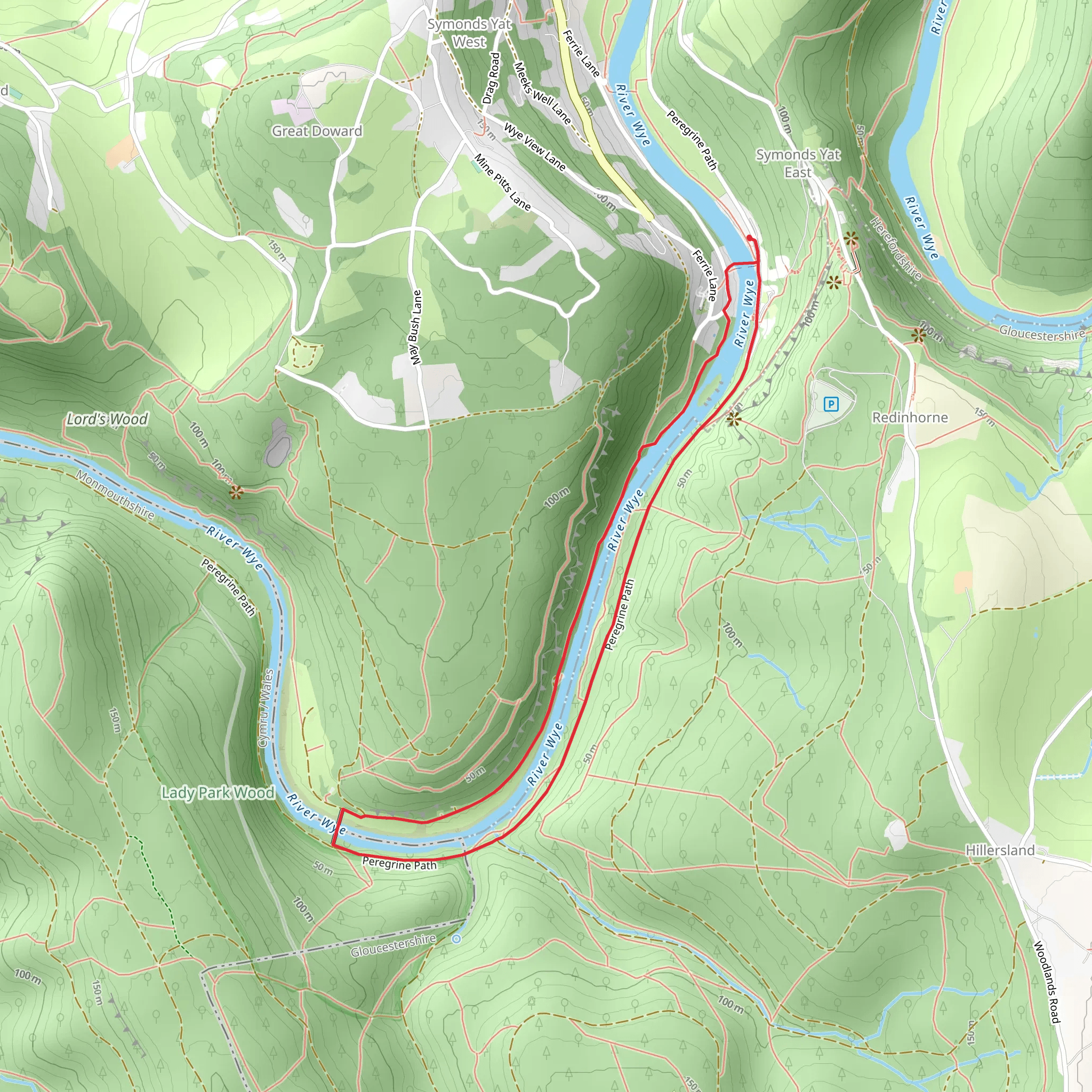
Starting near Herefordshire, England, the Wye Valley Walk and Peregrine Path is a delightful 5 km (3.1 miles) loop trail with an elevation gain of around 100 meters (328 feet). This trail offers a medium difficulty rating, making it suitable for moderately experienced hikers.
Getting There To reach the trailhead, you can drive or use public transport. If driving, set your GPS to the nearest known address: Symonds Yat Rock, Symonds Yat, Ross-on-Wye HR9 6BJ, UK. For those using public transport, the nearest train station is in Hereford. From Hereford, you can take a bus to Ross-on-Wye and then a taxi or local bus to Symonds Yat Rock.
Trail Navigation For navigation, it's highly recommended to use HiiKER, which provides detailed maps and real-time updates. The trail is well-marked, but having a reliable navigation tool will enhance your experience.
Trail Highlights #### Symonds Yat Rock Starting at Symonds Yat Rock, you'll be greeted with panoramic views of the Wye Valley. This viewpoint is famous for its breathtaking scenery and is a great spot for birdwatching. Keep an eye out for peregrine falcons, which nest in the cliffs.
#### River Wye As you descend from Symonds Yat Rock, you'll follow the path along the River Wye. This section is relatively flat and offers serene views of the river. The lush greenery and the sound of flowing water create a peaceful atmosphere.
#### Historical Significance The Wye Valley is steeped in history. The area was a significant route for trade and travel during the Roman era. You might come across remnants of ancient settlements and old stone bridges that tell tales of the past.
Flora and Fauna The trail is rich in biodiversity. In spring and summer, the path is adorned with wildflowers like bluebells and primroses. The dense woodlands are home to various species of birds, including the elusive kingfisher. Deer and badgers are also commonly spotted in the area.
Elevation and Terrain The trail features a mix of terrains, from rocky paths to forest trails. The initial descent from Symonds Yat Rock is the steepest part, with an elevation drop of about 50 meters (164 feet) over 1 km (0.6 miles). The rest of the trail is relatively gentle, with minor undulations.
Safety and Preparation Given the medium difficulty rating, it's advisable to wear sturdy hiking boots and carry a walking stick if needed. The trail can be slippery after rain, so check the weather forecast before heading out. Bring sufficient water and snacks, as there are limited facilities along the route.
Points of Interest #### King Arthur's Cave Approximately 2 km (1.2 miles) into the hike, you'll find a detour leading to King Arthur's Cave. This limestone cave is steeped in legend and offers a fascinating glimpse into prehistoric times. Archaeological finds suggest it was inhabited during the Stone Age.
#### Biblins Suspension Bridge Around the 3 km (1.9 miles) mark, you'll cross the Biblins Suspension Bridge. This pedestrian bridge offers stunning views of the River Wye and is a popular spot for photography.
Final Stretch The last leg of the trail loops back towards Symonds Yat Rock. This section is relatively easy, allowing you to enjoy the final views of the valley before completing the loop.
By following this guide and using HiiKER for navigation, you'll be well-prepared to enjoy the Wye Valley Walk and Peregrine Path.
What to expect?
Activity types
Comments and Reviews
User comments, reviews and discussions about the Wye Valley Walk and Peregrine Path, England.
4.0
average rating out of 5
2 rating(s)

