Download
Preview
Add to list
More
14.8 km
~3 hrs 10 min
130 m
Point-to-Point
“The Wickham to West Meon Walk offers scenic beauty, historical landmarks, and moderate hiking challenges in Hampshire.”
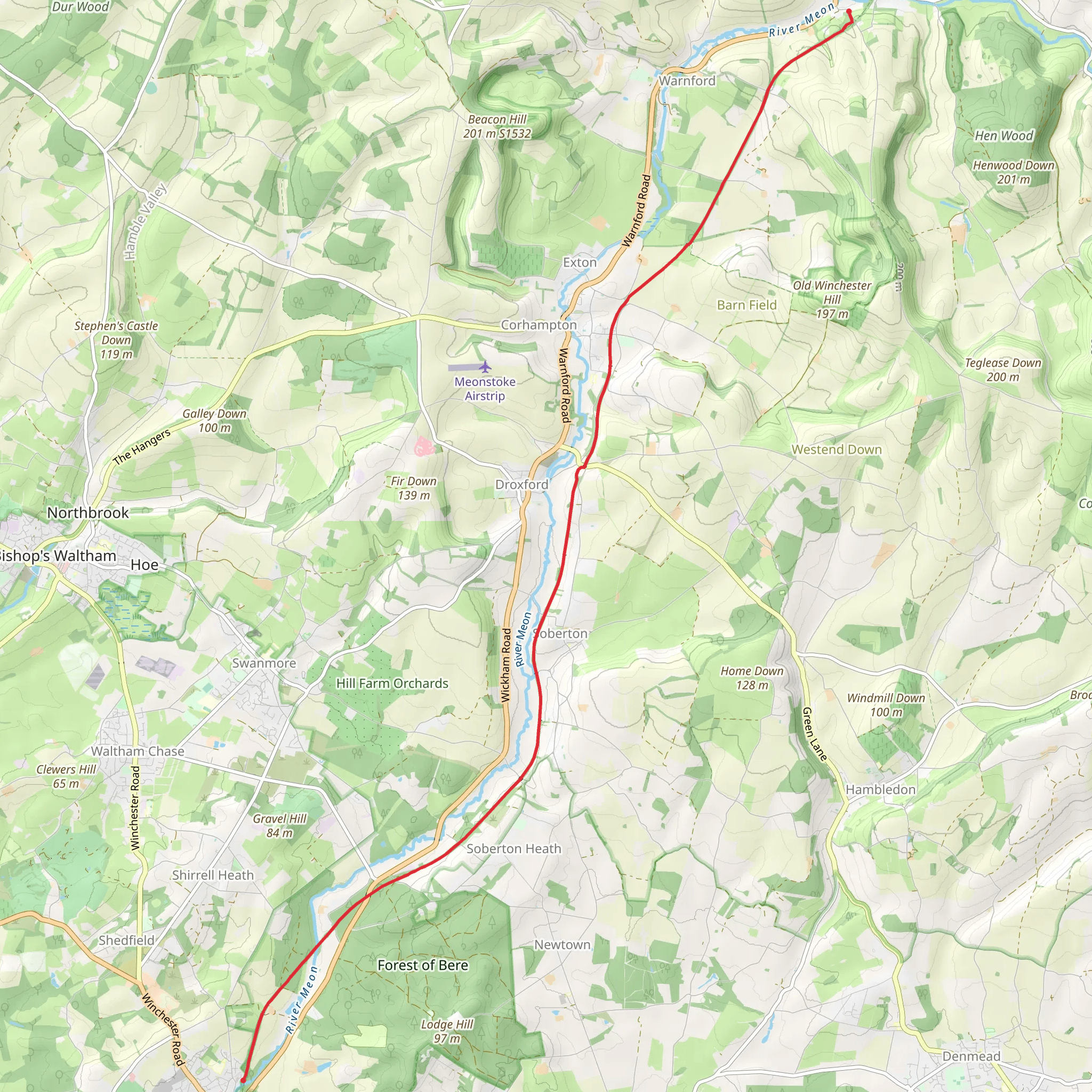
Starting near the charming village of Wickham in Hampshire, England, the Wickham to West Meon Walk spans approximately 15 km (9.3 miles) with an elevation gain of around 100 meters (328 feet). This point-to-point trail is estimated to be of medium difficulty, making it suitable for moderately experienced hikers.
Getting There To reach the trailhead in Wickham, you can either drive or use public transport. If driving, set your GPS to Wickham Square, Wickham, Fareham PO17 5JG, which is a convenient starting point. For public transport, take a train to Fareham Station, and from there, a local bus (such as the X9) will take you directly to Wickham Square.
Trail Overview The trail begins in Wickham, a village known for its historic square and Georgian architecture. As you set off, you'll traverse through a mix of woodland, open fields, and charming English countryside. The first few kilometers are relatively flat, allowing you to ease into the hike.
Significant Landmarks Around the 3 km (1.9 miles) mark, you'll come across the Meon Valley Railway Line, a disused railway that has been converted into a scenic walking path. This section is particularly picturesque, with lush greenery and occasional glimpses of the River Meon.
Nature and Wildlife The trail is abundant with wildlife. Keep an eye out for deer, foxes, and a variety of bird species, including kingfishers and herons near the river. The flora is equally diverse, with wildflowers dotting the landscape, especially in spring and summer.
Historical Significance As you approach the halfway point, you'll encounter the village of Droxford. This village holds historical significance as it was a key location during World War II. Winston Churchill and other Allied leaders met here in June 1944 to discuss the D-Day landings. The Droxford Railway Station, although no longer in use, stands as a historical landmark.
Navigation and Terrain The terrain varies from well-trodden paths to more rugged sections. It's advisable to use a reliable navigation tool like HiiKER to stay on track. The trail is well-marked, but having a digital map can be very helpful, especially in the more wooded areas.
Final Stretch to West Meon The last few kilometers involve a gentle ascent as you make your way towards West Meon. This section offers panoramic views of the South Downs, making the climb worthwhile. Upon reaching West Meon, you'll find yourself in another quaint village, known for its traditional pubs and the historic St. John the Evangelist Church.
Ending Point The trail concludes near the West Meon Hut, a well-known local landmark. From here, you can either arrange for a pickup or take a local bus back to your starting point or nearest train station.
This hike offers a blend of natural beauty, historical landmarks, and a moderate challenge, making it a rewarding experience for those looking to explore the Hampshire countryside.
What to expect?
Activity types
Comments and Reviews
User comments, reviews and discussions about the Wickham to West Meon Walk, England.
5.0
average rating out of 5
1 rating(s)

