Download
Preview
Add to list
More
5.3 km
~1 hrs 21 min
175 m
Loop
“The Butser Hill and Oxenbourne Lythe Loop offers a scenic, moderately challenging 5 km hike with historical landmarks.”
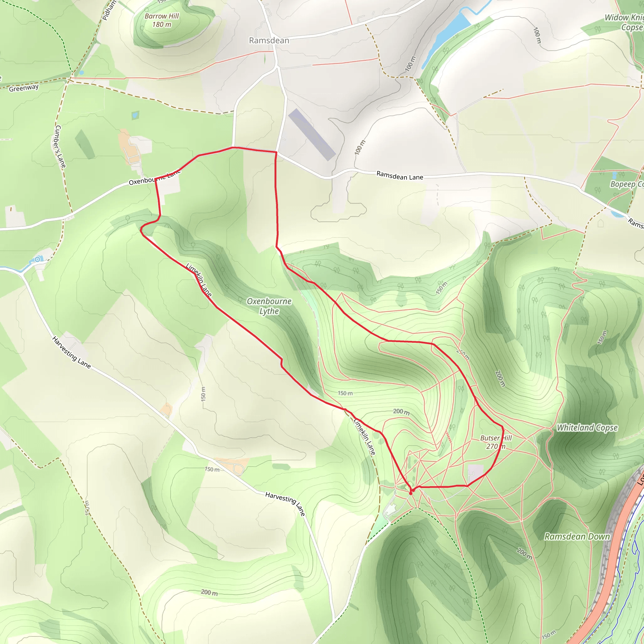
Starting near Hampshire, England, the Butser Hill and Oxenbourne Lythe Loop is a delightful 5 km (3.1 miles) trail with an elevation gain of around 100 meters (328 feet). This loop trail is rated medium in difficulty, making it suitable for moderately experienced hikers.
Getting There To reach the trailhead, you can drive or use public transport. If driving, head towards the Queen Elizabeth Country Park, which is well-signposted from the A3. There is ample parking available at the park. For those using public transport, the nearest train station is Petersfield. From Petersfield, you can take a taxi or a local bus to the Queen Elizabeth Country Park.
Trail Overview The trail begins at the Queen Elizabeth Country Park, a significant landmark in the area. As you start your hike, you'll immediately notice the lush greenery and the well-maintained paths. The initial section is relatively flat, allowing you to ease into the hike.
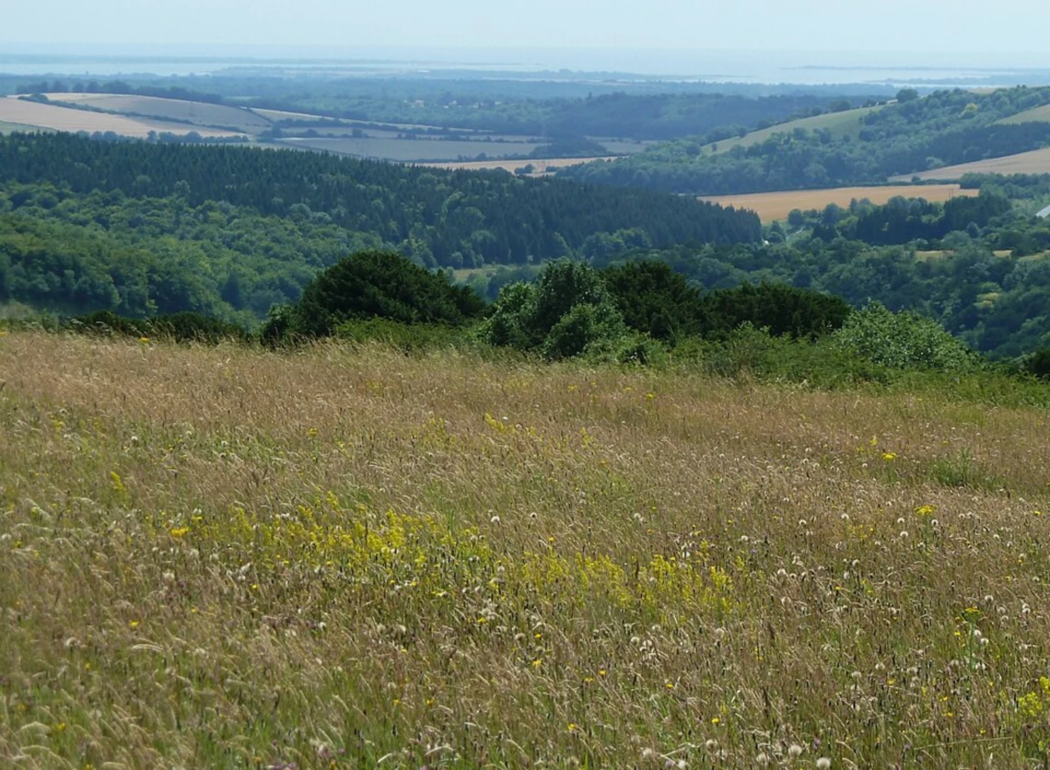
Butser Hill Approximately 1.5 km (0.9 miles) into the hike, you'll begin the ascent up Butser Hill, the highest point in the South Downs National Park. The climb is gradual but steady, gaining about 100 meters (328 feet) in elevation. As you reach the summit, you'll be rewarded with panoramic views of the surrounding countryside. On a clear day, you can see as far as the Isle of Wight.
Oxenbourne Lythe Descending from Butser Hill, the trail leads you into Oxenbourne Lythe, a beautiful wooded area. This section is around 2 km (1.2 miles) from the start. The dense foliage provides a cool, shaded environment, making it a pleasant contrast to the open hilltop. Keep an eye out for local wildlife, including deer and various bird species.
Historical Significance The area around Butser Hill is rich in history. The hill itself is home to ancient earthworks and burial mounds dating back to the Bronze Age. As you hike, you'll pass by these historical landmarks, offering a glimpse into the region's past. The South Downs have been inhabited for thousands of years, and the landscape is dotted with remnants of ancient civilizations.
Navigation and Safety Given the varied terrain, it's advisable to use a reliable navigation tool like HiiKER to stay on track. The trail is well-marked, but having a digital map can be incredibly useful, especially in the wooded sections where paths can be less distinct.
Flora and Fauna The trail is a haven for nature enthusiasts. In the spring and summer months, the meadows are awash with wildflowers, including orchids and cowslips. The wooded areas are home to a variety of trees, such as beech and oak. Birdwatchers will enjoy spotting species like the red kite and the skylark.
Final Stretch As you near the end of the loop, the trail gradually descends back towards the Queen Elizabeth Country Park. This final section is around 1.5 km (0.9 miles) and offers a gentle walk back to the starting point. The park itself has facilities including restrooms, a café, and picnic areas, making it a great spot to relax after your hike.
This 5 km loop offers a perfect blend of natural beauty, historical intrigue, and moderate physical challenge, making it a rewarding experience for any hiker.
What to expect?
Activity types
Comments and Reviews
User comments, reviews and discussions about the Butser Hill and Oxenbourne Lythe Loop, England.
4.75
average rating out of 5
4 rating(s)

