Download
Preview
Add to list
More
18.1 km
~4 hrs 15 min
373 m
Point-to-Point
“Embark on a scenic 18 km hike from Winchcombe to Tewkesbury, blending nature, history, and moderate challenges.”
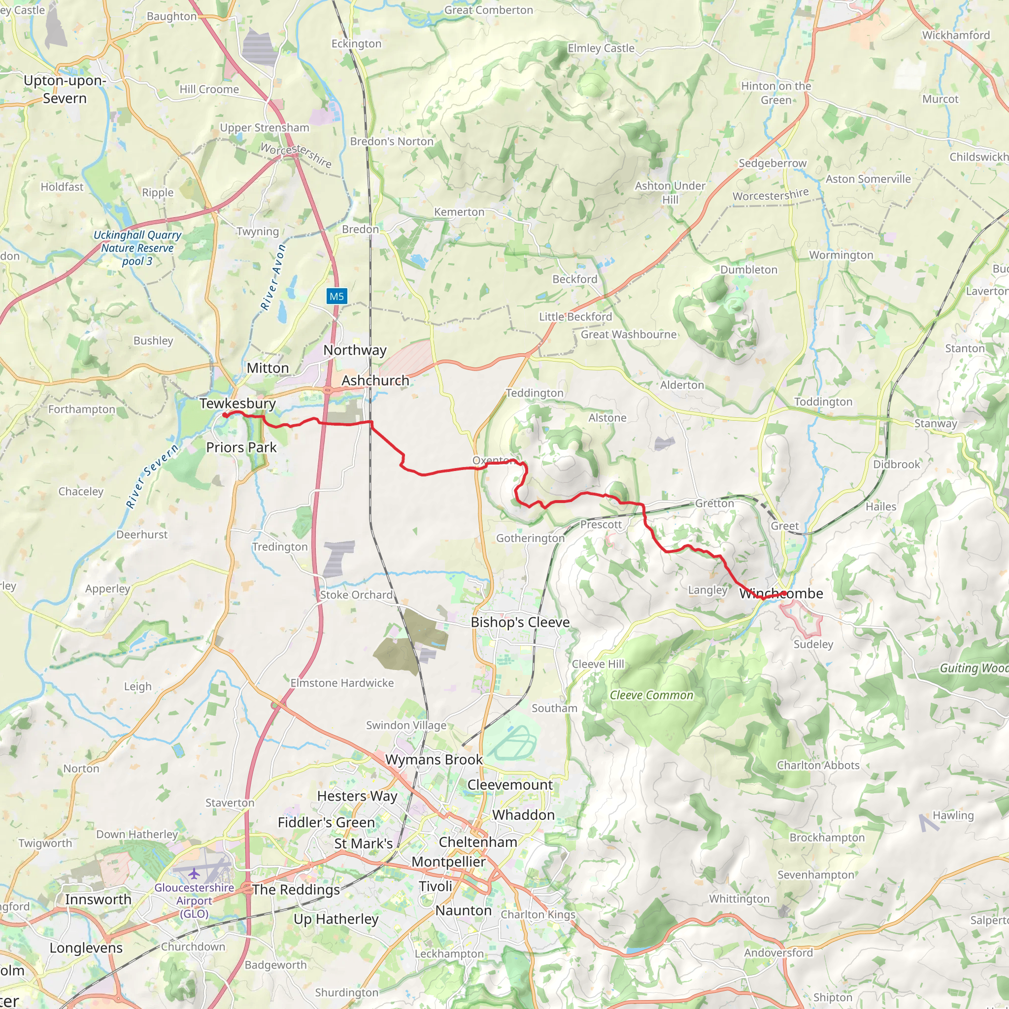
Starting near the picturesque town of Winchcombe in Gloucestershire, England, this 18 km (approximately 11 miles) point-to-point trail offers a delightful mix of natural beauty, historical landmarks, and moderate physical challenge. With an elevation gain of around 300 meters (approximately 984 feet), hikers can expect a moderately challenging experience suitable for those with a reasonable level of fitness.
Getting There To reach the trailhead, you can either drive or use public transport. If driving, head towards Winchcombe, which is well-signposted from major roads in the region. For those using public transport, the nearest major railway station is Cheltenham Spa. From there, you can take a bus or taxi to Winchcombe. The bus services are frequent and reliable, making it a convenient option for hikers.
Trail Overview The trail begins in Winchcombe, a charming town known for its historic buildings and vibrant community. As you set off, you'll pass by the stunning Sudeley Castle, a significant landmark with a rich history dating back to the 15th century. The castle is surrounded by beautiful gardens, and it's worth taking a moment to appreciate its grandeur before continuing on your journey.
Nature and Wildlife As you leave Winchcombe, the trail meanders through the rolling hills of the Cotswolds, offering breathtaking views of the countryside. The area is renowned for its diverse flora and fauna. Keep an eye out for wildflowers, especially in the spring and summer months, and you might spot local wildlife such as deer, foxes, and a variety of bird species.
Historical Significance About halfway through the hike, you'll come across the village of Alderton. This quaint village is home to St. Margaret's Church, a historical gem with origins in the 12th century. The church's architecture and serene surroundings provide a perfect spot for a brief rest and reflection.
Navigation and Terrain The trail is well-marked, but it's always a good idea to have a reliable navigation tool. HiiKER is an excellent app for this purpose, offering detailed maps and real-time tracking to ensure you stay on course. The terrain varies from gentle slopes to more challenging inclines, particularly as you approach the highest points of the trail. Good hiking boots are recommended to handle the mixed terrain, which can be muddy in places, especially after rain.
Final Stretch to Tewkesbury As you descend towards Tewkesbury, the landscape gradually flattens out. The final stretch of the trail takes you along the banks of the River Avon, providing a peaceful and scenic end to your hike. Tewkesbury itself is a town steeped in history, known for its well-preserved medieval streets and the impressive Tewkesbury Abbey. The abbey, dating back to the 12th century, is a must-visit landmark with its stunning architecture and tranquil grounds.
Practical Tips - **Water and Snacks:** Ensure you carry enough water and snacks, as there are limited facilities along the trail. - **Weather:** Check the weather forecast before setting out and dress accordingly. The Cotswolds can be unpredictable, and layers are advisable. - **Public Transport:** If you plan to return to Winchcombe, check the bus schedules from Tewkesbury in advance. Alternatively, arrange for a taxi or have a car waiting at the end point.
This trail offers a perfect blend of natural beauty, historical intrigue, and moderate physical challenge, making it a rewarding experience for any hiker.
What to expect?
Activity types
Comments and Reviews
User comments, reviews and discussions about the Winchcombe to Tewkesbury Walk, England.
5.0
average rating out of 5
1 rating(s)

