Download
Preview
Add to list
More
19.3 km
~4 hrs 24 min
334 m
Point-to-Point
“Explore 19 km of scenic trails from Gloucestershire Airport to Cold Slad, rich in history and wildlife.”
Starting near Gloucestershire, England, this 19 km (approximately 12 miles) point-to-point trail offers a moderate challenge with an elevation gain of around 300 meters (about 984 feet). The trailhead is conveniently accessible by both public transport and car. If you're driving, you can park near the Gloucestershire Airport, which is a significant landmark and a good starting point. For those using public transport, buses frequently run to the airport from Gloucester city center.
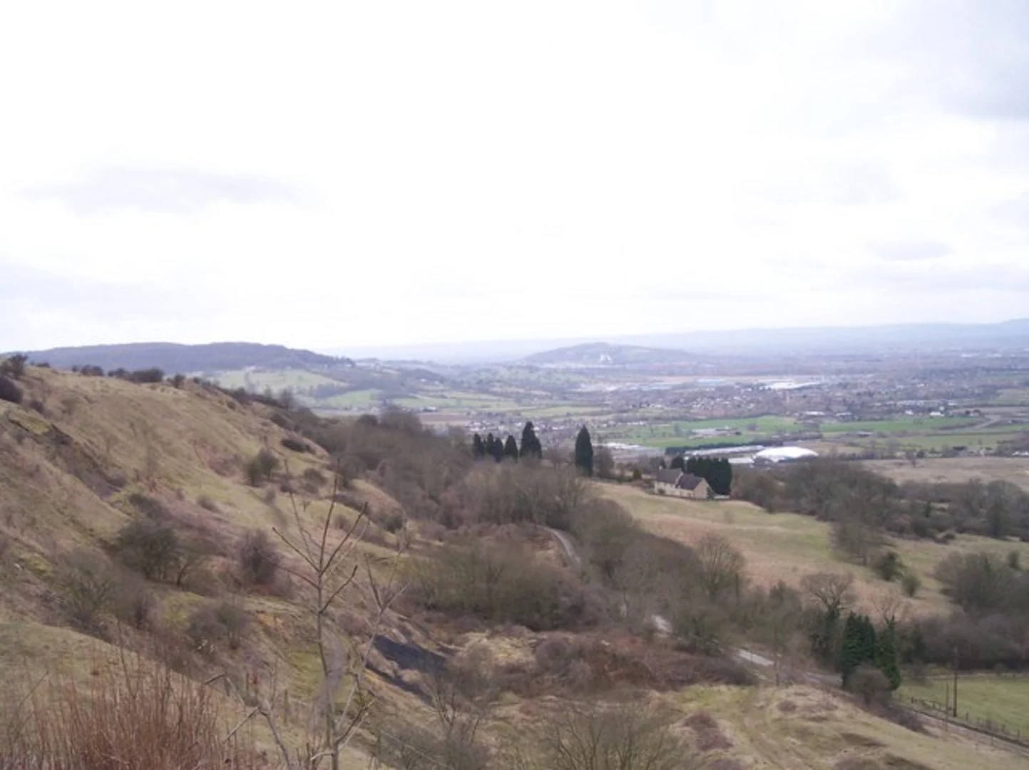
Initial Stretch: Gloucestershire Airport to Churchdown Hill The trail begins near Gloucestershire Airport, a notable landmark in the region. As you set off, you'll traverse through a mix of open fields and wooded areas. The first significant ascent is Churchdown Hill, located approximately 5 km (3 miles) from the start. This hill offers panoramic views of the surrounding countryside and is a great spot for a short break. The elevation gain here is about 100 meters (328 feet), making it a moderate climb.
Midway: Churchdown Hill to Innsworth Continuing from Churchdown Hill, the trail descends gently towards the village of Innsworth, which is around 8 km (5 miles) into the hike. This section is relatively flat and passes through picturesque farmlands and small woodlands. Innsworth is known for its historical significance, particularly its connections to World War II, as it was home to a large military base. You might spot remnants of old military structures along the way.
Nature and Wildlife As you hike, keep an eye out for local wildlife. The area is home to various bird species, including kestrels and buzzards, which are often seen soaring above the fields. The woodlands are rich with flora, including bluebells in the spring and a variety of fungi in the autumn.
Final Stretch: Innsworth to Cold Slad The final leg of the journey takes you from Innsworth to Cold Slad, covering the remaining 6 km (4 miles). This section includes another moderate climb, with an elevation gain of about 200 meters (656 feet). The trail meanders through more wooded areas and open fields, offering a mix of shaded and sunny paths. Cold Slad is a quaint hamlet, providing a peaceful end to your hike.
Navigation and Safety For navigation, it's highly recommended to use HiiKER, which offers detailed maps and real-time tracking to ensure you stay on course. The trail is well-marked, but having a reliable navigation tool can be invaluable, especially in the more remote sections.
Historical Significance The region is steeped in history, from ancient settlements to its role in more recent military history. Churchdown Hill, for instance, has been a site of human activity since prehistoric times, and you might come across ancient earthworks and old quarries.
This trail offers a blend of natural beauty, historical intrigue, and moderate physical challenge, making it a rewarding experience for hikers of all levels.

What to expect?
Activity types
Comments and Reviews
User comments, reviews and discussions about the Gloucester to Cold Slad via Gloucestershire Airport, England.
average rating out of 5
0 rating(s)