Download
Preview
Add to list
More
46.3 km
~3 days
1270 m
Multi-Day
“Traverse the historic and scenic Pennine Way, a 46-kilometer trek through England's majestic landscapes and storied terrain.”
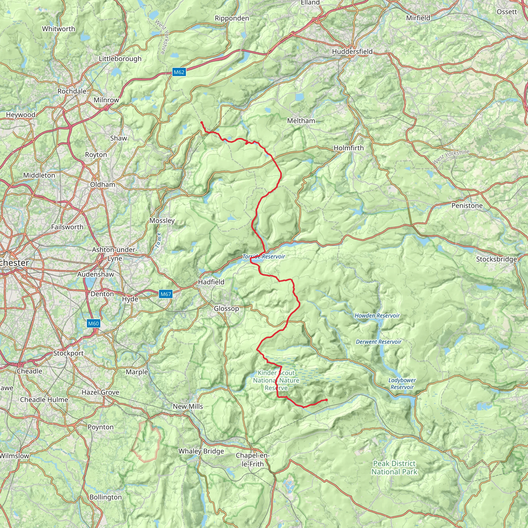
Embarking on the Pennine Way from Edale to Standedge, hikers will traverse approximately 46 kilometers (around 28.5 miles) of diverse landscapes, with an elevation gain of about 1200 meters (nearly 3937 feet). This point-to-point trail, rated medium in difficulty, offers a rich tapestry of English countryside, steeped in history and natural beauty.
Getting to the Trailhead
The trailhead is located near the village of Edale in Derbyshire, England. For those arriving by public transport, regular trains run to Edale from Manchester and Sheffield. If you're driving, Edale is accessible via the A625 road, and there is a car park in the village where you can leave your vehicle before starting the hike.
The Journey Begins
Setting out from Edale, the trail immediately immerses you in the picturesque landscape of the Peak District National Park. The path ascends gradually, offering views of the Vale of Edale and the surrounding moorlands. As you progress, you'll encounter Jacob's Ladder, a series of stone steps leading to Kinder Scout, the highest point in the Peak District. This area is rich in history, with Kinder Scout being the site of the famous 1932 mass trespass that played a pivotal role in securing access rights to open country for the public in the UK.
Kinder Scout to Snake Pass
After conquering Kinder Scout, the trail undulates across the peat bogs and moorlands characteristic of the Dark Peak. The path can be challenging to navigate, so using HiiKER to stay on track is advisable. The route takes you past the Kinder Downfall, a waterfall that, on windy days, is known to blow water upwards. As you approach Snake Pass, approximately 16 kilometers (10 miles) from Edale, you'll find the Snake Pass Inn, a welcome rest stop for many hikers.
Crossing the Watershed
Beyond Snake Pass, the Pennine Way crosses the watershed between the Irish Sea and the North Sea. This section is marked by remote moorland and the occasional gritstone edge, offering expansive views. The trail passes Bleaklow Head, another high point with a somber history, as it is the site of several aircraft wrecks from the mid-20th century.
Toward Standedge
Continuing north, the landscape transitions as you descend into the Longdendale Valley, with its series of reservoirs that were historically significant for supplying water to the growing cities of the Industrial Revolution. The trail then climbs again onto the Millstone Grit cap of Black Hill, where the path becomes less defined, requiring careful navigation.
As you approach Standedge, the trail offers a sense of solitude and wilderness despite its proximity to urban areas. Standedge itself is known for its impressive tunnel system, which includes the longest, deepest, and highest canal tunnel in Britain.
Wildlife and Nature
Throughout the hike, keep an eye out for the rich wildlife, including curlews, golden plovers, and red grouse. The moorlands and peat bogs are also home to unique plant species like cotton grass and heather, which bloom into a purple haze in late summer.
Preparation and Planning
Given the trail's length and remote sections, it is essential to be well-prepared. Ensure you have adequate clothing, food, and water, and be ready for the unpredictable English weather. It's also wise to carry a map and compass, although HiiKER can serve as your primary navigation tool, offering detailed maps and trail information.
This section of the Pennine Way is a journey through time, nature, and the enduring spirit of the English countryside, offering hikers an unforgettable experience of England's first and most iconic National Trail.
What to expect?
Activity types
Comments and Reviews
User comments, reviews and discussions about the Pennine Way - Edale to Standedge, England.
4.6
average rating out of 5
10 rating(s)

