Download
Preview
Add to list
More
10.5 km
~3 hrs 33 min
872 m
Loop
“Explore the Lake District's breathtaking landscapes and rich history on this challenging 11-kilometer loop trail.”
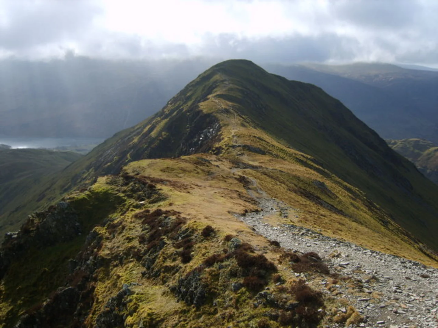
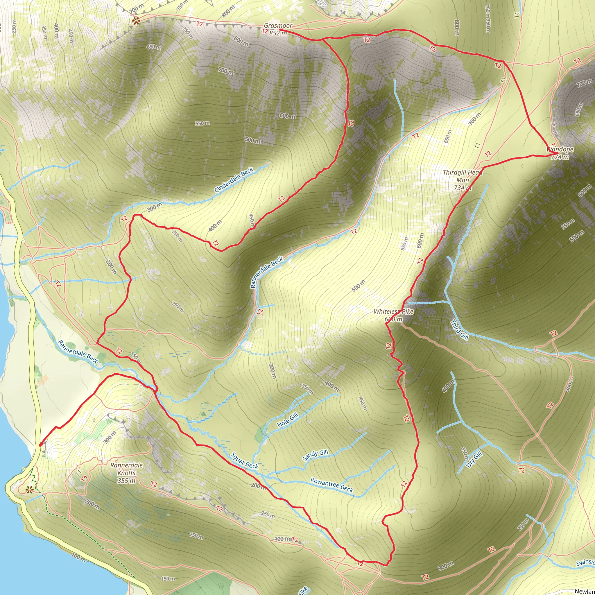
Starting near the charming village of Braithwaite in Cumberland, England, this loop trail spans approximately 11 kilometers (around 6.8 miles) with an elevation gain of about 800 meters (2,625 feet). The trailhead is easily accessible by car, with parking available in Braithwaite. For those using public transport, the nearest train station is in Keswick, from where you can take a local bus or taxi to Braithwaite.### Initial Ascent and Whiteless Pike The hike begins with a steady ascent through lush green fields and past quaint stone walls, typical of the Lake District. As you climb, the path becomes steeper and rockier, leading you towards Whiteless Pike. This section covers roughly 3 kilometers (1.9 miles) and gains about 400 meters (1,312 feet) in elevation. The summit of Whiteless Pike offers panoramic views of the surrounding fells and valleys, making it a rewarding first milestone.### Wandope and Geological Features Continuing from Whiteless Pike, the trail leads you towards Wandope. This stretch is less steep but still challenging, covering another 2 kilometers (1.2 miles) with an additional 200 meters (656 feet) of elevation gain. Wandope is known for its unique geological formations, including exposed rock strata that tell a story of ancient volcanic activity. Keep an eye out for these fascinating features as you make your way to the summit.### Grasmoor and Wildlife From Wandope, the path takes you to Grasmoor, the highest point on this loop. This section is about 2.5 kilometers (1.5 miles) long and involves a final ascent of 200 meters (656 feet). Grasmoor offers sweeping views of the Lake District, including Crummock Water and Buttermere. The area is also a haven for wildlife; you might spot red deer, peregrine falcons, and various species of butterflies.### Descent and Return to Braithwaite The descent from Grasmoor is gradual, taking you through heather-covered moorlands and past small streams. This final leg of the journey is approximately 3.5 kilometers (2.2 miles) and brings you back to Braithwaite. The path can be slippery, especially after rain, so take care on your way down.### Historical Significance The Lake District has a rich history, and this trail is no exception. The area around Grasmoor has been inhabited since prehistoric times, with evidence of ancient settlements and stone circles. During the Industrial Revolution, the region was also known for its mining activities, particularly for lead and copper. As you hike, you'll pass remnants of these historical endeavors, adding an extra layer of intrigue to your journey.### Navigation and Safety Given the varied terrain and potential for rapidly changing weather conditions, it's advisable to use a reliable navigation tool like HiiKER to stay on track. Ensure you have appropriate gear, including sturdy hiking boots, weather-appropriate clothing, and sufficient water and snacks.This loop trail offers a blend of natural beauty, challenging climbs, and historical intrigue, making it a must-do for any avid hiker exploring the Lake District.
What to expect?
Activity types
Comments and Reviews
User comments, reviews and discussions about the Whiteless Pike,Wandope and Grasmoor Loop, England.
4.4
average rating out of 5
5 rating(s)

