Download
Preview
Add to list
More
12.8 km
~4 hrs 18 min
1049 m
Loop
“Embark on a captivating 13 km journey through lush pastures, dramatic cols, and historic passes near Cumberland, England.”
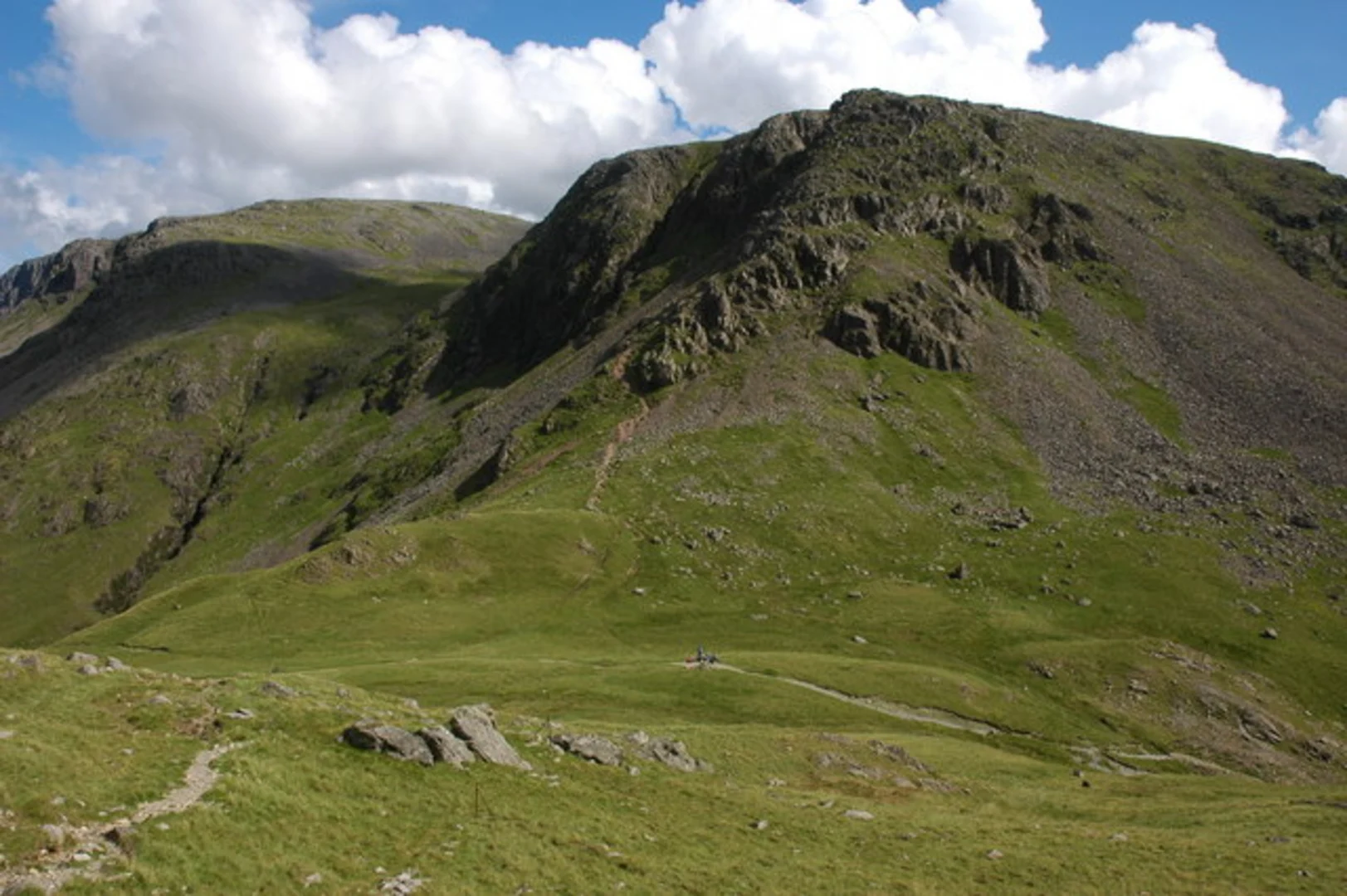
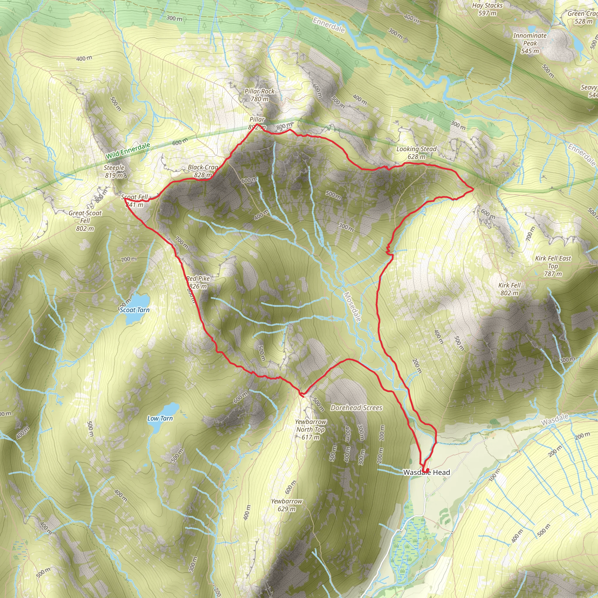
Starting your adventure near Cumberland, England, the Scoat Fell, Wind Gap, and Black Sail Pass Loop is a captivating 13 km (8 miles) journey with an elevation gain of approximately 1000 meters (3280 feet). This loop trail is rated as medium difficulty, making it suitable for hikers with a moderate level of fitness and some experience in hill walking.### Getting There To reach the trailhead, you can drive or use public transport. If driving, head towards the nearest significant landmark, Ennerdale Bridge, which is well-signposted and has parking facilities. For those using public transport, the nearest major town is Whitehaven, from where you can catch a bus to Ennerdale Bridge. From there, it's a short walk to the trailhead.### Trail Overview The trail begins with a gentle ascent through lush, green pastures and woodlands, offering a serene start to your hike. As you progress, the path becomes steeper, leading you towards the first significant landmark, Scoat Fell. At around 4 km (2.5 miles) into the hike, you'll reach the summit of Scoat Fell, standing at 841 meters (2759 feet). Here, you'll be rewarded with panoramic views of the surrounding fells and valleys.### Wind Gap Continuing from Scoat Fell, the trail descends slightly before ascending again towards Wind Gap. This section is approximately 2 km (1.2 miles) and involves a mix of rocky terrain and grassy slopes. Wind Gap is a narrow col between Scoat Fell and Pillar, offering dramatic views and a sense of isolation. Be cautious here, as the path can be slippery, especially after rain.### Black Sail Pass From Wind Gap, the trail descends steeply towards Black Sail Pass. This section is about 3 km (1.9 miles) and can be challenging due to loose rocks and steep gradients. Black Sail Pass is a historic route used by shepherds and travelers for centuries. The pass itself is a narrow, rugged path that offers breathtaking views of the Ennerdale Valley and the surrounding peaks.### Wildlife and Flora Throughout the hike, keep an eye out for local wildlife. Red deer, foxes, and a variety of bird species, including peregrine falcons and buzzards, are commonly spotted in this area. The flora is equally impressive, with heather, bilberry, and various wildflowers adding splashes of color to the landscape.### Historical Significance The region is steeped in history, with ancient stone walls and remnants of old shepherd huts dotting the landscape. The Black Sail Pass has been a crucial route for centuries, connecting the remote valleys and facilitating trade and communication.### Navigation Given the varied terrain and potential for rapidly changing weather conditions, it's advisable to use a reliable navigation tool like HiiKER to keep you on track. The app provides detailed maps and real-time updates, ensuring you stay on the correct path.### Final Stretch The final leg of the loop takes you back towards the trailhead, descending through picturesque valleys and alongside babbling brooks. This section is around 4 km (2.5 miles) and offers a gentle cooldown after the more strenuous parts of the hike.Prepare adequately with appropriate gear, plenty of water, and snacks. The weather can change rapidly, so layers and waterproofs are essential. Enjoy the stunning landscapes and the sense of accomplishment as you complete this rewarding loop trail.
What to expect?
Activity types
Comments and Reviews
User comments, reviews and discussions about the Scoat Fell, Wind Gap and Black Sail Pass Loop, England.
5.0
average rating out of 5
3 rating(s)

