Download
Preview
Add to list
More
6.9 km
~1 hrs 42 min
204 m
Loop
“The Wincle Loop is a scenic 7 km trail featuring diverse landscapes, historical sites, and moderate difficulty.”
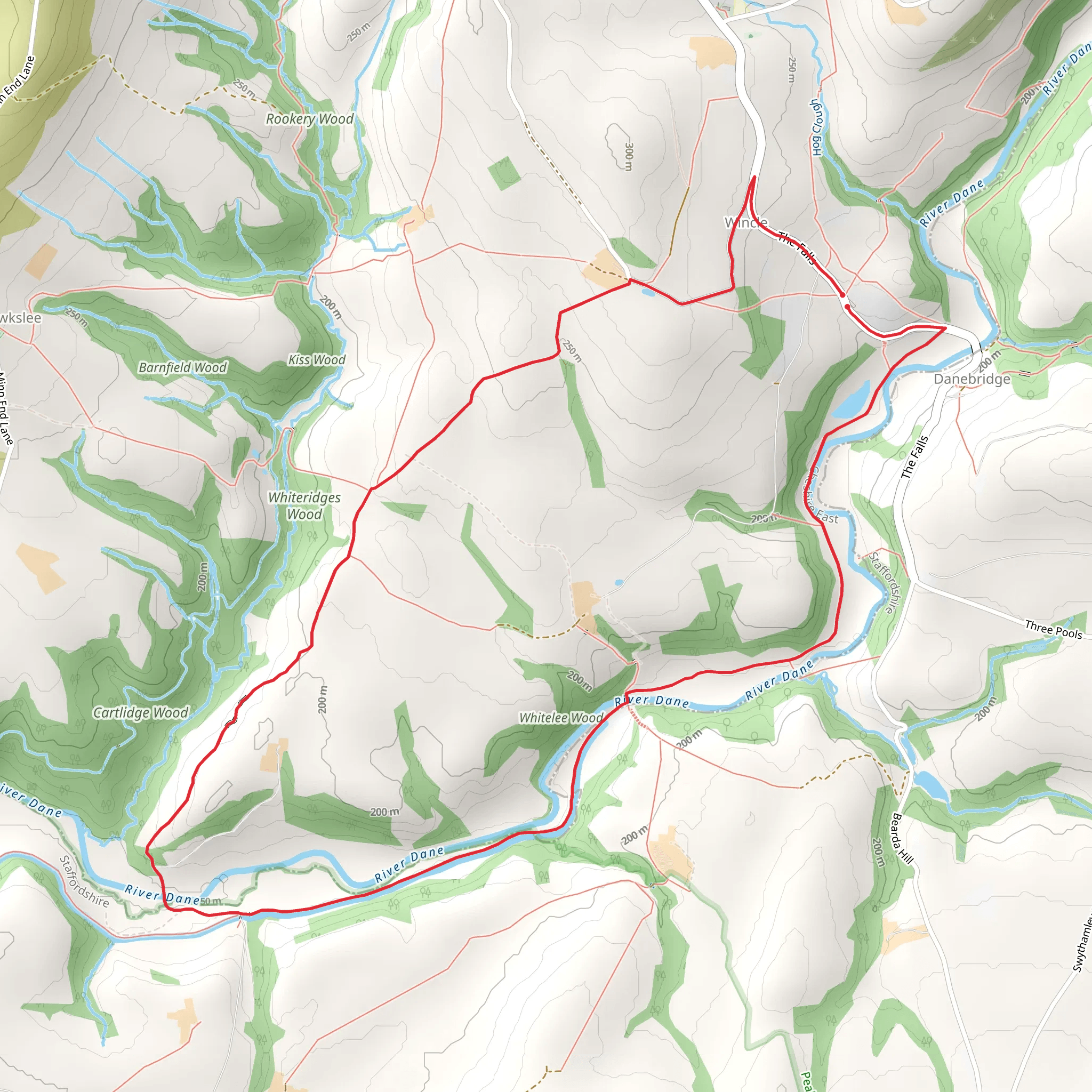
Starting near Cheshire East, England, the Wincle Loop is a delightful 7 km (4.3 miles) trail with an elevation gain of approximately 200 meters (656 feet). This loop trail is rated as medium difficulty, making it suitable for moderately experienced hikers.
Getting There To reach the trailhead, you can drive or use public transport. If driving, set your GPS to Wincle Brewery, Danebridge, Wincle, Macclesfield SK11 0QE, which is a well-known landmark near the starting point. For those using public transport, the nearest train station is Macclesfield. From there, you can take a local bus or taxi to Wincle Brewery.
Trail Overview The Wincle Loop offers a variety of landscapes, from lush woodlands to open fields, and provides stunning views of the Cheshire countryside. The trail is well-marked, but it's always a good idea to have a navigation tool like HiiKER for added assurance.
Key Landmarks and Points of Interest
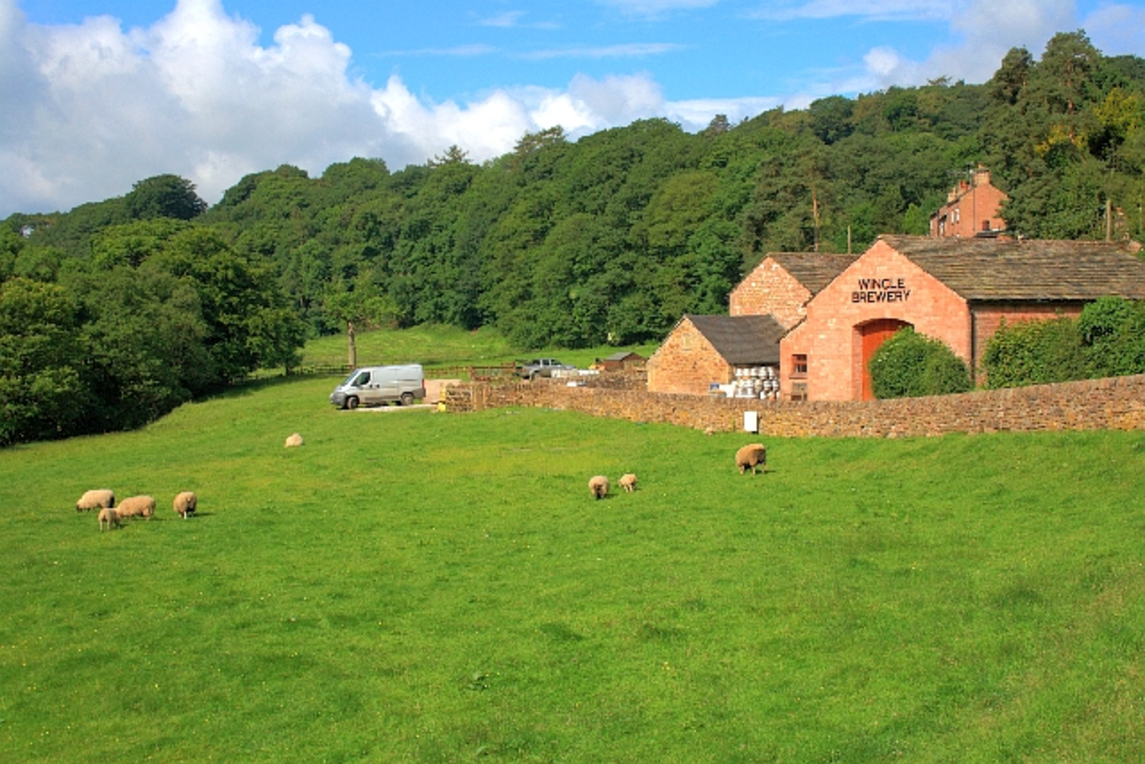
#### Wincle Brewery At the start of your hike, you'll pass by Wincle Brewery, a local gem known for its craft beers. It's worth noting for a post-hike refreshment.
#### Dane Valley Around the 2 km (1.2 miles) mark, you'll enter the picturesque Dane Valley. The River Dane meanders through this area, offering serene views and the soothing sound of flowing water. This section is relatively flat, making it a good spot to catch your breath.
#### Gradbach Mill Approximately 4 km (2.5 miles) into the hike, you'll come across Gradbach Mill, a historic building that dates back to the 18th century. Originally a silk mill, it now serves as a youth hostel and is a fascinating glimpse into the area's industrial past.
Flora and Fauna The Wincle Loop is rich in biodiversity. In the woodlands, you might spot deer, foxes, and a variety of bird species, including woodpeckers and owls. The open fields are home to wildflowers like bluebells in the spring and heather in the late summer.
Elevation and Terrain The trail features a mix of gentle slopes and steeper inclines. The most significant elevation gain occurs between the 3 km (1.9 miles) and 5 km (3.1 miles) marks, where you'll ascend approximately 100 meters (328 feet). This section can be a bit challenging, so take your time and enjoy the panoramic views from the top.
Historical Significance The area around Wincle has a rich history. The village itself dates back to the Domesday Book of 1086. Along the trail, you'll find remnants of old stone walls and farmsteads, offering a glimpse into the agricultural heritage of the region.
Practical Tips - Wear sturdy hiking boots, as the trail can be muddy, especially after rain. - Bring a map or use HiiKER for navigation. - Pack enough water and snacks, as there are no facilities along the trail. - Check the weather forecast before heading out, as conditions can change rapidly.
The Wincle Loop is a rewarding hike that combines natural beauty, historical landmarks, and a moderate challenge, making it a perfect day out for hikers looking to explore the Cheshire countryside.
What to expect?
Activity types
Comments and Reviews
User comments, reviews and discussions about the Wincle Loop, England.
4.5
average rating out of 5
4 rating(s)

