Download
Preview
Add to list
More
5.2 km
~1 hrs 12 min
103 m
Loop
“The Coley Loop is a scenic, moderately challenging 5 km trail near Calderdale, rich in history and nature.”
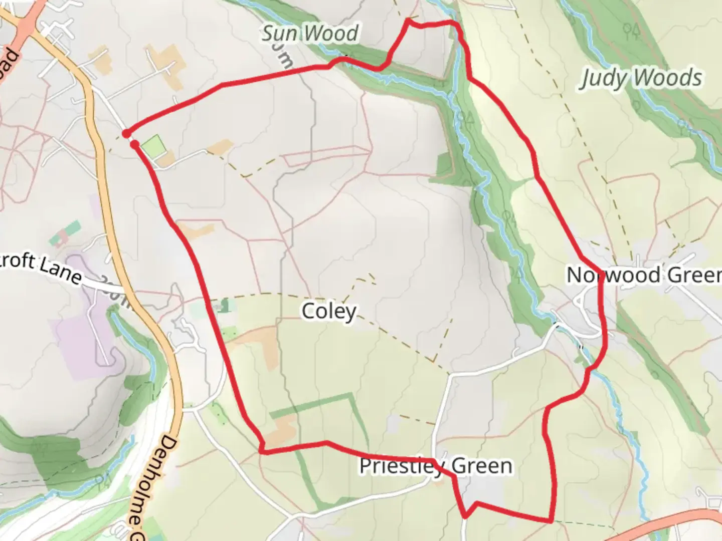
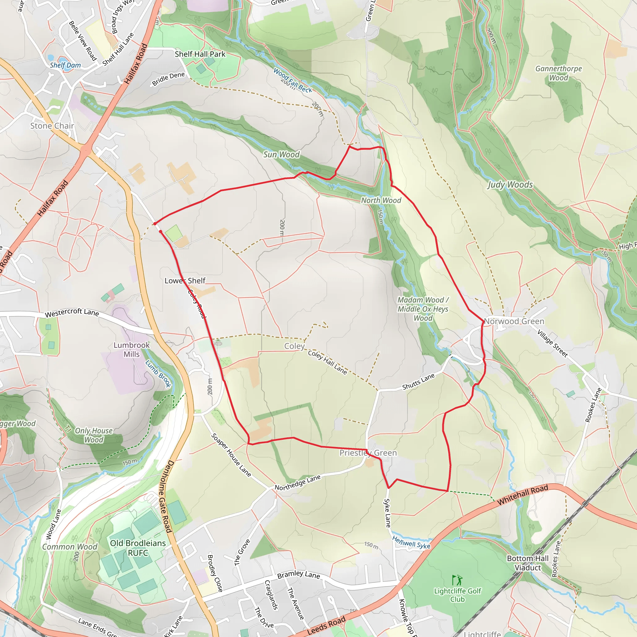
Starting near Calderdale, England, the Coley Loop is a delightful 5 km (approximately 3.1 miles) loop trail with an elevation gain of around 100 meters (328 feet). This trail offers a moderate challenge, making it suitable for hikers with some experience. ### Getting There To reach the trailhead, you can drive or use public transport. If driving, set your GPS to the vicinity of Coley Church, Coley Road, Halifax, HX3 7SA. For those using public transport, the nearest bus stop is at Coley Church, serviced by local buses from Halifax and Bradford. From the bus stop, it's a short walk to the trailhead.### Trail Overview The Coley Loop begins near the historic Coley Church, a significant landmark dating back to the 16th century. The church itself is worth a visit for its beautiful architecture and serene surroundings. As you start your hike, you'll be greeted by a mix of open fields and wooded areas, providing a varied landscape that keeps the hike interesting.### Key Sections and Landmarks - First Kilometer (0.6 miles): The initial stretch is relatively flat, passing through pastoral landscapes dotted with grazing sheep. Keep an eye out for the dry stone walls, a characteristic feature of the Yorkshire countryside. - Second Kilometer (1.2 miles): As you progress, the trail begins to ascend gently. Here, you'll enter a wooded area known as Judy Woods. This section is particularly beautiful in the spring when bluebells carpet the forest floor. The woods are also home to various bird species, so bring your binoculars if you're a birdwatcher. - Third Kilometer (1.8 miles): The trail continues to climb, reaching its highest point at around 100 meters (328 feet) of elevation gain. From this vantage point, you can enjoy panoramic views of the Calderdale Valley. This is a great spot to take a break and soak in the scenery. - Fourth Kilometer (2.5 miles): The descent begins, leading you through more wooded areas and eventually opening up to fields. This section can be muddy after rain, so appropriate footwear is recommended. - Final Kilometer (3.1 miles): The last stretch brings you back towards Coley Church, passing by a few charming cottages and farmhouses. The trail here is well-marked and easy to follow.### Historical Significance The area around Calderdale is steeped in history. Coley Church itself has historical significance, having been a place of worship for over 400 years. The surrounding landscape has been shaped by centuries of agricultural use, and you'll notice remnants of old farm buildings and stone walls that tell the story of the region's past.### Navigation and Safety For navigation, it's highly recommended to use the HiiKER app, which provides detailed maps and real-time tracking to ensure you stay on course. The trail is generally well-marked, but having a reliable navigation tool can enhance your hiking experience.### Flora and Fauna The Coley Loop offers a rich tapestry of flora and fauna. In addition to the bluebells in Judy Woods, you'll find a variety of wildflowers along the trail. The wooded areas are home to squirrels, rabbits, and a variety of bird species, including woodpeckers and owls.### Final Tips - Footwear: Wear sturdy hiking boots, especially if hiking after rain. - Weather: Check the weather forecast before heading out, as conditions can change rapidly. - Supplies: Bring water and snacks, as there are no facilities along the trail. - Respect Nature: Follow the Leave No Trace principles to keep the trail beautiful for future hikers.Enjoy your hike on the Coley Loop, a trail that beautifully encapsulates the charm and history of the Calderdale region.
What to expect?
Activity types
Comments and Reviews
User comments, reviews and discussions about the Coley Loop, England.
5.0
average rating out of 5
3 rating(s)
