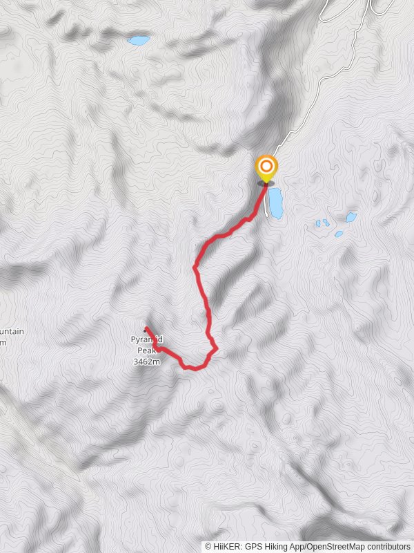
Pyramid Peak via Black Mountain Creek Trail
13.3 km
~3 hrs 53 min
744 m
“"Experience Colorado's rugged beauty on a rewarding 13 km hike through forests, meadows, and alpine landscapes."”
Starting your journey near Rio Blanco County, Colorado, the Pyramid Peak via Black Mountain Creek Trail offers a rewarding 13 km (8 miles) out-and-back adventure with an elevation gain of approximately 700 meters (2,300 feet). This medium-difficulty trail is perfect for those looking to experience the rugged beauty of Colorado's wilderness.
### Getting There
To reach the trailhead, you can drive or use public transport. If driving, head towards the town of Meeker, Colorado. From Meeker, take County Road 8 east for about 30 miles until you reach the turnoff for Forest Road 250. Follow Forest Road 250 for approximately 10 miles to the trailhead. For those using public transport, the nearest significant landmark is the town of Meeker, where you can arrange for a local shuttle or taxi service to take you to the trailhead.
### Trail Overview
The trail begins at the Black Mountain Creek Trailhead, located near the confluence of Black Mountain Creek and the White River. The initial section of the trail meanders through a dense forest of aspen and pine trees, providing ample shade and a serene atmosphere. As you progress, the trail gradually ascends, offering glimpses of the surrounding peaks and valleys.
### Significant Landmarks and Nature
At around 3 km (1.9 miles) into the hike, you'll encounter a picturesque meadow, often frequented by elk and deer. This is a great spot to take a break and enjoy the natural beauty. Continuing on, the trail becomes steeper and rockier, requiring careful footing. Approximately 5 km (3.1 miles) from the trailhead, you'll reach a small alpine lake, a perfect spot for a quick rest and some photos.
### Wildlife and Flora
The area is rich in wildlife, including black bears, mountain lions, and various bird species. Keep an eye out for marmots and pikas as you ascend higher. The flora changes with elevation, transitioning from dense forests to alpine meadows filled with wildflowers during the summer months.
### Historical Significance
The region around Pyramid Peak has a rich history, with evidence of Native American presence dating back thousands of years. The Ute tribe, in particular, used these lands for hunting and gathering. In the late 19th century, the area saw an influx of settlers and miners, leaving behind remnants of old mining camps and cabins that you might spot along the trail.
### Final Ascent
The final 2 km (1.2 miles) of the trail are the most challenging, with a steep ascent to the summit of Pyramid Peak. The trail becomes less defined, and hikers should use navigation tools like HiiKER to stay on track. The summit offers panoramic views of the surrounding mountain ranges and valleys, making the effort well worth it.
### Return Journey
After soaking in the views, retrace your steps back to the trailhead. The descent can be tricky, especially on the steeper sections, so take your time and watch your footing.
This trail offers a mix of natural beauty, wildlife, and historical significance, making it a must-do for any avid hiker visiting Colorado.
Reviews
User comments, reviews and discussions about the Pyramid Peak via Black Mountain Creek Trail, Colorado.
0.0
average rating out of 5
0 rating(s)


