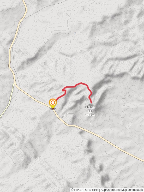
9.1 km
~2 hrs 11 min
220 m
“Discover Colorado's beauty on the moderately challenging 9km Mellen Hill trail with stunning summit views.”
Starting near Rio Blanco County, Colorado, the Mellen Hill trail offers a moderately challenging out-and-back hike that spans approximately 9 kilometers (5.6 miles) with an elevation gain of around 200 meters (656 feet). This trail is perfect for those looking to experience the natural beauty of Colorado without tackling an overly strenuous route.
### Getting There
To reach the trailhead, you can drive or use public transportation. If you're driving, head towards Rio Blanco County and look for signs directing you to the trailhead near the town of Meeker. For those using public transport, the nearest significant landmark is the Meeker Airport (Meeker Coulter Field), from where you can take a local taxi or rideshare service to the trailhead.
### Trail Overview
The trail begins with a gentle ascent through a mixed forest of pine and aspen trees. Early on, you'll notice the fresh scent of pine and the rustling of leaves, which sets a serene tone for the hike. The first kilometer (0.6 miles) is relatively easy, with a gradual elevation gain of about 50 meters (164 feet).
### Key Landmarks and Points of Interest
#### The Meadow
At approximately 2 kilometers (1.2 miles) into the hike, you'll come across a beautiful open meadow. This is a great spot to take a break, have a snack, and enjoy the panoramic views of the surrounding hills. During the spring and summer months, the meadow is often dotted with wildflowers, adding a splash of color to the landscape.
#### Wildlife Spotting
As you continue, keep an eye out for local wildlife. Deer and elk are commonly seen in this area, especially during the early morning or late afternoon. Birdwatchers will also appreciate the variety of species that inhabit the region, including hawks and eagles.
### Historical Significance
The Mellen Hill area has a rich history, with evidence of Native American presence dating back thousands of years. Artifacts such as arrowheads and pottery shards have been found in the vicinity, indicating that this area was once a significant hunting ground. Additionally, the trail passes near old mining sites from the late 19th century, remnants of Colorado's mining boom.
### Final Ascent
The last stretch of the trail involves a steeper climb, gaining about 100 meters (328 feet) in elevation over the final 2 kilometers (1.2 miles). This section can be a bit more challenging, so take your time and ensure you have adequate water and energy snacks. The trail is well-marked, but it's always a good idea to have a reliable navigation tool like HiiKER to keep you on track.
### Reaching the Summit
Upon reaching the summit of Mellen Hill, you'll be rewarded with breathtaking views of the surrounding valleys and distant mountain ranges. This is an excellent spot for photography, so don't forget your camera. The summit also offers a peaceful place to rest and reflect before beginning your descent.
### Descent and Return
The return journey follows the same path, allowing you to revisit the beautiful landscapes and perhaps notice details you missed on the way up. The descent is generally easier, but still requires caution, especially on the steeper sections.
### Preparation Tips
- Footwear: Sturdy hiking boots are recommended due to the varied terrain. - Water: Carry at least 2 liters (0.5 gallons) of water per person. - Weather: Check the weather forecast before heading out, as conditions can change rapidly. - Navigation: Use HiiKER for accurate trail navigation and to stay on course.
By following these guidelines and being prepared, you'll have a memorable and enjoyable hike on the Mellen Hill trail.
Reviews
User comments, reviews and discussions about the Mellen Hill, Colorado.
5.0
average rating out of 5
3 rating(s)
Loading reviews...


