Download
Preview
Add to list
More
34.2 km
~2 days
1010 m
Multi-Day
“Embark on the Marvine Loop's 21-mile trek through aspen groves and wildlife-rich forests for a glimpse into Colorado's rugged mountain history.”
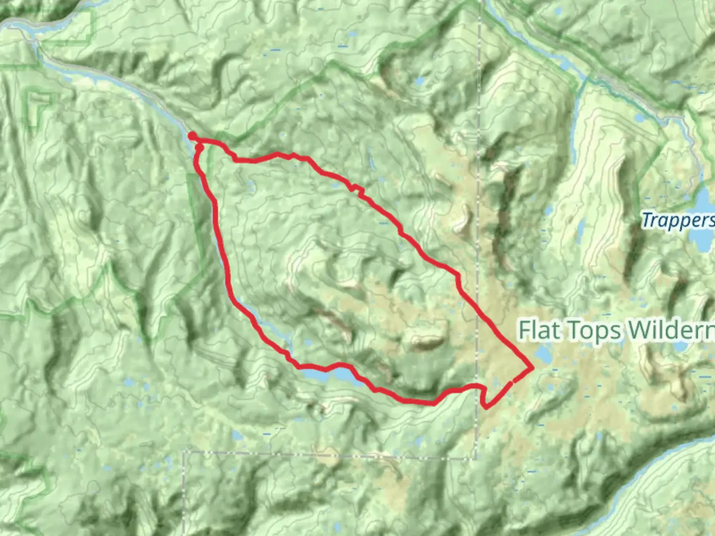
The Marvine Loop, nestled in the heart of the Flat Tops Wilderness Area near Rio Blanco County, Colorado, offers an immersive experience into the rugged beauty of the Rocky Mountains. This approximately 34 km (21 miles) trail is a point-to-point journey that begins at the Marvine Campground, easily accessible by car from the nearest towns of Meeker or Yampa. There is no direct public transportation to the trailhead, so hikers will need to drive or arrange a private shuttle.
As you embark on the Marvine Loop, you'll be greeted with a steady climb, contributing to the total elevation gain of around 1000 meters (3280 feet). The trail is rated as medium difficulty, making it accessible to hikers with a reasonable level of fitness and experience.
Navigating the Trail
To navigate the trail, hikers are encouraged to use the HiiKER app, which provides detailed maps and GPS coordinates to ensure you stay on the right path. The trail is well-marked, but as with any backcountry adventure, conditions can change, and having a reliable navigation tool is essential.
Natural Landmarks and Wildlife
The Marvine Loop is a treasure trove of natural landmarks. Approximately 5 km (3 miles) into the hike, you'll encounter the Marvine Creek, which accompanies you with its soothing sounds as you traverse through aspen groves and coniferous forests. The trail offers stunning views of the Flat Tops, a series of flat-topped mountains that give the wilderness area its name.
Wildlife is abundant in this region. Keep an eye out for elk, mule deer, and the occasional black bear, while overhead, birds of prey such as eagles and hawks can be seen soaring against the backdrop of the Colorado sky. Remember to keep a safe distance from wildlife and practice Leave No Trace principles to preserve the area's natural beauty.
Historical Significance
The Flat Tops Wilderness Area is steeped in history. It was one of the original areas protected by the Wilderness Act of 1964, a testament to its unspoiled landscapes and ecological importance. As you hike, imagine the Ute tribes who once roamed these lands, and the early settlers who found both challenges and opportunities in the rugged terrain.
Preparing for the Hike
Before setting out on the Marvine Loop, ensure you are well-prepared with adequate supplies. Bring plenty of water, as sources along the trail may not be reliable or require treatment before consumption. Pack layers of clothing to adapt to the unpredictable mountain weather, and consider bringing trekking poles to assist with the varied terrain.
Accessing the Trailhead
To reach the Marvine Campground trailhead, take County Road 8 from Meeker towards the Flat Tops Wilderness Area. Follow the signs for Marvine Campground, where you'll find parking and the trailhead. The drive from Meeker to the trailhead is scenic and offers a glimpse of the rural Colorado landscape.
Remember, the Marvine Loop is a backcountry trail, and while it offers an incredible opportunity to connect with nature, it also requires respect for the environment and preparation for self-sufficiency. Happy hiking!

Comments and Reviews
User comments, reviews and discussions about the Marvine Loop, Colorado.
4.33
average rating out of 5
3 rating(s)