Download
Preview
Add to list
More
40.5 km
~2 day
1645 m
Out and Back
“Embark on a thrilling hike through Colorado's scenic wilderness, uncovering alpine lakes and rich history.”
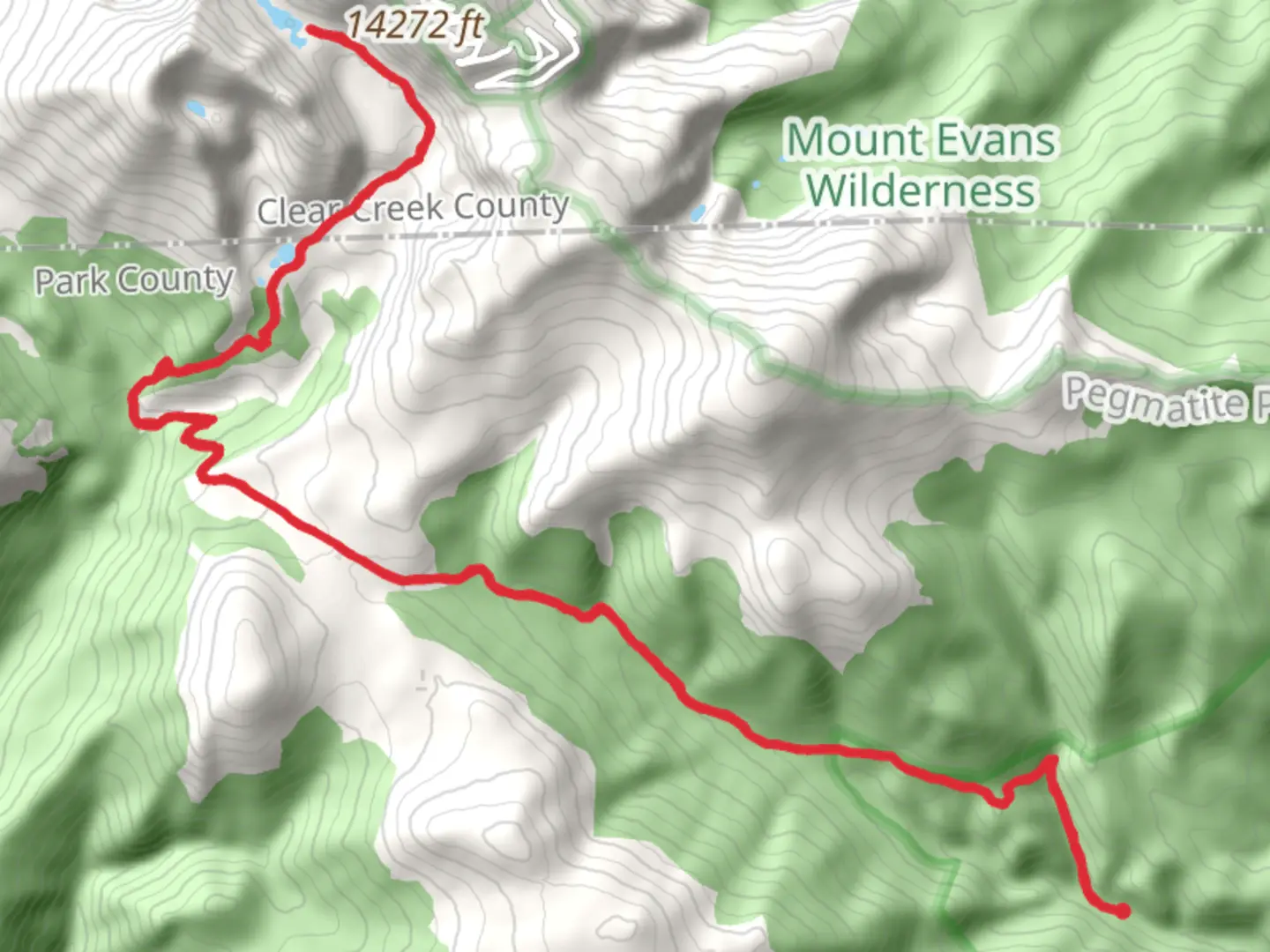
Nestled in the rugged beauty of Colorado, the Abyss Lake and Helms Lake via Rosalie Trail offers an exhilarating adventure for seasoned hikers. This challenging out-and-back trail spans approximately 40 kilometers (about 25 miles) with an elevation gain of around 1,600 meters (5,250 feet), promising breathtaking vistas and a rewarding experience for those who embark on this journey.### Getting ThereThe trailhead is conveniently located near Park County, Colorado. For those driving, you can reach the trailhead by heading towards the Guanella Pass Scenic Byway. The nearest significant landmark is the town of Grant, Colorado. From Grant, take County Road 62 (Guanella Pass Road) north for about 10 miles until you reach the Abyss Trailhead parking area. If you're relying on public transport, the closest major city is Denver. From Denver, you can take a bus to the town of Bailey, and from there, arrange for a local taxi or rideshare to the trailhead.### Trail Highlights#### Rosalie TrailThe journey begins on the Rosalie Trail, which meanders through dense forests of lodgepole pine and Engelmann spruce. As you ascend, the trail offers glimpses of the surrounding peaks, including the majestic Mount Evans. The initial stretch is a moderate climb, allowing hikers to acclimate to the elevation gradually.#### Abyss LakeApproximately 16 kilometers (10 miles) into the hike, you'll reach Abyss Lake, a stunning alpine lake nestled in a cirque beneath the towering cliffs of Mount Bierstadt. The lake sits at an elevation of about 3,658 meters (12,000 feet), offering a serene spot to rest and take in the panoramic views. The area around Abyss Lake is known for its vibrant wildflower displays in the summer months, with columbines and Indian paintbrush adding splashes of color to the landscape.#### Helms LakeContinuing on, the trail leads you to Helms Lake, located roughly 4 kilometers (2.5 miles) beyond Abyss Lake. This secluded lake is less frequented, providing a tranquil setting for those seeking solitude. The path to Helms Lake is more rugged and requires careful navigation, so it's advisable to use the HiiKER app to stay on track. The elevation gain becomes more pronounced here, with steep sections that test your endurance.### Nature and WildlifeThe trail traverses diverse ecosystems, from subalpine forests to alpine tundra. Wildlife enthusiasts may encounter mule deer, elk, and the occasional black bear. Birdwatchers can spot a variety of species, including the Clark's nutcracker and the mountain bluebird. As you ascend, keep an eye out for marmots and pikas darting among the rocks.### Historical SignificanceThe region surrounding the trail is steeped in history, with remnants of old mining operations from the late 19th century. These mines were part of Colorado's rich mining heritage, and while most are now abandoned, they serve as a reminder of the area's past. The trail itself follows routes that were once used by miners and early settlers, adding a layer of historical intrigue to your hike.### Preparation and SafetyGiven the trail's difficulty rating, it's essential to be well-prepared. Ensure you have adequate supplies, including water, food, and weather-appropriate clothing. The weather in the mountains can change rapidly, so be prepared for sudden shifts in temperature and conditions. Due to the high elevation, acclimatization is crucial to avoid altitude sickness. Always check trail conditions and weather forecasts before setting out, and consider starting early to make the most of daylight hours.

What to expect?
Activity types
Comments and Reviews
User comments, reviews and discussions about the Abyss Lake and Helms Lake via Rosalie Trail, Colorado.
average rating out of 5
0 rating(s)