Download
Preview
Add to list
More
77.0 km
~6 days
3819 m
Multi-Day
“Trek the Weminuche High Route: a high-altitude, wild adventure through Colorado's rugged peaks and historic landscapes.”
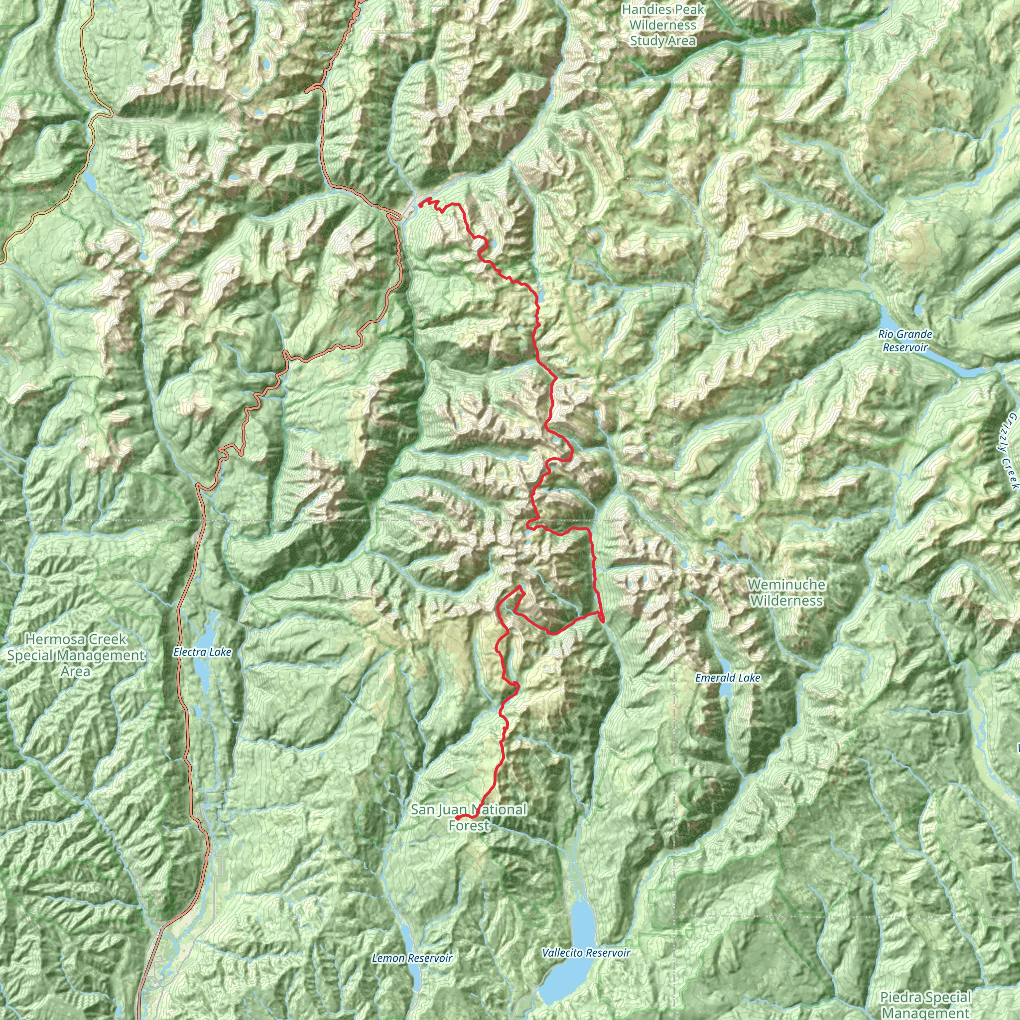
The Weminuche High Route is an ambitious and challenging trek that spans approximately 77 kilometers (about 48 miles) through the heart of the San Juan Mountains in Colorado. With an elevation gain of roughly 3800 meters (approximately 12,500 feet), this point-to-point trail is not for the faint-hearted and is best suited for experienced hikers who are well-prepared for high-altitude, backcountry travel.
Getting to the Trailhead
The trailhead is located near La Plata County, and the nearest significant landmark is the town of Silverton, Colorado. To reach the starting point, hikers can drive to Silverton and then take a 4x4 vehicle to the trailhead, as the roads can be rough and rugged. Alternatively, the Durango & Silverton Narrow Gauge Railroad offers a unique and scenic route into the wilderness, dropping passengers off at the Elk Park stop, from which hikers can access the trailhead.
Navigating the Route
Hikers should be equipped with a reliable navigation tool such as HiiKER, which provides detailed maps and GPS tracking to assist with route finding. The Weminuche High Route is not officially marked, so strong navigation skills are essential. The route traverses multiple high passes, remote basins, and offers the opportunity to summit several peaks along the way.
Landmarks and Scenery
The trail offers breathtaking views of jagged peaks, alpine meadows, and pristine lakes. Notable landmarks include the Vestal Basin, known for its iconic peak, Vestal Peak, and the Grenadier Range, which presents some of the most rugged and dramatic mountain scenery in the Rockies. Hikers will also encounter the Continental Divide, where the trail intersects with the famous Colorado Trail.
Flora and Fauna
The Weminuche Wilderness is home to a diverse array of wildlife, including black bears, mountain lions, elk, and marmots. Hikers should be aware of proper food storage and bear safety practices. The region's flora is equally impressive, with wildflowers such as columbines and Indian paintbrushes dotting the landscape, especially during the summer months.
Historical Significance
The area is steeped in history, with the San Juan Mountains being a central part of Colorado's mining boom in the late 19th century. The remnants of old mines and ghost towns can be seen throughout the region, offering a glimpse into the area's past.
Preparation and Safety
Due to the trail's difficulty and remote nature, hikers should be self-sufficient and prepared for changing weather conditions. It is essential to carry a comprehensive first-aid kit, adequate food and water supplies, and emergency shelter. Acclimatization to the high altitude is crucial to avoid altitude sickness.
Seasonal Considerations
The best time to hike the Weminuche High Route is from July to September when the snow has mostly melted, and the weather is more stable. However, afternoon thunderstorms are common during this period, so an early start is advisable to avoid exposure to lightning on high ridges and peaks.
Leave No Trace
As always, hikers should adhere to Leave No Trace principles to minimize their impact on the environment, ensuring that the wilderness remains pristine for future generations to enjoy.
What to expect?
Activity types
Comments and Reviews
User comments, reviews and discussions about the Weminuche High Route, Colorado.
5.0
average rating out of 5
6 rating(s)

