2.7 km
~48 min
165 m
“Explore history and nature on the moderately challenging Welch Ditch and Basalt Cap Loop Trail.”
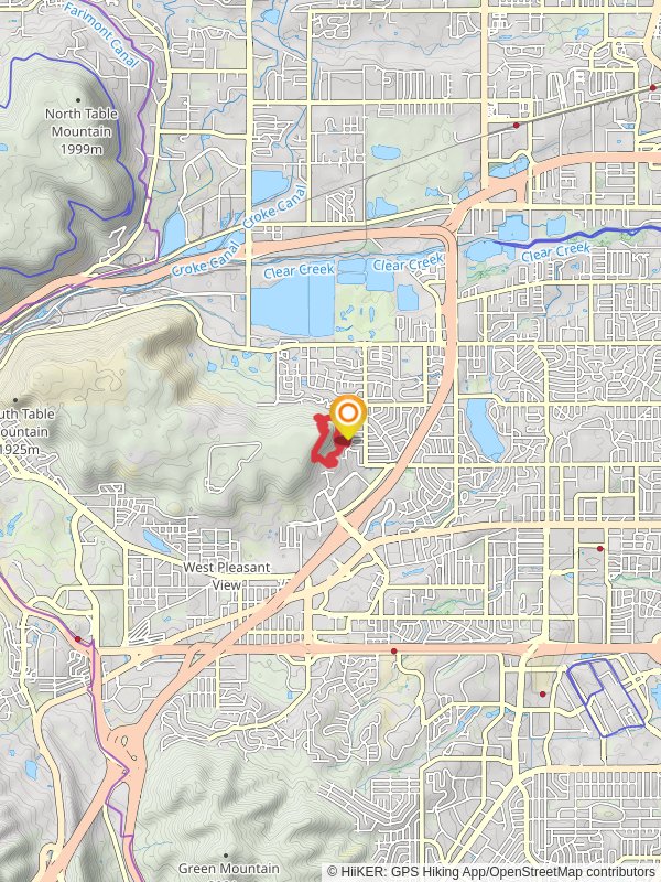
Starting your adventure near Jefferson County, Colorado, the Welch Ditch Trail and Basalt Cap Loop Trail offers a delightful 3 km (1.86 miles) loop with an elevation gain of approximately 100 meters (328 feet). This trail is rated as medium difficulty, making it suitable for moderately experienced hikers.
### Getting There To reach the trailhead, you can drive or use public transportation. If driving, head towards Golden, Colorado, and follow signs to Clear Creek Canyon Park. The nearest significant landmark is the Clear Creek Canyon Park parking area. For those using public transport, take the RTD bus to Golden Station and then a short taxi or rideshare to the trailhead.
### Trail Overview The trail begins at the Clear Creek Canyon Park parking area. From here, you'll embark on a scenic loop that combines the Welch Ditch Trail and the Basalt Cap Loop Trail. The initial section of the trail follows the historic Welch Ditch, an irrigation ditch constructed in the late 1800s. This part of the trail is relatively flat and offers a gentle introduction to the hike.
### Historical Significance The Welch Ditch is a significant historical feature, originally built to divert water from Clear Creek for agricultural purposes. As you hike along this section, you'll notice remnants of the old irrigation system, providing a glimpse into the area's agricultural past.
### Nature and Wildlife As you progress, the trail begins to ascend, leading you into a more rugged terrain. The elevation gain of 100 meters (328 feet) is gradual but steady. Along the way, you'll encounter a variety of flora and fauna. Keep an eye out for mule deer, foxes, and a diverse array of bird species. The trail is particularly beautiful in the spring and fall when wildflowers and autumn foliage are at their peak.
### Key Landmarks At approximately 1.5 km (0.93 miles) into the hike, you'll reach the Basalt Cap, a geological formation that offers stunning views of the surrounding landscape. This is a great spot to take a break and enjoy the panoramic vistas. The basalt formations are remnants of ancient volcanic activity, adding a unique geological aspect to your hike.
### Navigation The trail is well-marked, but it's always a good idea to have a reliable navigation tool. HiiKER is an excellent app for this purpose, providing detailed maps and real-time GPS tracking to ensure you stay on course.
### Final Stretch The final section of the loop descends back towards the Clear Creek Canyon Park parking area. This part of the trail is shaded by tall pines and offers a serene end to your hike. The entire loop takes about 1.5 to 2 hours to complete, depending on your pace and how often you stop to take in the scenery.
### Preparation Tips Given the moderate difficulty, it's advisable to wear sturdy hiking boots and bring plenty of water, especially during the warmer months. The trail can be rocky in sections, so trekking poles might be helpful for added stability. Always check the weather forecast before heading out, as conditions can change rapidly in this region.
Enjoy your hike on the Welch Ditch Trail and Basalt Cap Loop Trail, a perfect blend of history, nature, and stunning views.
Reviews
User comments, reviews and discussions about the Welch Ditch Trail and Basalt Cap Loop Trail, Colorado.
0.0
average rating out of 5
0 rating(s)


