20.6 km
~1 day 0 hrs
569 m
“Embark on a picturesque 21 km hike through Colorado's aspen groves and wildflower meadows, steeped in history and natural splendor.”
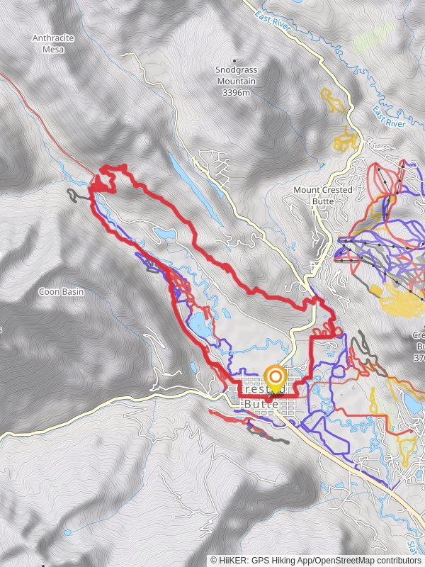
Nestled in the scenic heart of Gunnison County, Colorado, the Lower Loop Upper Section combined with the Woods Walk Loop Trail offers an immersive 21 km (approximately 13 miles) journey through diverse landscapes with an elevation gain of around 500 meters (about 1640 feet). This loop trail is rated medium in difficulty, making it accessible to hikers with a moderate level of fitness.
Getting to the Trailhead
To reach the trailhead, which is conveniently located near the town of Crested Butte, hikers can drive or take public transportation. If driving, take Gothic Road north from Crested Butte and turn left onto Slate River Road. The trailhead is just a short distance from this junction. For those opting for public transport, the local bus service provides access to Crested Butte, and from there, it's a quick taxi ride or a bike ride to the trailhead.
Trail Experience
As you embark on the Lower Loop Upper Section, you'll be greeted by the picturesque Slate River, with opportunities to spot beavers and other wildlife in their natural habitat. The trail meanders through aspen groves, which are particularly breathtaking in the fall when the leaves turn a vibrant gold. The path then leads you into evergreen forests, providing a refreshing canopy of shade.
After approximately 5 km (3.1 miles), the trail begins to ascend, offering panoramic views of the surrounding Elk Mountains. Keep an eye out for the remnants of historic mining operations, a nod to the region's rich past during the Colorado Silver Boom in the late 19th century.
Connecting to the Woods Walk Loop
The Woods Walk Loop intersects with the Lower Loop Upper Section at around the 10 km (6.2 miles) mark. This section is known for its wildflower displays in the spring and summer, with a colorful array of columbines, lupines, and Indian paintbrushes. The trail gently rises and falls, weaving through open meadows and dense forests, providing a varied hiking experience.
Wildlife is abundant in this area, so it's not uncommon to encounter deer, elk, and a variety of bird species. Remember to keep a safe distance from wildlife and to not feed any animals you may come across.
Navigational Tools
For navigation, hikers are encouraged to use the HiiKER app, which provides detailed maps and GPS tracking to ensure you stay on the correct path. It's always a good idea to download the trail map on your device before setting out, as cell service can be spotty in remote areas.
Preparation and Safety
Before setting out, ensure you have adequate water, as there are limited sources along the trail. The weather can change rapidly in the mountains, so pack layers and be prepared for varying conditions. It's also wise to inform someone of your hiking plans and expected return time.
Accessibility
The trail is best accessed from late spring to early fall, as snow can make the path difficult to navigate in the winter months. Dogs are allowed on the trail but should be kept on a leash to protect wildlife and the natural environment.
With its combination of natural beauty, historical significance, and varied terrain, the Lower Loop Upper Section and Woods Walk Loop Trail provide a fulfilling adventure for hikers looking to explore the heart of Colorado's mountainous landscape.
Reviews
User comments, reviews and discussions about the Lower Loop Upper Section and Woods Walk Loop Trail, Colorado.
5.0
average rating out of 5
10 rating(s)


