South Fork and Williams Fork Trail
Arapaho and Roosevelt National Forests · Grand County, Colorado
6.6 km
~1 hrs 29 min
112 m
“Explore a 7 km trail near Grand County, Colorado, with serene forests, wildlife, and historical intrigue.”
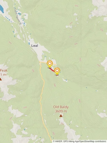
Starting near Grand County, Colorado, the South Fork and Williams Fork Trail offers a delightful 7 km (approximately 4.3 miles) out-and-back adventure with an elevation gain of around 100 meters (328 feet). This medium-difficulty trail is perfect for those looking to immerse themselves in the natural beauty of the area without tackling overly strenuous terrain.
### Getting There To reach the trailhead, you can drive or use public transportation. If driving, head towards the town of Parshall, Colorado. From there, take County Road 3 to the trailhead, which is located near the Williams Fork Reservoir. For those using public transport, the nearest significant landmark is the town of Granby, Colorado. From Granby, you can arrange for a local taxi or rideshare service to take you to the trailhead.
### Trail Overview The trail begins with a gentle ascent through a mixed forest of aspen and pine, providing ample shade and a serene atmosphere. As you progress, you'll encounter a series of small streams and creeks, which are particularly picturesque in the spring and early summer when the water flow is at its peak.
### Landmarks and Points of Interest - Williams Fork Reservoir: Approximately 1 km (0.6 miles) from the trailhead, you'll get your first glimpse of the Williams Fork Reservoir. This large body of water is a popular spot for fishing and boating, and its shimmering surface adds a touch of tranquility to the hike. - Wildlife Viewing: Keep an eye out for local wildlife, including deer, elk, and a variety of bird species. The area is known for its rich biodiversity, so bringing a pair of binoculars can enhance your experience. - Historical Significance: The region around the Williams Fork was historically inhabited by the Ute tribes. Artifacts and remnants of their presence can occasionally be found, adding a layer of historical intrigue to your hike.
### Navigation and Safety Using HiiKER for navigation is highly recommended. The app provides detailed maps and real-time updates, ensuring you stay on track. The trail is well-marked, but having a reliable navigation tool can be invaluable, especially if you decide to explore any of the smaller, less-traveled paths branching off the main trail.
### Flora and Fauna The trail is a botanical delight, especially during the spring and summer months. You'll encounter a variety of wildflowers, including columbines and Indian paintbrushes. The dense forest sections are home to numerous small mammals and birds, making it a great spot for nature enthusiasts.
### Elevation and Terrain The elevation gain of 100 meters (328 feet) is spread out over the 7 km (4.3 miles), making the ascent manageable for most hikers. The trail surface varies from packed dirt to rocky sections, so wearing sturdy hiking boots is advisable. Trekking poles can also be helpful, particularly on the steeper sections.
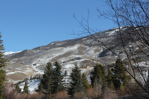
### Final Stretch As you approach the turnaround point, the trail opens up to a beautiful meadow, offering panoramic views of the surrounding mountains. This is an excellent spot to take a break, enjoy a snack, and soak in the natural beauty before heading back.
### Practical Tips - Water and Snacks: Bring enough water and snacks to keep your energy levels up. There are no facilities along the trail, so you'll need to be self-sufficient. - Weather: Check the weather forecast before you go. The area can experience sudden changes in weather, especially in the higher elevations. - Leave No Trace: Be mindful of the environment. Pack out all your trash and respect the natural habitat.
This trail offers a perfect blend of natural beauty, moderate challenge, and historical significance, making it a rewarding experience for hikers of all levels.
Reviews
User comments, reviews and discussions about the South Fork and Williams Fork Trail, Colorado.
5.0
average rating out of 5
6 rating(s)


