Download
Preview
Add to list
More
9.7 km
~2 hrs 55 min
589 m
Loop
“Embark on an awe-inspiring hike through Colorado's rugged beauty to summit the majestic Uneva Peak.”
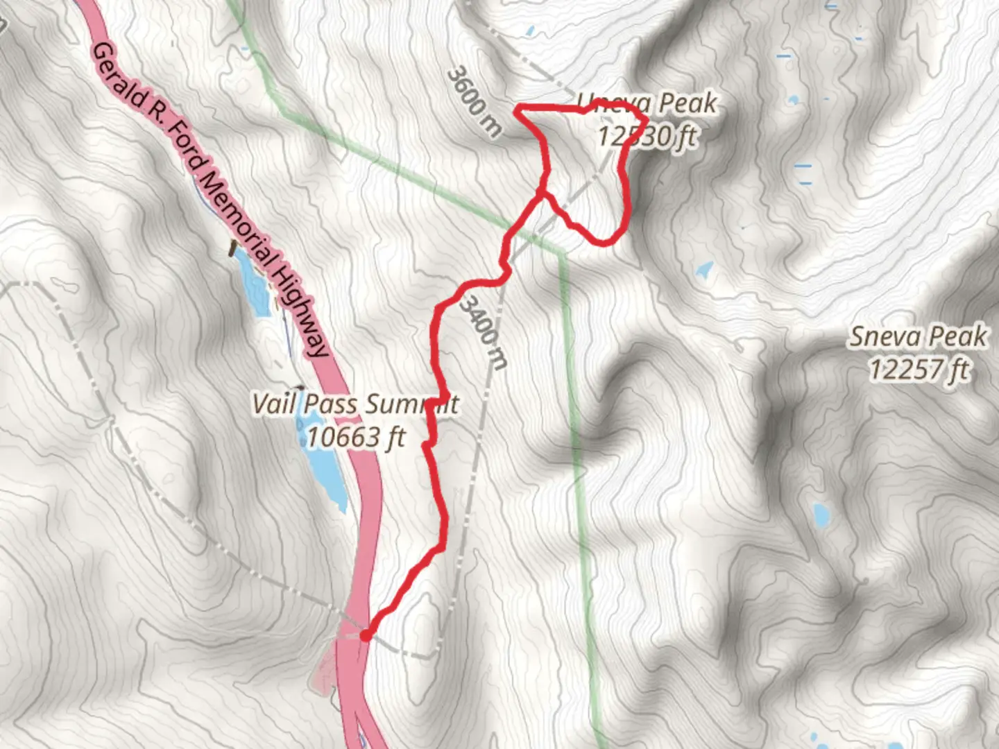
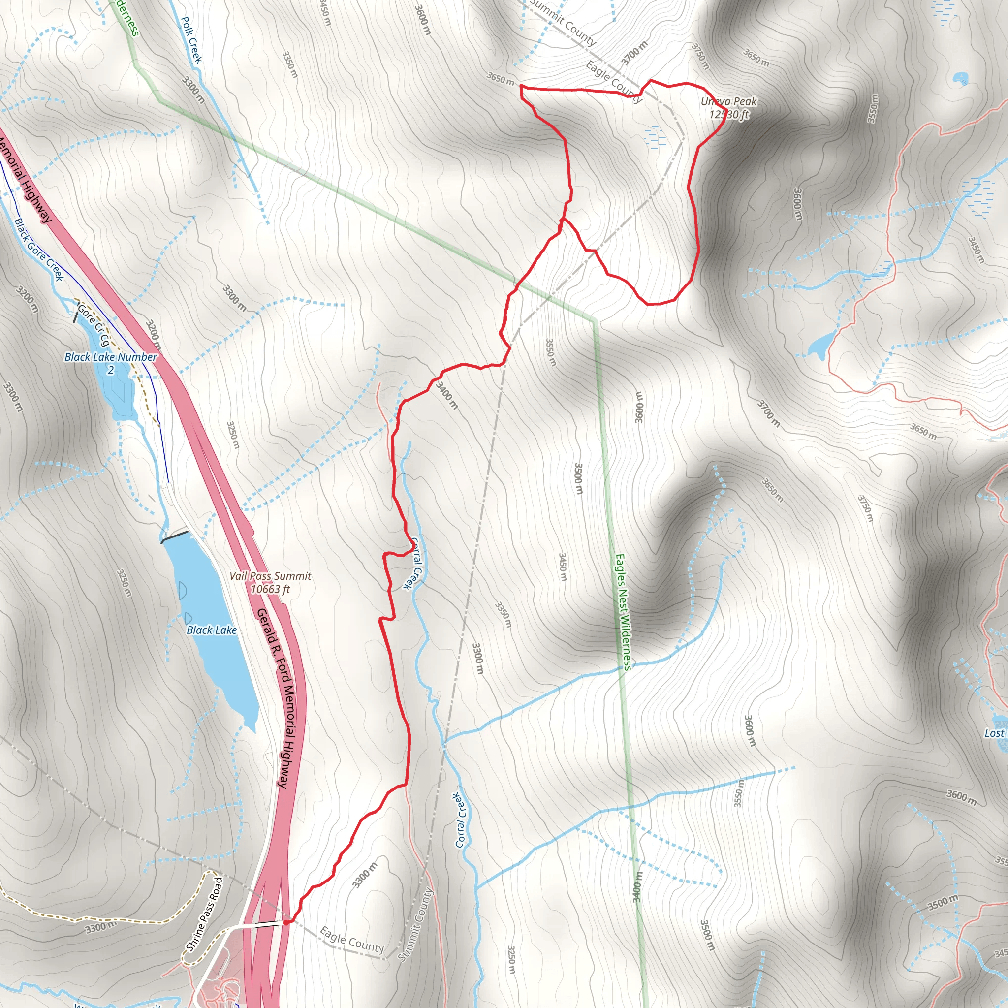
The Uneva Peak via Corral Creek Trail offers an invigorating hike through the heart of the Colorado backcountry, with the trailhead conveniently located near Eagle County. This loop trail spans approximately 10 kilometers (about 6.2 miles) and features an elevation gain of roughly 500 meters (approximately 1640 feet), presenting a medium difficulty level that is suitable for hikers with some experience.
Getting to the Trailhead
To reach the starting point of the trail, hikers can drive to the vicinity of Eagle County, Colorado. The trailhead is accessible by taking I-70 to Exit 190 for Vail Pass, then following the signs for Shrine Pass Road (Forest Service Road 709). Parking is available near the Shrine Pass Road, and from there, the trailhead is just a short walk away. For those relying on public transportation, options may be limited, and it's advisable to check local transit resources for the latest schedules and routes that can get you as close as possible to the trailhead.
Navigating the Trail
Once on the trail, hikers will traverse a variety of terrains, including lush meadows, dense forests, and rocky ridges. The initial segment of the trail meanders alongside Corral Creek, offering the soothing sounds of flowing water as you ascend. Hikers can use the HiiKER app to navigate the trail, ensuring they stay on the correct path and can anticipate upcoming changes in terrain or elevation.
Landmarks and Scenery
As you gain elevation, the landscape opens up to reveal stunning vistas of the surrounding Gore Range. The trail will lead you through subalpine and alpine ecosystems, where you might spot wildflowers in the summer or golden aspens in the fall. Wildlife is abundant in the area, with chances to see mule deer, elk, and various bird species. Always keep a respectful distance from wildlife and practice Leave No Trace principles to preserve their natural habitat.
Historical Significance
The region around Uneva Peak is steeped in history, with the Gore Range named after Sir St. George Gore, an Irish baronet who explored the area in the mid-19th century. The mining and railroad industries also left their mark on the landscape, and hikers may come across old mining structures or railroad grades from Colorado's boom period.
Summiting Uneva Peak
The highlight of the hike is the summit of Uneva Peak, which stands at an elevation of 3,752 meters (12,310 feet). The final push to the peak is the most challenging part of the hike, with steep and rocky sections that require careful footing. Upon reaching the summit, hikers are rewarded with panoramic views of the surrounding mountain ranges, including the Sawatch Range to the south and the Tenmile Range to the east.
Descent and Loop Completion
After taking in the views from the summit, the trail loops back towards the trailhead, descending through similar terrain. The loop aspect of the trail allows hikers to experience a different perspective of the landscape on the return journey.
Preparation and Safety
Hikers should come prepared with appropriate gear, including sturdy hiking boots, weather-appropriate clothing, and plenty of water. The high altitude can affect individuals differently, so it's important to acclimate and be aware of the signs of altitude sickness. Additionally, the weather in the mountains can change rapidly, so be prepared for varying conditions and start your hike early in the day to avoid afternoon thunderstorms.
By following these guidelines and being prepared for the challenges of the trail, hikers can enjoy a memorable experience on the Uneva Peak via Corral Creek Trail, taking in the natural beauty and historical significance of this Colorado gem.
What to expect?
Activity types
Comments and Reviews
User comments, reviews and discussions about the Uneva Peak via Corral Creek Trail, Colorado.
4.59
average rating out of 5
17 rating(s)
