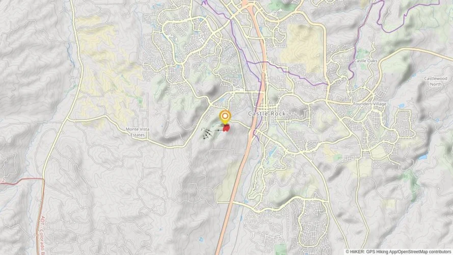
12.7 km
~2 hrs 54 min
225 m
“The Plum Creek Parkway Trail offers a scenic, moderately challenging hike rich in natural beauty and historical significance.”
Starting near Douglas County, Colorado, the Plum Creek Parkway Trail is an inviting out-and-back trail that stretches approximately 13 kilometers (8 miles) with an elevation gain of around 200 meters (656 feet). This medium-difficulty trail offers a blend of natural beauty and historical significance, making it a rewarding experience for hikers of various skill levels.
### Getting There
To reach the trailhead, you can drive or use public transportation. If you're driving, head towards the intersection of Plum Creek Parkway and South Perry Street in Castle Rock, Colorado. There is ample parking available near the trailhead. For those using public transport, the nearest bus stop is at the Castle Rock Transportation Center, located about 1.5 kilometers (1 mile) from the trailhead. From there, it's a short walk to the starting point.
### Trail Overview
The trail begins with a gentle ascent, allowing hikers to ease into the journey. As you progress, you'll encounter a mix of paved and dirt paths, making it suitable for both casual walkers and more seasoned hikers. The initial 2 kilometers (1.2 miles) are relatively flat, providing a good warm-up before the trail starts to climb more noticeably.
### Nature and Wildlife
One of the highlights of the Plum Creek Parkway Trail is its diverse ecosystem. The trail meanders through a variety of landscapes, including open meadows, dense woodlands, and riparian zones along Plum Creek. Keep an eye out for local wildlife such as deer, foxes, and a variety of bird species. The spring and summer months bring a burst of wildflowers, adding vibrant colors to the scenery.
### Significant Landmarks
Around the 4-kilometer (2.5-mile) mark, you'll come across a scenic overlook that offers panoramic views of the surrounding area, including the iconic Castle Rock formation. This is a great spot to take a break and soak in the vistas. Continuing on, the trail passes by several historical markers that provide insights into the region's past, including its significance during the westward expansion and its role in local Native American history.
### Elevation and Terrain
As you approach the halfway point, the trail's elevation gain becomes more apparent. The climb is steady but manageable, with the most significant ascent occurring between the 5 and 7-kilometer (3 to 4.3-mile) marks. The highest point of the trail offers another excellent vantage point for taking in the surrounding landscape.
### Navigation
For navigation, it's recommended to use the HiiKER app, which provides detailed maps and real-time updates to ensure you stay on track. The trail is well-marked, but having a reliable navigation tool can enhance your hiking experience and provide peace of mind.
### Return Journey
The return journey follows the same path, allowing you to revisit the scenic spots and perhaps notice details you missed on the way out. The descent is gradual, making for a pleasant and less strenuous hike back to the trailhead.
### Historical Significance
The Plum Creek Parkway Trail is steeped in history. The area was once a significant route for Native American tribes and later became a critical path during the westward expansion of the United States. Historical markers along the trail provide context and stories from these periods, enriching your hiking experience with a sense of the past.
Whether you're a local or visiting from afar, the Plum Creek Parkway Trail offers a perfect blend of natural beauty, moderate challenge, and historical intrigue.
Reviews
User comments, reviews and discussions about the Plum Creek Parkway Trail, Colorado.
0.0
average rating out of 5
0 rating(s)


