8.8 km
~2 hrs 37 min
519 m
“The Horse Creek Trail offers a moderate 9-kilometer hike through stunning landscapes and historical landmarks in Colorado.”
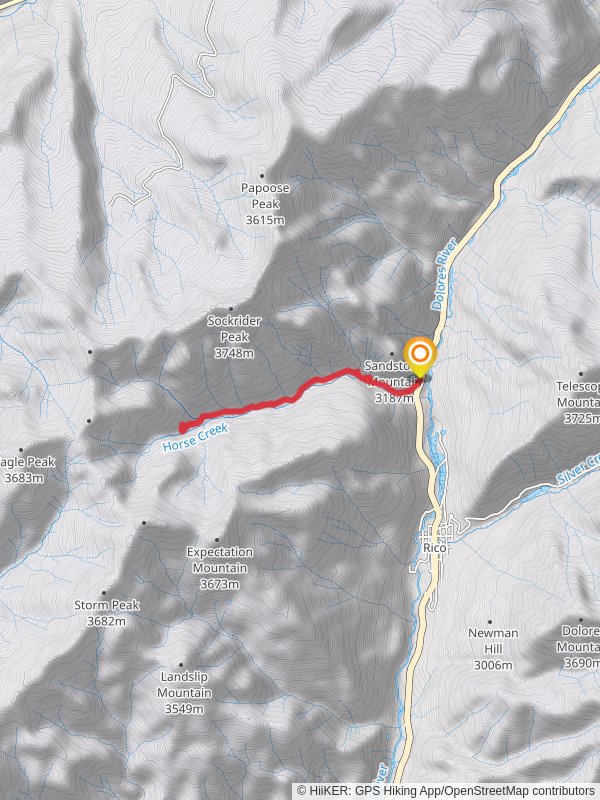
Starting near Dolores County, Colorado, the Horse Creek Trail is an invigorating out-and-back hike that spans approximately 9 kilometers (about 5.6 miles) with an elevation gain of around 500 meters (approximately 1,640 feet). This medium-difficulty trail offers a blend of natural beauty, historical significance, and a moderate challenge suitable for most hikers.
### Getting There To reach the trailhead, you can drive or use public transport. If driving, head towards Dolores County, Colorado, and look for signs directing you to the trailhead near the town of Rico. For those using public transport, the nearest significant landmark is the town of Dolores, from where you can catch a local bus or arrange a shuttle service to the trailhead.
### Trail Overview The trail begins with a gentle ascent through a dense forest of aspen and pine trees. The initial 1.5 kilometers (about 1 mile) are relatively easy, allowing you to acclimate to the terrain and enjoy the serene surroundings. As you progress, the trail becomes steeper, gaining elevation more rapidly.
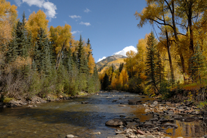
### Key Landmarks and Points of Interest - Horse Creek: Around the 3-kilometer (1.9-mile) mark, you'll encounter Horse Creek, a picturesque stream that meanders through the landscape. This is a great spot to take a short break, refill your water bottles, and enjoy the sound of flowing water. - Wildlife Viewing: Keep an eye out for local wildlife, including deer, elk, and various bird species. Early morning or late afternoon hikes increase your chances of spotting these animals. - Flora: The trail is rich in diverse plant life. Depending on the season, you might see wildflowers like columbines and Indian paintbrushes. The fall season offers a spectacular display of golden aspen leaves.
### Historical Significance The region around Horse Creek Trail has a rich history tied to the mining era of the late 19th and early 20th centuries. As you hike, you might notice remnants of old mining equipment and structures, particularly around the 5-kilometer (3.1-mile) mark. These relics serve as a reminder of the area's industrious past and the people who once worked here.
### Navigation and Safety Given the trail's moderate difficulty, it's advisable to use a reliable navigation tool like HiiKER to stay on track. The trail is well-marked, but having a digital map can be invaluable, especially if you decide to explore any of the side paths.
### Final Stretch The final 2 kilometers (1.2 miles) of the trail are the most challenging, with a steep ascent that rewards you with panoramic views of the surrounding mountains and valleys. This section requires careful footing, especially if the trail is wet or icy.
### Preparation Tips - Footwear: Sturdy hiking boots with good ankle support are recommended. - Water: Carry at least 2 liters (about half a gallon) of water per person. - Weather: Check the weather forecast before heading out. The trail can be slippery after rain, and temperatures can drop quickly in the evening. - Wildlife Safety: Be aware of your surroundings and make noise to avoid surprising wildlife.
By following these guidelines and being well-prepared, you'll have a rewarding experience on the Horse Creek Trail, enjoying both its natural beauty and historical context.
Reviews
User comments, reviews and discussions about the Horse Creek Trail, Colorado.
4.0
average rating out of 5
7 rating(s)


