Download
Preview
Add to list
More
14.5 km
~4 hrs 24 min
905 m
Loop
“Ascend the challenging Venable Trail to discover alpine lakes cradled by Colorado's majestic Sangre de Cristo peaks.”
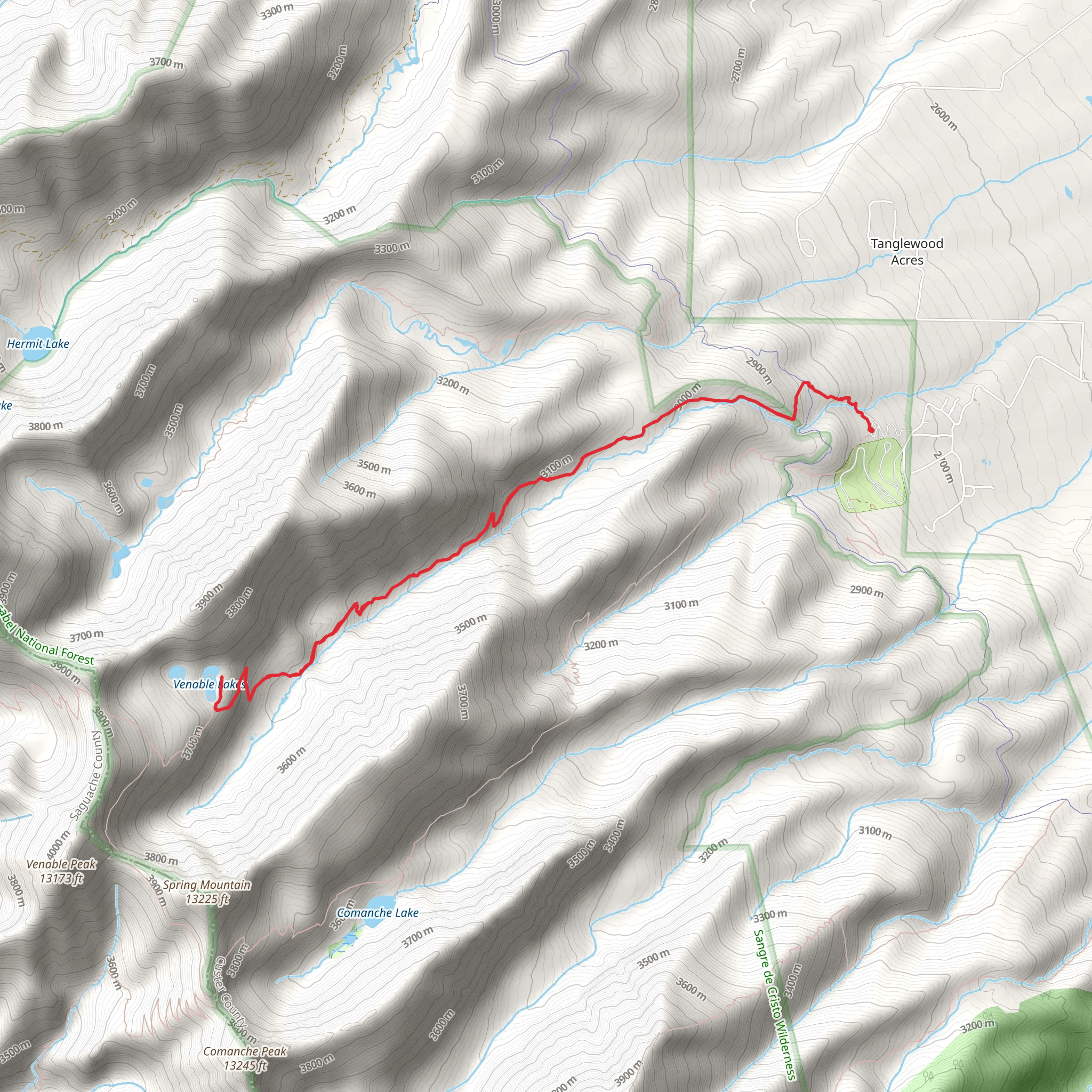
Embarking on the Venable Lakes via Venable Trail, hikers will find themselves exploring the heart of the Sangre de Cristo Range, with the trailhead located near Custer County, Colorado. This approximately 14 km (8.7 miles) loop trail, with an elevation gain of around 900 meters (2950 feet), is considered difficult and is best suited for experienced hikers.
Getting to the Trailhead
To reach the trailhead, if you're driving, navigate towards Westcliffe, Colorado. From Westcliffe, take Hermit Road (County Road 160) west out of town. After about 6.5 km (4 miles), turn left onto Schoolfield Road, which becomes Alvarado Road. Continue for another 8 km (5 miles) until you reach the Alvarado Campground. The trailhead is located near the campground, with parking available for hikers.
For those relying on public transport, options are limited, and it's advisable to check local resources for the latest information on services that can get you close to Westcliffe. From there, a taxi or a local shuttle might be necessary to reach the trailhead.
Navigating the Trail
As you set out on the Venable Trail, the path will lead you through dense forests of aspen and evergreen, opening up to reveal the rugged peaks of the Sangre de Cristo Range. The trail is well-marked, but carrying a map or using a navigation tool like HiiKER is recommended to keep track of your progress and waypoints.
Landmarks and Natural Features
The first few kilometers will challenge you with a series of switchbacks, gaining elevation steadily as you approach the treeline. Approximately halfway through the hike, you'll reach the Venable Lakes, a series of alpine lakes nestled in the high valley. These lakes are a perfect spot to rest and enjoy the serene mountain landscape.
Wildlife and Flora
The area is rich in wildlife, including mule deer, elk, and black bears, so be sure to practice safe wildlife habits and store food properly. The trail also offers a variety of wildflowers in the spring and summer months, adding splashes of color to the greenery.
Historical Significance
The Sangre de Cristo Range is steeped in history, with the name itself meaning "Blood of Christ" in Spanish, attributed to the red hue of the mountains at sunrise and sunset. The region was historically used by Native American tribes and later by miners and settlers during Colorado's gold and silver rushes.
Preparation and Safety
Given the trail's difficulty, hikers should be well-prepared with proper gear, including sturdy hiking boots, layered clothing, and sufficient water and food. The weather can change rapidly at high elevations, so be ready for varying conditions. It's also wise to inform someone of your hiking plans and expected return time.
Seasonal Considerations
The best time to hike Venable Lakes via Venable Trail is from June to September when the snow has melted, and the trail is most accessible. Outside of these months, the trail can be covered in snow, making it more suitable for those prepared for winter hiking conditions.
Remember, this trail is a loop, so you'll end your hike at the same place you started, allowing for a sense of completion as you take in the views one last time before descending back to the trailhead.
Comments and Reviews
User comments, reviews and discussions about the Venable Lakes via Venable Trail, Colorado.
4.5
average rating out of 5
2 rating(s)

