Download
Preview
Add to list
More
13.6 km
~4 hrs 58 min
1349 m
Out and Back
“Embark on the scenic Mount Ouray via Grays Creek Trail for a moderately challenging, 14-kilometer adventure.”
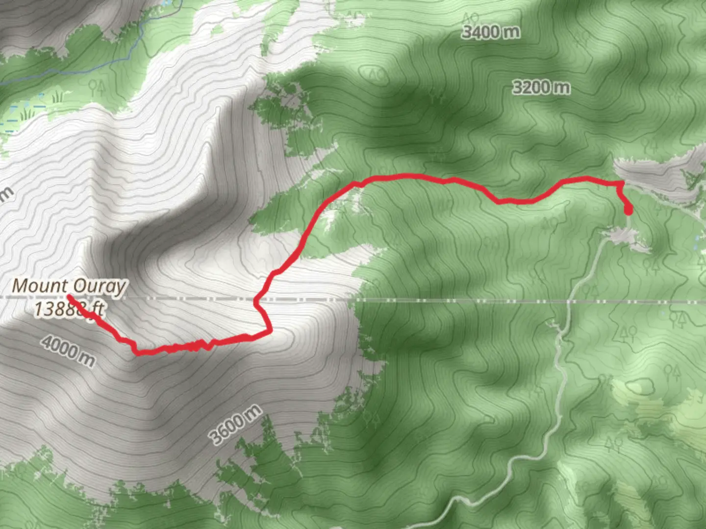
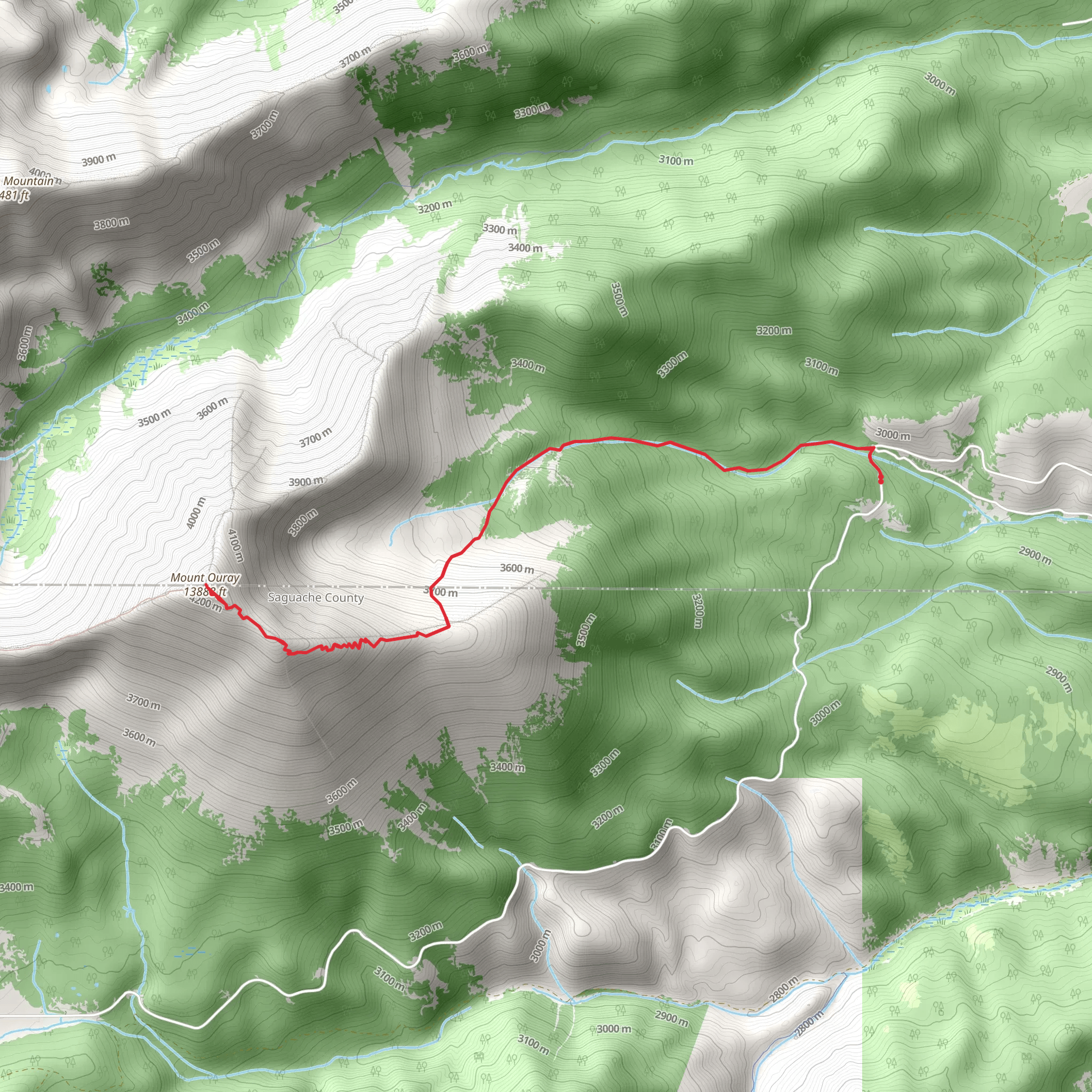
Starting your adventure near Chaffee County, Colorado, the Mount Ouray via Grays Creek Trail is a captivating out-and-back journey that spans approximately 14 kilometers (8.7 miles) with an elevation gain of around 1300 meters (4265 feet). This trail is rated as medium difficulty, making it suitable for moderately experienced hikers.
Getting There To reach the trailhead, you can drive or use public transportation. If driving, head towards the town of Poncha Springs, Colorado. From there, take US-285 South and turn onto County Road 200. Continue on this road until you reach the Grays Creek Trailhead. For those using public transport, the nearest significant landmark is Poncha Springs, where you can arrange for a local taxi or shuttle service to the trailhead.
Trail Overview The trail begins at the Grays Creek Trailhead, situated at an elevation of approximately 2,743 meters (9,000 feet). The initial section of the trail meanders through dense forests of pine and aspen, offering a serene and shaded environment. As you progress, the trail starts to ascend more steeply, and the forest begins to thin out, providing glimpses of the surrounding mountains.
Key Landmarks and Sections #### Grays Creek At around 2 kilometers (1.2 miles) into the hike, you'll encounter Grays Creek. This is a good spot to take a short break and enjoy the sound of the flowing water. The creek is also a reliable source of water, but make sure to purify it before drinking.
#### Alpine Meadows Continuing on, the trail opens up into beautiful alpine meadows at approximately 4 kilometers (2.5 miles). These meadows are often dotted with wildflowers in the summer months, creating a picturesque landscape. Keep an eye out for wildlife such as marmots and pikas, which are commonly seen in this area.
#### Steeper Ascent Around the 6-kilometer (3.7-mile) mark, the trail becomes steeper and rockier. This section can be challenging, so take your time and watch your footing. The elevation gain is more pronounced here, and you may start to feel the effects of the altitude.
Summit Push The final push to the summit of Mount Ouray is the most strenuous part of the hike. The trail becomes less defined, and you may need to navigate using a map or GPS device like HiiKER. The summit sits at an elevation of approximately 4,290 meters (14,070 feet). Once at the top, you'll be rewarded with panoramic views of the Sawatch Range and the San Luis Valley.
Historical Significance Mount Ouray is named after Chief Ouray of the Ute tribe, a prominent figure in Colorado's history. Chief Ouray was known for his efforts to maintain peace between the Ute people and European settlers during the late 19th century. The region is rich in Native American history, and it's worth taking a moment to reflect on the cultural significance of the land you're traversing.
Wildlife and Flora The trail offers a diverse range of flora and fauna. In the lower elevations, you'll find dense forests of pine and aspen. As you ascend, the vegetation transitions to alpine meadows filled with wildflowers such as Indian paintbrush and columbine. Wildlife sightings may include mule deer, elk, and various bird species. Always practice Leave No Trace principles to preserve the natural beauty of the area.
Final Tips Given the elevation gain and the high altitude, it's crucial to be well-prepared. Bring plenty of water, snacks, and layers of clothing to adjust to changing weather conditions. Trekking poles can be helpful for the steeper sections, and sturdy hiking boots are a must. Always check the weather forecast before heading out, as conditions can change rapidly in the mountains.
By following these guidelines and being well-prepared, you'll have a rewarding and memorable experience hiking the Mount Ouray via Grays Creek Trail.
What to expect?
Activity types
Comments and Reviews
User comments, reviews and discussions about the Mount Ouray via Grays Creek Trail, Colorado.
4.5
average rating out of 5
6 rating(s)
