Sugar Magnolia Trail
Arapaho and Roosevelt National Forests · Boulder County, Colorado
1.4 km
~25 min
86 m
“Embark on the vibrant Sugar Magnolia Trail, a historical Colorado gem adorned with wildflowers and wildlife.”
The Sugar Magnolia Trail, nestled near Boulder County, Colorado, offers a relatively short but engaging hike that spans approximately 1 km (0.62 miles) with minimal elevation gain, making it accessible to hikers of varying abilities. Despite its brevity, the trail is rated medium difficulty due to its terrain and potential weather conditions.
Getting to the Trailhead
To reach the starting point of the Sugar Magnolia Trail, hikers can drive to the nearest landmark, which is the scenic Boulder Falls located off of Boulder Canyon Drive. Parking is available in the vicinity for those arriving by car. For those opting for public transportation, the regional bus system provides routes that approach the area, and from the nearest bus stop, it's a short walk to the trailhead.
Navigating the Trail
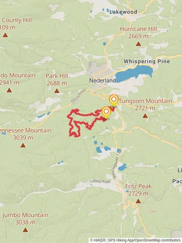
Once on the trail, hikers can rely on the HiiKER app for detailed navigation assistance. The trail is a point-to-point hike, meaning it does not loop back to the starting point. Hikers should be prepared for a return journey or arrange transportation at the other end of the trail.
Landmarks and Natural Features
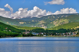
As you embark on the Sugar Magnolia Trail, you'll be greeted by a diverse array of flora and fauna native to the Colorado landscape. The trail is known for its wildflowers, especially during the spring and summer months, when the area bursts into a kaleidoscope of colors. Keep an eye out for the vibrant magenta petals of the wild geraniums and the delicate blue of the columbines, Colorado's state flower.
Wildlife and Safety
The region is home to a variety of wildlife, including mule deer, black bears, and mountain lions. While encounters are rare, it's important to be aware of your surroundings and knowledgeable about wildlife safety practices. Make noise while hiking to alert animals to your presence, and know how to store food properly if you're bringing snacks.
Historical Significance
The area around Boulder County is rich in history, with the trail itself offering a glimpse into the region's past. The land has seen the comings and goings of indigenous peoples, gold rush miners, and early settlers. As you hike, consider the historical significance of the landscape, which has been shaped by both natural forces and human activity over the centuries.
Preparation and Planning
Before setting out on the Sugar Magnolia Trail, ensure you have adequate water, as there are no water sources along the route. The weather can change rapidly, so layered clothing is advisable. Check local weather forecasts and trail conditions prior to your hike. Remember, the trail is best enjoyed at a leisurely pace, allowing you to fully absorb the natural beauty and tranquility of the surroundings.
By following these guidelines and preparing accordingly, hikers can look forward to a memorable experience on the Sugar Magnolia Trail, where the beauty of Colorado's landscape can be appreciated in all its splendor.
Reviews
User comments, reviews and discussions about the Sugar Magnolia Trail, Colorado.
4.0
average rating out of 5
2 rating(s)


