Download
Preview
Add to list
More
24.6 km
~2 days
1004 m
Multi-Day
“Embark on a captivating journey through the Indian Peaks Wilderness, brimming with history, wildlife, and awe-inspiring vistas on the Devils Thumb to King Lake Loop.”
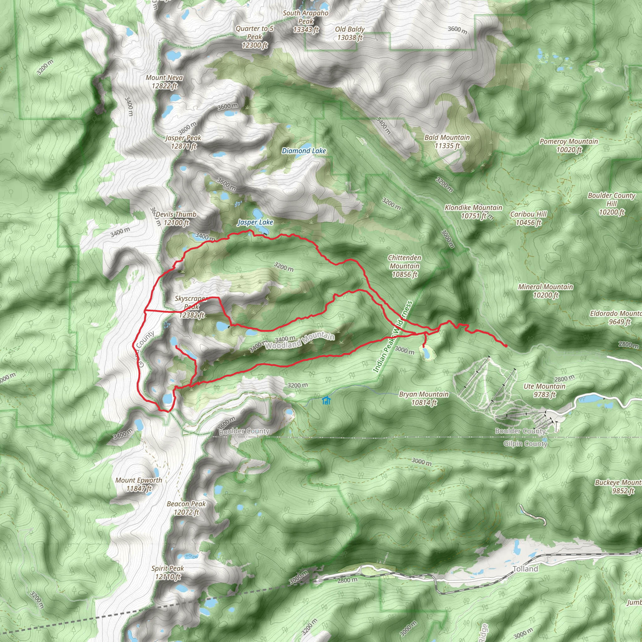
Embarking on the Devils Thumb to King Lake Loop, hikers will traverse a challenging yet rewarding circuit that spans approximately 25 kilometers (15.5 miles) with an elevation gain of around 1000 meters (3280 feet). The trailhead is conveniently located near Boulder County, Colorado, and can be accessed by car or public transport. For those driving, parking is available near the Hessie Trailhead, which is the common starting point for this adventure. Public transport options include taking a bus from Boulder to the town of Nederland, followed by a short hike or shuttle ride to the Hessie Trailhead.
Navigating the Trail
As you set out from the Hessie Trailhead, the trail begins with a moderate incline through dense forest, opening up to the stunning alpine scenery of the Indian Peaks Wilderness. Hikers should use the HiiKER app to navigate the loop, ensuring they stay on the correct path as there are multiple intersecting trails in the area. The ascent towards Devils Thumb Pass is strenuous, with switchbacks that offer increasingly impressive views of the surrounding peaks and valleys.
Landmarks and Natural Beauty
Upon reaching Devils Thumb Pass, at an elevation of around 3600 meters (11,800 feet), hikers are rewarded with panoramic vistas of the Continental Divide. The trail continues to King Lake, a serene alpine lake nestled at the base of the divide. This is an excellent spot for a rest and perhaps a picnic while soaking in the natural beauty.
The loop then descends into the forest, winding through meadows dotted with wildflowers during the summer months. Wildlife is abundant in this area, with opportunities to spot moose, elk, and various bird species. Hikers should be aware of their surroundings and knowledgeable about wildlife safety practices.
Historical Significance
The Indian Peaks Wilderness, through which the Devils Thumb to King Lake Loop passes, is rich in history. The region was named after the Native American tribes that once roamed these lands, and evidence of their presence can be seen in various archaeological sites. The area also played a role in Colorado's mining history, with remnants of old mines scattered throughout the landscape.
Preparation and Safety
Given the trail's difficulty rating and the unpredictable mountain weather, hikers should be well-prepared with appropriate gear, including sturdy hiking boots, layered clothing, and sufficient water and food. It's also wise to carry a map, compass, and the HiiKER app for navigation. Due to the high elevation, acclimatization is important to prevent altitude sickness, and hikers should be prepared for rapid weather changes.
Access to the Trailhead
To reach the trailhead from Boulder, take CO-119 to Nederland, then follow signs to the Hessie Trailhead. Parking is limited, especially on weekends, so arriving early is advisable. Alternatively, the RTD bus service from Boulder to Nederland can be used, followed by a shuttle or a hike to the Hessie Trailhead.
The Devils Thumb to King Lake Loop is a must-do for seasoned hikers seeking a challenging and scenic experience in the Colorado Rockies. With its breathtaking landscapes, diverse wildlife, and rich history, this trail offers an unforgettable adventure in the heart of the Indian Peaks Wilderness.
What to expect?
Activity types
Comments and Reviews
User comments, reviews and discussions about the Devils Thumb to King Lake Loop, Colorado.
4.5
average rating out of 5
6 rating(s)

