Download
Preview
Add to list
More
41.7 km
~2 day
1370 m
Out and Back
“Explore Northern California's rugged beauty on a challenging trail through stunning landscapes and rich history.”
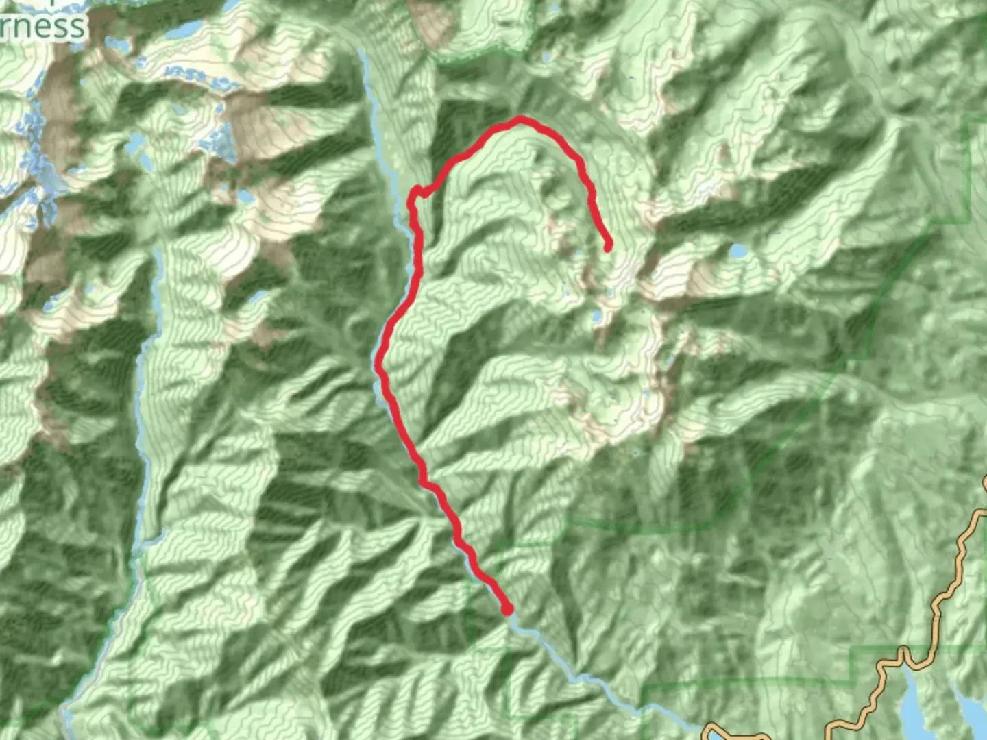
Nestled in the rugged wilderness of Northern California, the Deer Creek and Stuart Fork Trail offers a challenging yet rewarding adventure for seasoned hikers. This out-and-back trail spans approximately 42 kilometers (about 26 miles) and features an elevation gain of around 1,300 meters (approximately 4,265 feet). The trailhead is conveniently located near Trinity County, California, making it accessible for those seeking a remote and scenic hiking experience.
Getting There
To reach the trailhead, travelers can drive to the Trinity Alps Wilderness area. If you're coming by car, the most straightforward route is via Highway 299, which runs through the heart of Trinity County. From there, follow signs to the Stuart Fork Trailhead, located near the Trinity Alps Resort. For those relying on public transportation, the nearest major city is Redding, California. From Redding, you can rent a car or arrange for a shuttle service to the trailhead, as public transport options directly to the trailhead are limited.
Trail Overview
The Deer Creek and Stuart Fork Trail is renowned for its breathtaking landscapes and diverse ecosystems. As you embark on this journey, you'll traverse through dense forests, cross crystal-clear streams, and ascend to panoramic vistas that showcase the grandeur of the Trinity Alps. The trail is rated as difficult, so it's essential to be well-prepared with adequate supplies, including water, food, and appropriate gear for changing weather conditions.
Key Landmarks and Natural Features
- Deer Creek: Early in the hike, you'll encounter Deer Creek, a serene waterway that meanders through the forest. This is an excellent spot for a brief rest and to enjoy the tranquil surroundings.
- Stuart Fork: As you progress, the trail follows the Stuart Fork of the Trinity River. This section offers stunning views of the river's cascading waters and is a prime location for spotting local wildlife, including deer and various bird species.
- Emerald and Sapphire Lakes: Approximately 16 kilometers (10 miles) into the hike, you'll reach the junction leading to Emerald and Sapphire Lakes. These alpine lakes are known for their striking blue-green hues and are surrounded by towering granite peaks. They provide a perfect backdrop for photography and a peaceful spot for a lunch break.
Historical Significance
The Trinity Alps region holds historical significance, having been inhabited by Native American tribes for thousands of years. The area was also a focal point during the California Gold Rush in the mid-19th century, attracting prospectors and settlers. Remnants of this era can still be found in the form of old mining equipment and abandoned cabins scattered throughout the wilderness.
Navigation and Safety
Given the trail's difficulty and remote location, it's crucial to have reliable navigation tools. The HiiKER app is highly recommended for its detailed maps and real-time GPS tracking, ensuring you stay on course. Additionally, always inform someone of your hiking plans and expected return time, as cell service can be unreliable in the wilderness.
Wildlife and Flora
The trail is home to a rich variety of flora and fauna. Keep an eye out for black bears, which are common in the area, and always practice safe food storage to avoid attracting them. The forests are lush with Douglas fir, ponderosa pine, and cedar, providing ample shade and a vibrant green canopy. In the spring and early summer, wildflowers such as lupine and Indian paintbrush add bursts of color to the landscape.
Embarking on the Deer Creek and Stuart Fork Trail is a journey into the heart of the Trinity Alps, offering both a physical challenge and an opportunity to connect with the natural beauty and history of this remarkable region.

What to expect?
Activity types
Comments and Reviews
User comments, reviews and discussions about the Deer Creek and Stuart Fork Trail, California.
average rating out of 5
0 rating(s)