Download
Preview
Add to list
More
24.3 km
~2 days
1133 m
Multi-Day
“A scenic 15-mile trek through Trinity's forests, Granite Lake's reflections, and the Trinity Alps' panoramic vistas.”
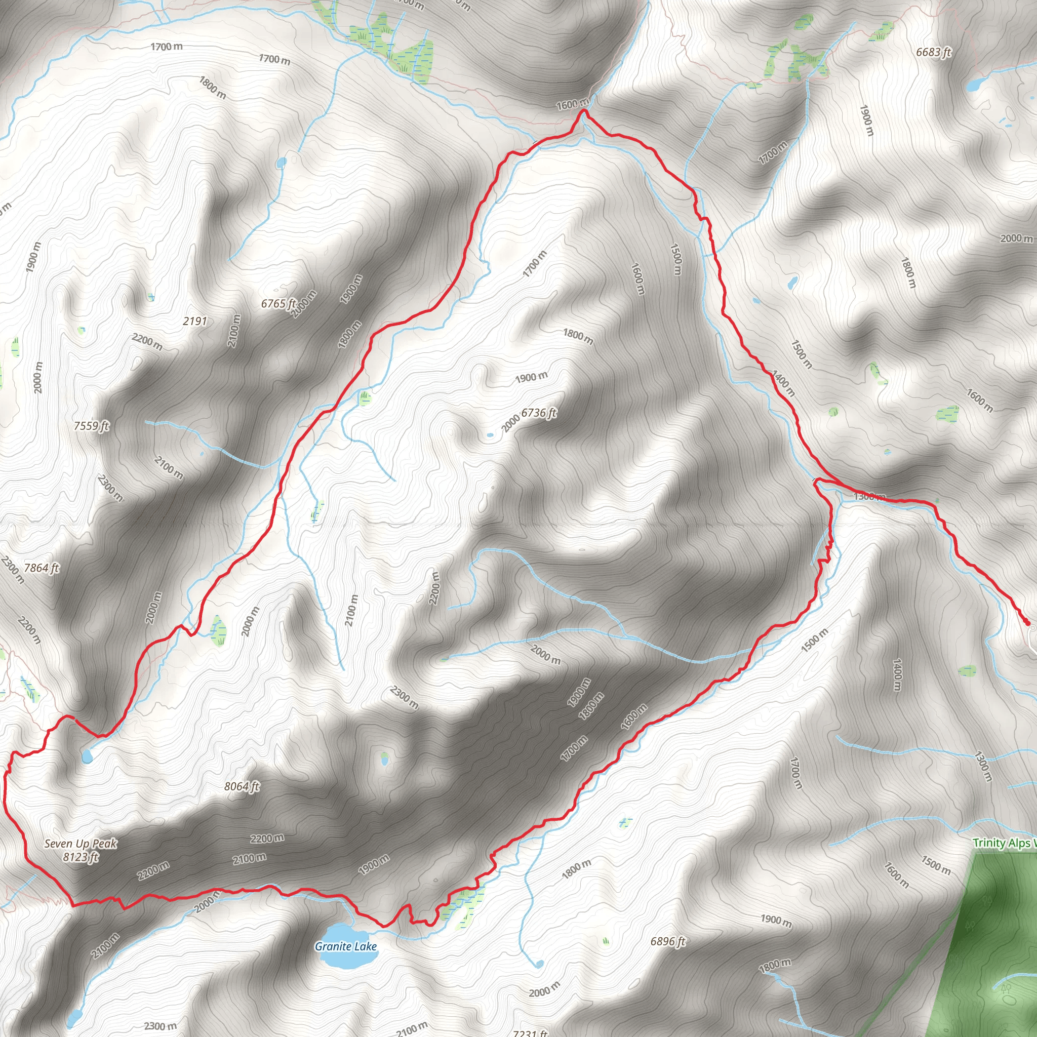
Embarking on the Bear Basin - Granite Lake Loop Trail, hikers will find themselves exploring the rugged beauty of Trinity County, California. This 24 km (approximately 15 miles) loop trail, with an elevation gain of around 1100 meters (roughly 3600 feet), offers a medium difficulty rating, making it accessible to hikers with a reasonable level of fitness and experience.
Getting to the Trailhead To reach the trailhead, which is nestled in the Shasta-Trinity National Forest, drivers can navigate to the vicinity of Coffee Creek Road in Trinity County. For those relying on public transportation, options are limited due to the remote nature of the area, so a car rental from the nearest major town may be necessary.
The Hike Itself The journey begins amidst a dense forest canopy, where the air is filled with the scent of pine and cedar. The trail meanders through a series of switchbacks, gradually ascending towards the subalpine zones. As you progress, the mixed coniferous forest transitions to sparser vegetation, offering glimpses of the surrounding peaks.
Landmarks and Scenery One of the highlights of this hike is the stunning Granite Lake, which is reached after approximately 8 km (5 miles) of hiking. The lake, nestled at the base of craggy peaks, provides a serene spot for a rest or a picnic. The reflection of the surrounding mountains on the clear waters is a sight to behold, especially in the early morning or late afternoon light.
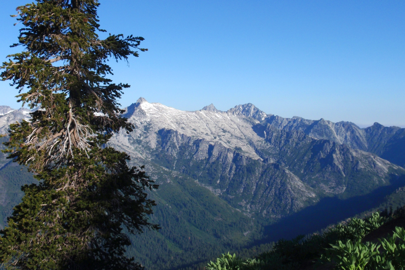
Continuing on the loop, hikers will traverse a ridge that offers panoramic views of the Trinity Alps. This section can be particularly breathtaking, with wildflowers in bloom during the spring and early summer months.
Wildlife and Flora The area is rich in biodiversity, with chances to spot wildlife such as black bears, deer, and a variety of bird species. Hikers should be bear-aware, storing food properly and making noise to avoid surprise encounters. The trail also passes through areas of lush meadows and old-growth forests, where the flora is diverse and includes species like the Pacific yew and Douglas fir.
Historical Significance The region holds historical significance as part of the Klamath Mountains, with a rich history of Native American habitation and later, gold mining activities in the 19th century. The natural landscape has recovered from these extractive periods, but hikers can still sense the past's imprint on the land.
Navigation and Preparation For navigation purposes, HiiKER is an excellent tool to use for this trail, providing detailed maps and waypoints to ensure you stay on the correct path. It's advisable to download the map for offline use, as cell service can be spotty in remote areas.
Preparation is key for this hike. Hikers should bring plenty of water, as sources along the trail may not be reliable or safe for drinking. Layered clothing is recommended due to the varying elevations and temperatures that can change rapidly. Additionally, sturdy hiking boots are a must, as the terrain can be rocky and uneven in places.
Final Ascent and Descent The final ascent to the highest point of the trail rewards hikers with a 360-degree view of the Trinity Alps before beginning the descent back to the trailhead. The downward path can be steep at times, so careful footing is important.
As the loop closes and the trailhead comes back into view, hikers will have completed a journey through some of California's most striking wilderness, rich in natural beauty and historical lore.
What to expect?
Activity types
Comments and Reviews
User comments, reviews and discussions about the Bear Basin - Granite Lake Loop Trail, California.
average rating out of 5
0 rating(s)

