Download
Preview
Add to list
More
9.9 km
~3 hrs 4 min
663 m
Loop
“Embark on a scenic 10 km hike with ocean vistas, hot springs, and rich history near Santa Barbara.”
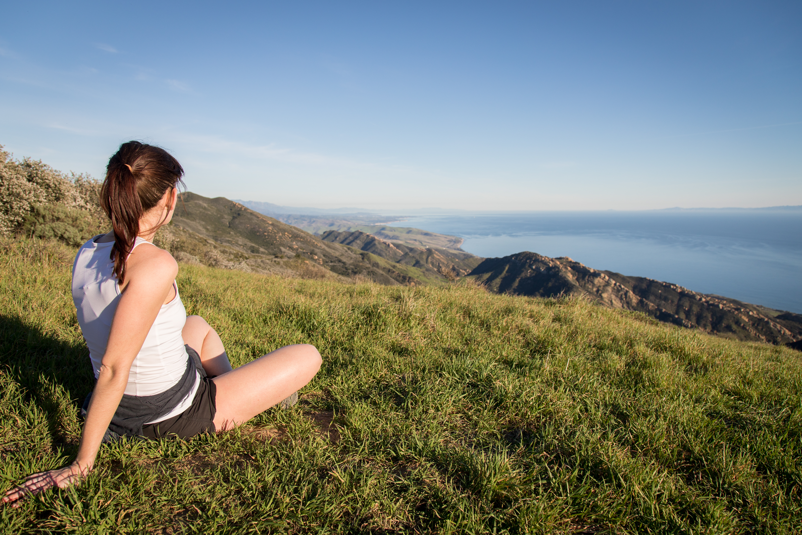
The Trespass and Gaviota Peak Loop Trail, nestled near Santa Barbara County, California, offers a moderately challenging hike that spans approximately 10 kilometers (about 6.2 miles) with an elevation gain of around 600 meters (nearly 2000 feet). This loop trail is a favorite among locals and visitors for its stunning views and the rewarding hot springs located near the peak.
Getting to the Trailhead
To reach the trailhead, if you're driving, take the US-101 N to the Gaviota State Park exit. After exiting, turn left and cross over the highway, then make another left onto the frontage road on the opposite side. The parking area for the trailhead is located here. For those opting for public transportation, check local transit schedules for buses that stop near Gaviota State Park, as services may vary.
The Hike
As you embark on the trail, the initial stretch will take you through a tunnel under the highway, leading to a junction. Here, you'll want to take the left fork, which marks the beginning of the Trespass Trail. The path ascends steadily, offering early views of the ocean and surrounding hills. The trail is well-maintained but can be steep in sections, so a good pair of hiking boots is recommended.
Flora and Fauna
As you climb, the landscape is dotted with coastal sage scrub and chaparral. Keep an eye out for wildlife such as red-tailed hawks soaring above and the occasional deer. The area is also home to a variety of lizards and snakes; always watch your step and give wildlife plenty of space.
Historical Significance
The region around Gaviota Peak is rich in history. The Chumash Native Americans once inhabited these lands, and evidence of their presence can be seen in the form of petroglyphs in nearby areas. The name "Gaviota" means "seagull" in Spanish, a nod to the Spanish explorers who traveled through California centuries ago.
Gaviota Hot Springs
Approximately 3 kilometers (about 1.9 miles) into the hike, you'll find a detour that leads to the Gaviota Hot Springs. This natural hot spring is a perfect spot to relax and soak your muscles. The springs are not always well-marked, so using HiiKER to navigate to this location is advisable.
Summit and Loop Completion
Continuing past the hot springs, the trail becomes more rugged as you approach Gaviota Peak. At the summit, you're rewarded with panoramic views of the Pacific Ocean and the Channel Islands. To complete the loop, follow the Gaviota Peak Fire Road downhill, which will lead you back to the trailhead. This section is less steep and allows for a more leisurely descent.
Preparation and Safety
Before setting out, ensure you have plenty of water, sun protection, and snacks. The trail can be exposed, and temperatures can rise, especially during summer months. Always check the weather forecast and start early to avoid the midday heat. Cell service can be spotty, so download offline maps on HiiKER to aid in navigation.
Remember to leave no trace, pack out all your trash, and respect the natural environment to preserve it for future hikers. With the right preparation and respect for the trail, the Trespass and Gaviota Peak Loop Trail is a rewarding experience that showcases the natural beauty of the Santa Barbara coastline.

What to expect?
Activity types
Comments and Reviews
User comments, reviews and discussions about the Trespass and Gaviota Peak Loop Trail, California.
average rating out of 5
0 rating(s)