Download
Preview
Add to list
More
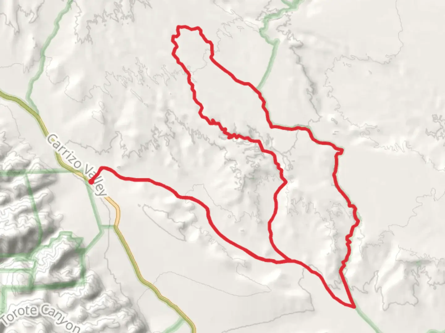
40.6 km
~1 day 3 hrs
344 m
Loop
“Explore diverse landscapes and rich history on San Diego's scenic Vallecito Creek and West Mesa Loop.”
Nestled in the scenic landscapes of San Diego County, California, the Vallecito Creek and West Mesa Loop offers a captivating journey through diverse terrains and rich history. This 41 km (approximately 25.5 miles) loop trail is a moderate challenge, with an elevation gain of around 300 meters (about 984 feet), making it suitable for hikers with some experience.### Getting ThereTo reach the trailhead, head towards the Anza-Borrego Desert State Park, a well-known landmark in the area. If you're driving, take the I-8 East from San Diego, then exit onto CA-79 North towards Julian. From there, follow the signs to the park. For those using public transport, the nearest major hub is San Diego, where you can catch a bus or train to Julian, and then a taxi or rideshare to the park entrance.### Trail HighlightsVallecito CreekStarting near the historic Vallecito Stage Station, the trail meanders alongside Vallecito Creek. This section is relatively flat, allowing you to ease into the hike while enjoying the serene sounds of flowing water. Keep an eye out for native flora such as the California fan palm and desert lavender, which thrive in this riparian habitat.West MesaAs you ascend towards West Mesa, the trail becomes more challenging, with a gradual climb that rewards you with panoramic views of the surrounding desert landscape. This area is known for its striking geological formations, including rugged mesas and colorful rock layers. The elevation gain here is about 150 meters (492 feet) over a few kilometers, providing a good workout without being overly strenuous.### Nature and WildlifeThe trail is home to a variety of wildlife, including mule deer, coyotes, and the occasional bobcat. Birdwatchers will delight in spotting species such as the red-tailed hawk and the greater roadrunner. The diverse plant life, from cacti to wildflowers, adds vibrant splashes of color to the arid landscape.### Historical SignificanceThe Vallecito Creek and West Mesa Loop is steeped in history. The Vallecito Stage Station, near the trailhead, was once a vital stop on the Butterfield Overland Mail route in the mid-19th century. This historic site offers a glimpse into the past, where travelers and mail carriers would rest and resupply during their arduous journeys across the American West.### Navigation and SafetyGiven the trail's remote location, it's advisable to download the HiiKER app for offline navigation. The trail is well-marked, but having a reliable map can enhance your experience and ensure you stay on course. Carry plenty of water, especially during the warmer months, as the desert environment can be unforgiving. Sunscreen, a hat, and sturdy hiking boots are also recommended to protect against the sun and rocky terrain.Embarking on the Vallecito Creek and West Mesa Loop is a journey through both natural beauty and historical intrigue, offering hikers a memorable adventure in one of California's most captivating regions.

What to expect?
Activity types
Comments and Reviews
User comments, reviews and discussions about the Vallecito Creek and West Mesa Loop, California.
average rating out of 5
0 rating(s)