Download
Preview
Add to list
More
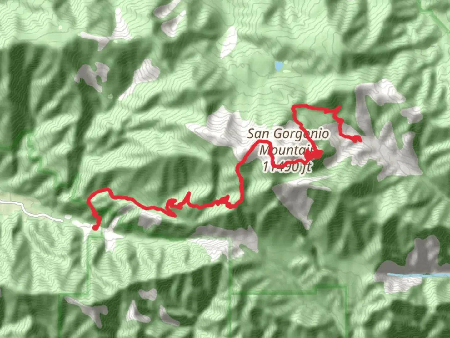
44.9 km
~2 day
2409 m
Out and Back
“Sky High Trail offers seasoned hikers a challenging adventure through breathtaking landscapes and rich history.”
Nestled in the rugged terrain of San Bernardino County, California, the Sky High Trail offers an exhilarating adventure for seasoned hikers. Spanning approximately 45 kilometers (about 28 miles) with an elevation gain of around 2400 meters (approximately 7874 feet), this out-and-back trail is rated as difficult, demanding both physical endurance and careful planning.
Getting There
The trailhead is conveniently located near San Bernardino County, accessible by car or public transport. If driving, take the I-10 East from Los Angeles, then merge onto CA-210 East, and follow signs to the trailhead near Big Bear Lake. For those using public transport, the Metrolink train service to San Bernardino is a viable option, followed by a local bus or taxi to the trailhead.
Trail Overview
The Sky High Trail begins with a steady ascent through dense pine forests, offering a serene start to your journey. As you progress, the trail becomes steeper, winding through rocky outcrops and offering panoramic views of the surrounding mountains. At approximately 10 kilometers (6.2 miles) in, you'll reach a notable landmark, the Eagle's Perch, a rocky viewpoint that provides breathtaking vistas of the valley below.
Flora and Fauna
The trail is a haven for nature enthusiasts, with diverse flora and fauna. Keep an eye out for the majestic California condor soaring overhead, and listen for the calls of the Steller's jay. The trail is lined with towering Jeffrey pines and sugar pines, providing shade and a refreshing scent as you hike.
Historical Significance
The region surrounding the Sky High Trail is steeped in history. The San Bernardino Mountains were once home to the indigenous Serrano people, who thrived in this area for thousands of years. As you hike, consider the rich cultural tapestry woven into the landscape, with remnants of old trails and settlements occasionally visible along the way.
Navigation and Safety
Given the trail's challenging nature, it's crucial to be well-prepared. Use HiiKER for accurate navigation and trail updates. Ensure you have adequate water, food, and weather-appropriate clothing. The trail can be treacherous in wet or icy conditions, so check the weather forecast before setting out.
Reaching the Summit
The final stretch of the trail is the most demanding, with a steep climb to the summit. At the top, you'll be rewarded with sweeping views of the San Bernardino National Forest and beyond. This vantage point is a perfect spot to rest and take in the natural beauty before beginning your descent.
Return Journey
The return journey follows the same path, allowing you to revisit the stunning landscapes from a new perspective. As you make your way back, take time to appreciate the changing light and shadows across the mountains, a fitting end to a challenging yet rewarding hike.

What to expect?
Activity types
Comments and Reviews
User comments, reviews and discussions about the Sky High Trail, California.
average rating out of 5
0 rating(s)