Download
Preview
Add to list
More
24.8 km
~2 days
1571 m
Multi-Day
“Traverse the awe-inspiring San Jacinto Trail for a rigorous journey through California's majestic wilderness and history.”
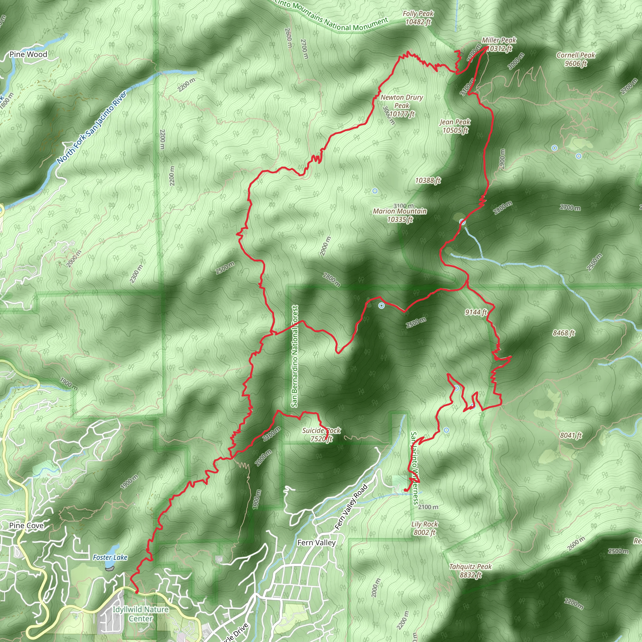
Embarking on the San Jacinto Trail, hikers will traverse approximately 25 kilometers (about 15.5 miles) with an elevation gain of around 1500 meters (nearly 4921 feet), making it a challenging adventure suitable for experienced hikers. This point-to-point trail is nestled near Riverside County, California, and is known for its breathtaking views and rigorous terrain.### Getting to the TrailheadTo reach the trailhead, if you're driving, you'll want to head towards Idyllwild, a charming mountain town that serves as a gateway to the San Jacinto Wilderness. The most common starting point is the Palm Springs Aerial Tramway's Mountain Station, which you can reach by taking the tramway from the Valley Station at 1 Tram Way, Palm Springs, CA. For those opting for public transportation, check local transit schedules for the latest routes and times to the tramway's Valley Station.### The Hike ItselfAs you begin your hike, the first section will take you through a mixed conifer forest, where the air is crisp and the scent of pine is invigorating. The trail is well-marked, but carrying a map or using the HiiKER app for navigation is recommended due to the network of intersecting paths in the area.### Landmarks and SceneryOne of the most significant landmarks you'll encounter is the San Jacinto Peak, which is the highest point in the San Jacinto Mountains and the second highest in Southern California. The peak offers panoramic views that are simply unmatched, stretching across the Coachella Valley and beyond.### Flora and FaunaThe trail is home to a diverse range of wildlife, including mule deer, mountain lions, and a variety of bird species. The flora is equally impressive, with a mix of mountain mahogany, Jeffrey pines, and the rare San Jacinto lupine. As you ascend, the vegetation changes, and you'll find yourself surrounded by ancient lodgepole pines and gnarled limber pines near the summit.### Historical SignificanceThe San Jacinto Mountains hold historical significance for several reasons. They were once a refuge for the Native American Cahuilla tribe, who left behind traces of their presence. Additionally, the area played a role during the California Gold Rush and later in the development of Southern California's water resources.### Preparing for the HikeGiven the trail's difficulty rating of Extra Difficult, it's crucial to be well-prepared. Ensure you have adequate water, high-energy food, layers of clothing to accommodate changing weather conditions, and sturdy hiking boots. The elevation gain is significant, so acclimatization and physical preparation are key to a successful hike.### Safety and RegulationsAlways check the weather forecast before setting out and be aware of the signs of altitude sickness. It's important to note that permits are required for day hikes, which can be obtained at the ranger station in Idyllwild or the State Park headquarters. Remember to practice Leave No Trace principles to preserve the beauty and integrity of the wilderness.By preparing accordingly and respecting the natural environment, hikers can look forward to an unforgettable experience on the San Jacinto Trail, filled with stunning vistas, challenging climbs, and a deep connection with the natural world.
What to expect?
Activity types
Comments and Reviews
User comments, reviews and discussions about the San Jacinto Trail, California.
5.0
average rating out of 5
1 rating(s)

