Download
Preview
Add to list
More
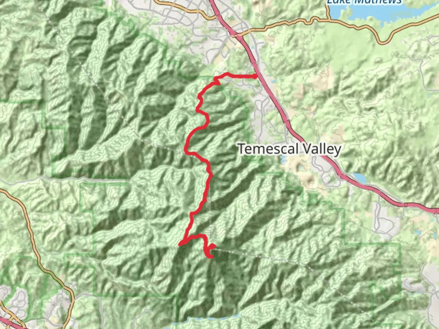
44.8 km
~2 day
1975 m
Out and Back
“Embark on a challenging hike showcasing breathtaking peaks, rich history, and diverse ecosystems in Southern California.”
Starting your adventure near Riverside County, California, the Bald Peak and Santiago Peak via Bedford Motorway trail offers a challenging yet rewarding experience for seasoned hikers. This out-and-back trail stretches approximately 45 kilometers (about 28 miles) with an elevation gain of around 1,900 meters (approximately 6,234 feet), making it a difficult trek that demands preparation and endurance.### Getting ThereTo reach the trailhead, you can drive to the vicinity of Riverside County. If you're using public transport, the nearest major city is Los Angeles, from where you can take a train or bus to Riverside. From Riverside, you may need to arrange a taxi or rideshare service to reach the trailhead, as public transport options are limited in this rural area.### Trail OverviewThe trail begins with a steady ascent along the Bedford Motorway, a rugged path that offers panoramic views of the surrounding landscape. As you climb, you'll traverse through diverse ecosystems, from chaparral-covered hillsides to oak woodlands. The initial section of the trail is characterized by a moderate incline, gradually increasing in steepness as you approach Bald Peak.### Key Landmarks and NatureBald Peak: At approximately 10 kilometers (6.2 miles) into the hike, you'll reach Bald Peak. This vantage point provides sweeping views of the Santa Ana Mountains and the valleys below. It's an ideal spot for a brief rest and to take in the natural beauty of the area.Santiago Peak: Continuing onward, the trail becomes more challenging as you approach Santiago Peak, the highest point in Orange County. At around 22.5 kilometers (14 miles) from the start, you'll reach the summit, standing at 1,734 meters (5,689 feet). The peak offers breathtaking 360-degree views, including glimpses of the Pacific Ocean on clear days.### Wildlife and FloraThe trail is home to a variety of wildlife, including deer, bobcats, and a diverse array of bird species. Keep an eye out for red-tailed hawks soaring above and listen for the calls of the California quail. The flora is equally diverse, with wildflowers blooming in the spring and hardy shrubs like manzanita and sagebrush dotting the landscape.### Historical SignificanceThe Santa Ana Mountains, where this trail is located, have a rich history. The area was once inhabited by the indigenous Tongva and Acjachemen peoples, who utilized the land for hunting and gathering. In the 19th century, the region saw an influx of settlers and ranchers, leaving behind remnants of old homesteads and cattle trails that can still be seen today.### Navigation and SafetyGiven the trail's difficulty, it's crucial to be well-prepared. Use HiiKER to download offline maps and track your progress. Ensure you have adequate water, food, and sun protection, as the trail offers limited shade. Weather conditions can change rapidly, so check forecasts and be prepared for temperature fluctuations.This trail is a demanding yet unforgettable journey through some of Southern California's most stunning landscapes, offering both physical challenge and natural beauty.

What to expect?
Activity types
Comments and Reviews
User comments, reviews and discussions about the Bald Peak and Santiago Peak via Bedford Motorway, California.
average rating out of 5
0 rating(s)