Download
Preview
Add to list
More
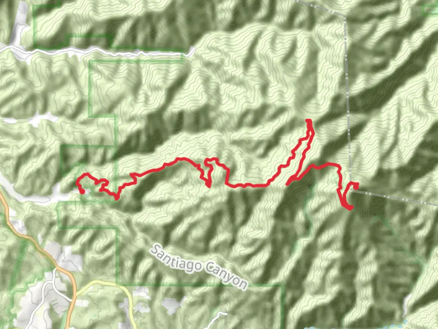
Trail length
22.1 km
Time
~2 days
Elevation Gain
1691 m
Hike Type
Multi-Day
“Explore diverse landscapes, rich history, and serene nature on this accessible Orange County trail adventure.”
Nestled near Orange County, California, this trail offers a delightful journey through diverse landscapes and gentle terrain. Spanning approximately 23 kilometers (about 14.3 miles) with an elevation gain of around 1400 meters (approximately 4593 feet), this point-to-point trail is estimated to be easy, making it accessible for hikers of various skill levels. Getting There To reach the trailhead, travelers can drive or use public transportation. If driving, head towards Orange County, California, and look for parking options near the trail's starting point. For those using public transport, the nearest major hub is the Anaheim Regional Transportation Intermodal Center (ARTIC). From there, local bus services or rideshare options can take you closer to the trailhead. ### Trail Highlights As you embark on this journey, you'll traverse a variety of terrains, from lush woodlands to open meadows. The trail is well-marked, but it's always wise to have a reliable navigation tool like HiiKER to ensure you stay on course. #### Flora and Fauna The trail is a haven for nature enthusiasts. Expect to see a rich tapestry of plant life, including native Californian wildflowers and towering oak trees. Keep an eye out for local wildlife such as deer, rabbits, and a variety of bird species that call this area home. The gentle rustling of leaves and the chirping of birds provide a serene soundtrack to your hike. #### Significant Landmarks Around the halfway point, approximately 11.5 kilometers (7.1 miles) in, you'll encounter a picturesque viewpoint offering sweeping vistas of the surrounding landscape. This spot is perfect for a rest and a photo opportunity. As you continue, the trail meanders past a small, tranquil creek, a refreshing sight especially during warmer months. ### Historical Context The region surrounding the trail is steeped in history. Orange County has a rich cultural heritage, with influences from Native American tribes who once inhabited the area. As you hike, consider the historical significance of the land beneath your feet, which has been a witness to centuries of change and development. ### Trail Tips Given the trail's easy rating, it's suitable for families and beginner hikers. However, always prepare adequately with sufficient water, snacks, and appropriate footwear. The weather can vary, so check forecasts and dress in layers to accommodate temperature changes throughout the day. This trail offers a perfect blend of natural beauty, gentle exercise, and a touch of history, making it a rewarding experience for all who venture along its path.

What to expect?
wheelchair-friendly
dog-friendly
forest
lakes
family-friendly
paved
rivers
stroller-friendly
wildlife
Activity types
fishing
road-biking
trail-running
walking
Comments and Reviews
User comments, reviews and discussions about the Flores Peak to Santiago Peak Trail, California.
average rating out of 5
0 rating(s)