21.9 km
~1 day 0 hrs
654 m
“Embark on Burma Grade Road's historic 22 km trail, where breathtaking vistas meet Gold Rush echoes.”
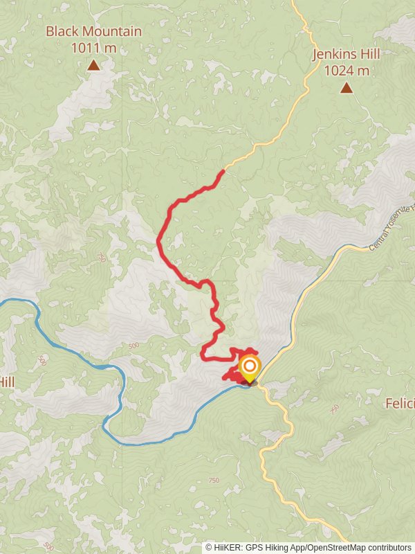
Burma Grade Road is a scenic trail located near Mariposa County, California, offering hikers a moderately challenging experience with its 22 km (approximately 13.7 miles) out-and-back route. The trail boasts an elevation gain of around 600 meters (roughly 1968 feet), providing a steady climb that is sure to get your heart pumping.
Getting to the Trailhead To reach the starting point of the Burma Grade Road trail, you can either drive or use public transportation. If driving, you can navigate to the trailhead by setting your destination near Mariposa County, where parking is typically available along the roadside. For those opting for public transport, check local transit schedules for the nearest routes and stops to the trail's vicinity.
Navigating the Trail As you embark on your hike, you can rely on HiiKER to assist with navigation, ensuring you stay on the correct path. The trail begins with a gentle incline, winding through a landscape dotted with oak trees and chaparral, typical of the Sierra Nevada foothills. The terrain here is a mix of dirt and gravel, and while it is well-defined, it's always wise to keep an eye on your navigation tools to stay on track.
Landmarks and Scenery As you progress, the trail offers expansive views of the surrounding mountains and valleys. Approximately halfway through the hike, you'll reach a notable vantage point that allows for a panoramic view of the region, making for an excellent spot to rest and take in the scenery.
Flora and Fauna The area is rich in biodiversity, with a chance to spot local wildlife such as deer, coyotes, and various bird species. The trail is also home to a variety of plant life, including wildflowers in the spring, which add a splash of color to the landscape.
Historical Significance Burma Grade Road has historical roots, as it was once used by early settlers and miners during the Gold Rush era. As you hike, you may come across remnants of this period, such as old mine shafts and equipment, which serve as a reminder of the region's rich past.
Preparation and Planning Before setting out, ensure you have adequate water, as there are no reliable water sources along the trail. The California climate can be quite warm, especially in the summer months, so sun protection and plenty of hydration are crucial. It's also advisable to check the weather forecast and start early to avoid the midday heat.
Safety and Etiquette Remember to follow Leave No Trace principles, keeping the trail clean and undisturbed for wildlife and fellow hikers. As the trail is shared with mountain bikers and occasionally vehicles, stay alert and be prepared to yield the right of way when necessary.
By preparing accordingly and respecting the natural and historical significance of the area, hikers can enjoy a fulfilling experience on the Burma Grade Road trail, taking in the beauty and history that Mariposa County has to offer.
Reviews
User comments, reviews and discussions about the Burma Grade Road, California.
5.0
average rating out of 5
6 rating(s)


