Download
Preview
Add to list
More
9.5 km
~2 hrs 34 min
400 m
Out and Back
“"Experience a rewarding 10-kilometer hike through diverse flora, wildlife, and historic landmarks to Goat Mountain Lookout."”
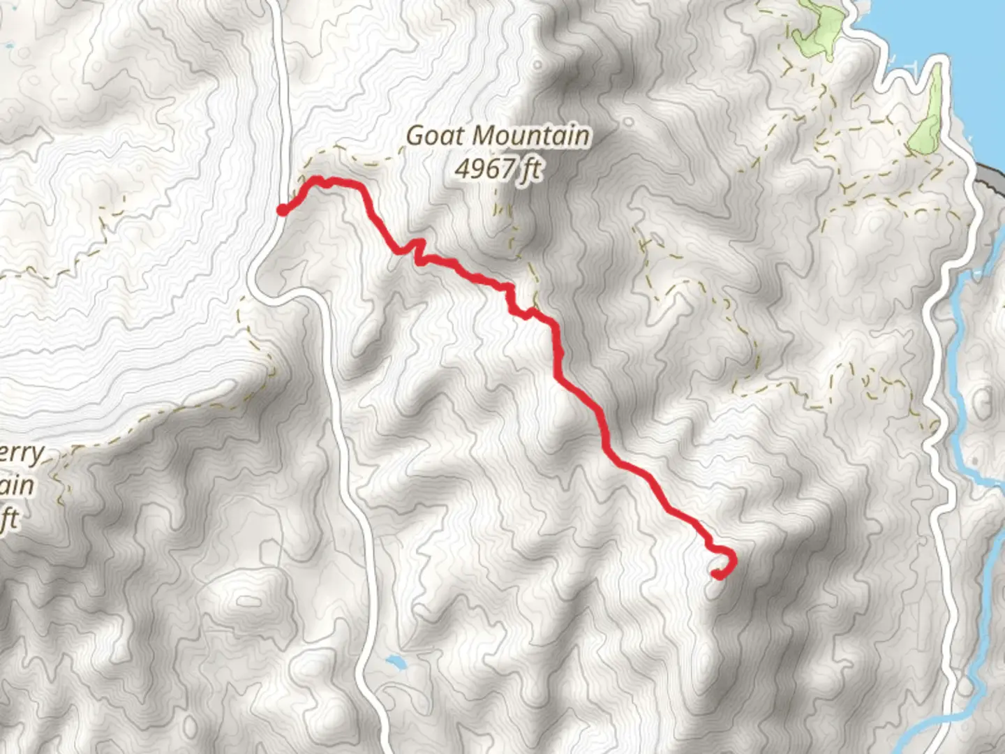
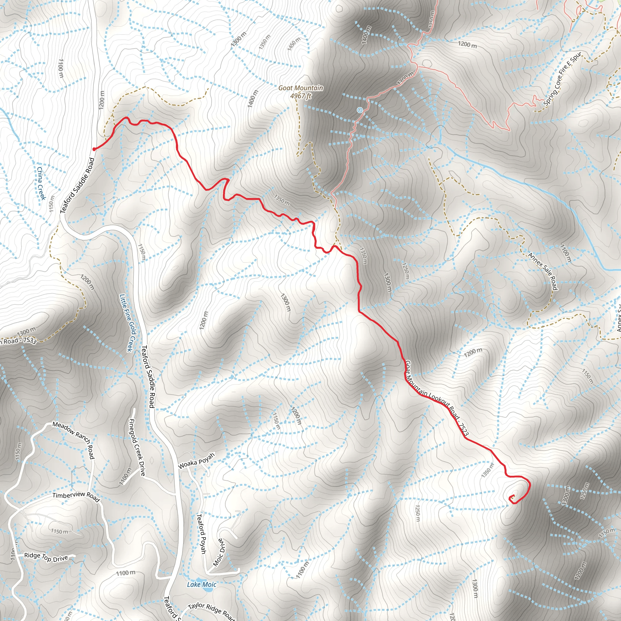
Starting near Madera County, California, the Goat Mountain Lookout Road trail offers a rewarding out-and-back hike that spans approximately 10 kilometers (6.2 miles) with an elevation gain of around 400 meters (1,312 feet). This trail is rated as medium difficulty, making it suitable for moderately experienced hikers.
Getting There To reach the trailhead, you can drive or use public transportation. If driving, head towards the nearest significant landmark, Bass Lake, California. From Bass Lake, follow the signs to Goat Mountain Lookout Road. For those using public transport, the nearest bus stop is in Oakhurst, California, from where you can take a taxi or rideshare service to the trailhead.
Trail Overview The trail begins with a gentle ascent through a mixed forest of pine and oak trees. Early on, you’ll encounter a few switchbacks that help to manage the elevation gain. The first 2 kilometers (1.2 miles) are relatively easy, with an elevation gain of about 100 meters (328 feet), making it a good warm-up for the more challenging sections ahead.
Flora and Fauna As you ascend, keep an eye out for the diverse flora and fauna. The area is home to mule deer, black bears, and a variety of bird species, including the Steller's Jay and the Mountain Chickadee. The forest floor is often carpeted with wildflowers in the spring and early summer, adding a splash of color to your hike.
Midway Point Around the 5-kilometer (3.1-mile) mark, you’ll reach a small clearing that offers a perfect spot for a short break. Here, you can enjoy panoramic views of the surrounding Sierra Nevada mountains. This is also a good place to check your progress using the HiiKER app, ensuring you’re on the right path.
Historical Significance The trail has historical significance as it leads to the Goat Mountain Lookout, a fire lookout tower that has been in operation since the early 20th century. The lookout was originally built to help spot forest fires in the Sierra National Forest, and it still serves that purpose today. The tower itself is a testament to early forest conservation efforts in the United States.
Final Ascent The final 3 kilometers (1.9 miles) involve a steeper ascent, gaining the remaining 300 meters (984 feet) in elevation. This section can be challenging, especially if the weather is hot, so make sure to bring plenty of water and take breaks as needed. The trail becomes rockier and more rugged as you approach the summit, so good hiking boots are essential.
Reaching the Lookout Upon reaching the Goat Mountain Lookout, you’ll be rewarded with breathtaking 360-degree views of the Sierra Nevada range and Bass Lake below. The lookout tower itself is often open to visitors, providing an excellent vantage point for photography and a deeper appreciation of the region's natural beauty.
Descent The return journey follows the same path, offering a chance to enjoy the scenery from a different perspective. Be cautious on the descent, as the rocky sections can be slippery, especially if it has rained recently.
Navigation and Safety For navigation, the HiiKER app is highly recommended. It provides real-time updates and ensures you stay on the correct path. Always check the weather forecast before heading out, and let someone know your plans, especially since cell service can be spotty in this remote area.
This trail offers a mix of natural beauty, wildlife, and historical significance, making it a must-visit for any hiking enthusiast exploring the Sierra Nevada region.
What to expect?
Activity types
Comments and Reviews
User comments, reviews and discussions about the Goat Mountain Lookout Road, California.
4.0
average rating out of 5
3 rating(s)
