Download
Preview
Add to list
More
42.9 km
~2 day
1406 m
Point-to-Point
“Embark on a challenging journey through Angeles National Forest's lush canyons, historic sites, and stunning vistas.”
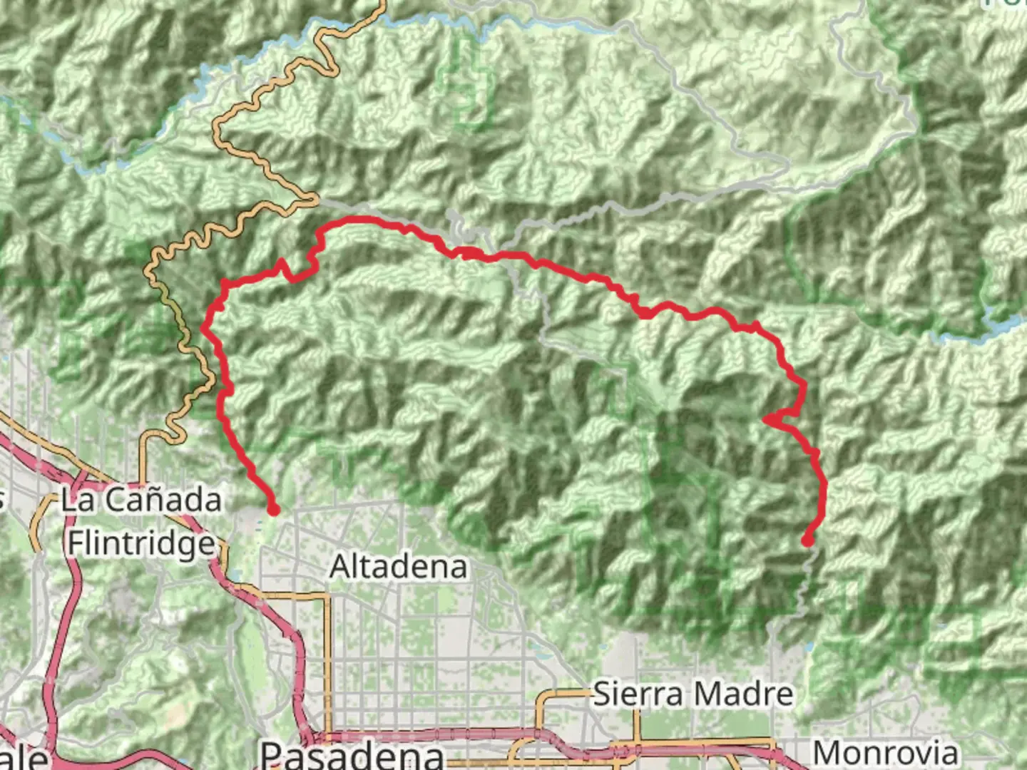
Starting your adventure on the Gabrielino Trail from Santa Anita Canyon Avenue, you'll find yourself immersed in the rugged beauty of the Angeles National Forest, just a short drive from Los Angeles County, California. This point-to-point trail stretches approximately 43 kilometers (about 27 miles) with an elevation gain of around 1,400 meters (approximately 4,600 feet), offering a challenging yet rewarding experience for seasoned hikers.
Getting There
To reach the trailhead, head towards the Chantry Flat Recreation Area, which is accessible by car. From downtown Los Angeles, take the I-210 freeway to Santa Anita Avenue and drive north until you reach the Chantry Flat parking area. Be aware that parking can be limited, especially on weekends, so arriving early is advisable. For those relying on public transport, the Metro Gold Line can take you to Arcadia Station, from where you can catch a local taxi or rideshare service to the trailhead.
Trail Highlights
As you embark on the Gabrielino Trail, you'll traverse a diverse landscape that includes lush canyons, serene streams, and towering pine forests. The trail is well-marked, but it's recommended to use the HiiKER app for navigation to ensure you stay on track.
#### Nature and Wildlife
The trail is home to a rich variety of flora and fauna. Keep an eye out for the vibrant wildflowers that bloom in spring and the majestic oak and sycamore trees that provide shade along the way. Wildlife enthusiasts might spot mule deer, bobcats, and a variety of bird species, including the striking Steller's jay.
#### Significant Landmarks
One of the first notable landmarks you'll encounter is Sturtevant Falls, located about 6 kilometers (3.7 miles) from the trailhead. This picturesque waterfall is a popular spot for a rest and photo opportunity. Continuing along the trail, you'll pass through the historic Sturtevant Camp, established in 1893, which offers a glimpse into the area's past as a retreat for city dwellers seeking respite in nature.
As you progress, the trail leads you through the heart of the San Gabriel Mountains, offering panoramic views of the surrounding peaks and valleys. The trail's highest point, Red Box Saddle, sits at an elevation of approximately 1,400 meters (4,600 feet) and provides a breathtaking vantage point to take in the expansive vistas.
Trail Challenges
The Gabrielino Trail is rated as difficult, primarily due to its length and elevation gain. Hikers should be prepared for steep ascents and descents, particularly in the sections leading to and from Red Box Saddle. The trail can be rocky and uneven, so sturdy hiking boots are essential. Additionally, water sources can be scarce, especially in the drier months, so carrying sufficient water is crucial.
Historical Significance
The Gabrielino Trail follows a route that has been used for centuries, originally by the indigenous Tongva people and later by early settlers and miners. The trail's historical significance is evident in the remnants of old cabins and campsites scattered along the way, offering a window into the region's rich cultural heritage.
Embarking on the Gabrielino Trail from Santa Anita Canyon Avenue is a journey through both natural beauty and history, providing a challenging yet unforgettable experience for those who venture into the heart of the Angeles National Forest.

What to expect?
Activity types
Comments and Reviews
User comments, reviews and discussions about the Gabrielino Trail from Santa Anita Canyon Avenue, California.
average rating out of 5
0 rating(s)