Download
Preview
Add to list
More
33.9 km
~3 days
2826 m
Multi-Day
“Embark on the epic Mount Whitney Trail for a breathtaking ascent to America's towering peak.”
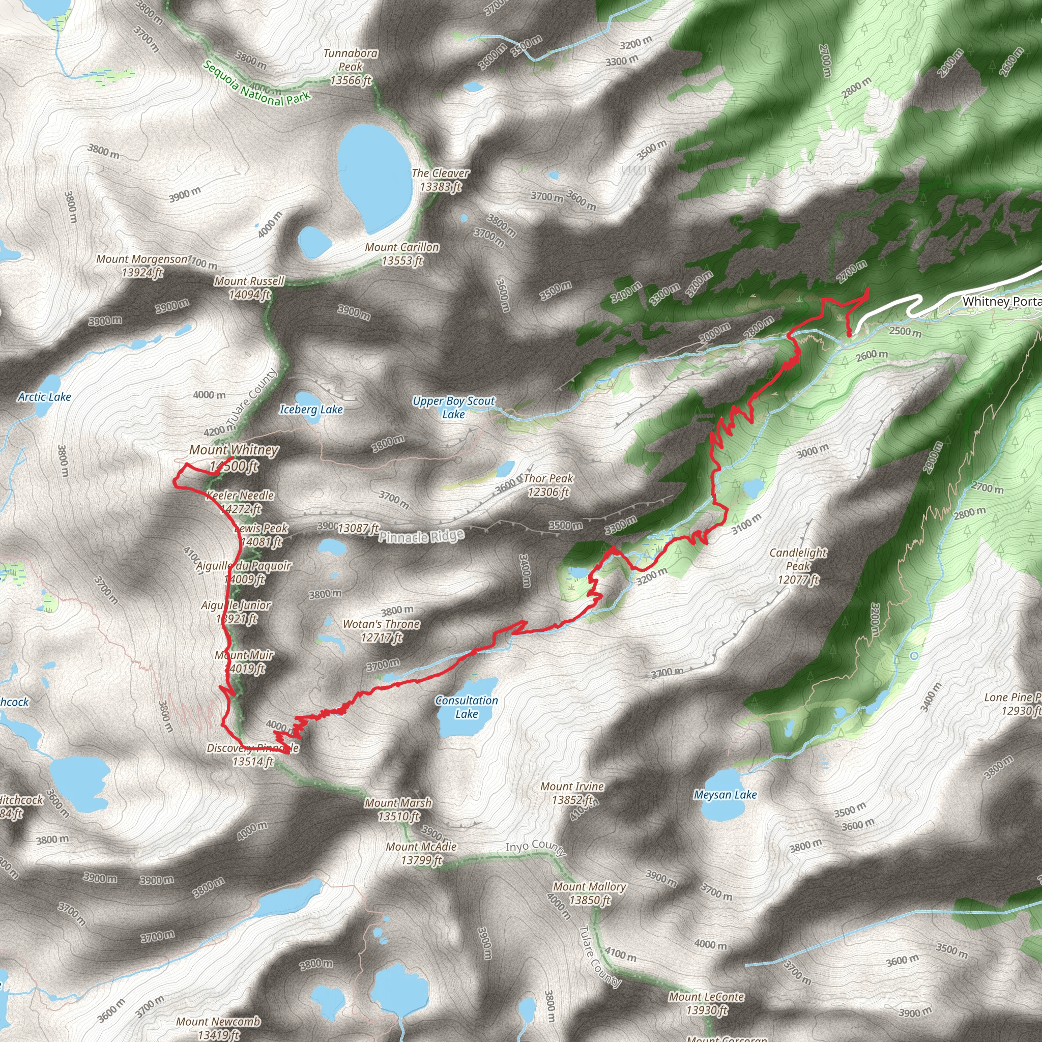
The Mount Whitney Trail is a challenging yet rewarding hike that takes you to the highest peak in the contiguous United States. Starting near Inyo County, California, the trailhead is accessible from Whitney Portal Road, which is about 13 miles (21 km) west of the town of Lone Pine. If you're driving, take the US-395 to Lone Pine and turn west onto Whitney Portal Road, following it to its end. For those relying on public transport, options are limited, but during the hiking season, there may be shuttle services available from Lone Pine to Whitney Portal.
Getting Started
As you embark on this approximately 21-mile (34 km) round-trip journey, you'll experience an elevation gain of roughly 9,200 feet (2800 meters). The trail is well-maintained but is considered extra difficult due to its length and the significant elevation gain involved. It's crucial to secure a permit for the Mount Whitney Zone, as this area is highly protected to preserve its natural beauty and to ensure the safety of hikers.
Navigating the Trail
The trail begins in a desert environment, quickly transitioning into the alpine zone as you ascend. You'll pass through the John Muir Wilderness and enter Sequoia National Park, where the trail is surrounded by ancient pines and rugged granite landscapes. The path is marked by cairns and switchbacks, which help manage the steep ascent. Hikers can use the HiiKER app to navigate the trail and keep track of their progress.
Landmarks and Scenery
One of the first significant landmarks you'll encounter is Lone Pine Lake, about 2.8 miles (4.5 km) from the trailhead. Continue on, and you'll reach Outpost Camp at around 3.8 miles (6.1 km), a popular spot for those who choose to break the hike into a multi-day trip. Mirror Lake is next, approximately 4.3 miles (6.9 km) from the start, offering stunning reflections of the surrounding peaks.
At around 6 miles (9.7 km), you'll arrive at Trail Camp, which is another common rest point. From here, you'll tackle the infamous 99 Switchbacks, a series of tight turns that gain elevation quickly and lead you to Trail Crest at 13,600 feet (4145 meters). This section offers breathtaking views of the High Sierras.
Summit Push
The final push to the summit of Mount Whitney is a 2-mile (3.2 km) trek from Trail Crest, with the trail becoming more rugged and the air thinner. The summit itself, at 14,505 feet (4,421 meters), provides a panoramic vista that includes the Great Western Divide and the Inyo National Forest.
Flora and Fauna
Throughout the hike, you'll encounter diverse wildlife, including marmots, pikas, and the occasional black bear. The flora ranges from sagebrush at lower elevations to alpine wildflowers and ancient bristlecone pines higher up.
Historical Significance
Mount Whitney is named after Josiah Whitney, the chief of the California Geological Survey. The region holds historical significance for both the indigenous people of the area and the early European settlers and explorers who mapped the West.
Preparation and Safety
Given the trail's difficulty and the potential for altitude sickness, it's essential to be well-prepared. Acclimatization, proper gear, and sufficient water and food supplies are critical. Weather can change rapidly, so be ready for cold and wind, even in summer months. Always check current conditions and start early to avoid afternoon thunderstorms.
Conclusion
The Mount Whitney Trail offers an unforgettable experience for seasoned hikers. With careful planning and respect for the trail's challenges, adventurers will find themselves immersed in the beauty of the High Sierras and rewarded with the accomplishment of reaching one of the most iconic summits in North America.
What to expect?
Activity types
Comments and Reviews
User comments, reviews and discussions about the Mount Whitney Trail, California.
5.0
average rating out of 5
1 rating(s)

