Download
Preview
Add to list
More
55.1 km
~4 days
2098 m
Multi-Day
“Embark on a breathtaking 55-km journey through the Eastern Sierra, scaling heights and exploring the majestic wilderness to Whitney Portal.”
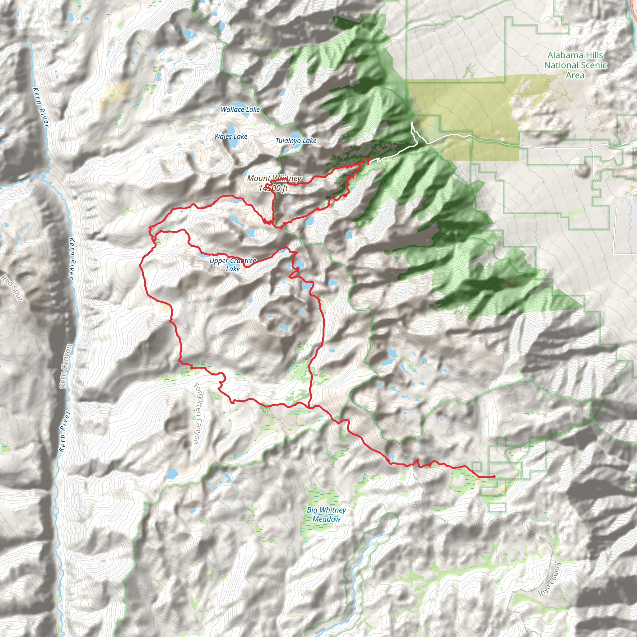
Embarking on the Horseshoe Meadow to Whitney Portal trail, hikers will traverse approximately 55 kilometers (34 miles) through the Eastern Sierra, with an elevation gain of around 2000 meters (6562 feet). This point-to-point journey begins near Inyo County, California, and is considered difficult due to its length, elevation gain, and potential for extreme weather conditions.
Getting to the Trailhead
The trailhead is accessible by car, located near Horseshoe Meadow, which can be reached from Lone Pine via the Whitney Portal Road and Horseshoe Meadow Road. For those relying on public transportation, options are limited, but during the hiking season, there may be shuttle services available from Lone Pine to the trailhead. It's advisable to check the latest shuttle schedules and availability before planning your trip.
The Journey Begins
Starting at an elevation of around 3,000 meters (10,000 feet) in the Golden Trout Wilderness, hikers will be greeted by expansive meadows and the towering presence of the Sierra Nevada. The trail meanders through a landscape dotted with foxtail pines and Jeffrey pines, offering a serene start to the adventure.
Ascending to New Heights
As the trail progresses, hikers will encounter a series of switchbacks leading to Cottonwood Pass. This section offers stunning views of the surrounding peaks and valleys. The trail continues through the John Muir Wilderness, where hikers will experience the beauty of alpine lakes and the rugged high Sierra terrain.
Landmarks and Natural Wonders
One of the most significant landmarks along the route is Mount Whitney, the highest peak in the contiguous United States, standing at 4,421 meters (14,505 feet). The trail does not summit Mount Whitney but offers views of its impressive eastern face as you approach Whitney Portal.
Wildlife Encounters
The region is home to a diverse array of wildlife, including mule deer, black bears, and mountain lions. Smaller creatures such as marmots and pikas are also common. Hikers should be aware of proper food storage techniques and bear safety precautions to protect both themselves and the wildlife.
Historical Significance
The area is rich in history, with the trail itself being part of the larger Pacific Crest Trail, which has been traveled by Native Americans, explorers, and hikers for centuries. The region played a significant role during the California Gold Rush and has been a focal point for conservation efforts.
Final Ascent to Whitney Portal
The last section of the trail descends into the Whitney Portal, where hikers will find the end of their journey. The descent is steep and can be challenging on the knees, so trekking poles are recommended. Upon reaching Whitney Portal, hikers can celebrate their accomplishment and enjoy the amenities available, including a store and campground.
Preparation and Planning
Due to the trail's difficulty and remote nature, it is essential to be well-prepared. Hikers should carry a detailed map, and it's recommended to use the HiiKER app for navigation. Water sources are available along the trail, but purification is necessary. Hikers should also be prepared for sudden weather changes and have appropriate gear for cold temperatures, even in summer.
Permits are required for overnight trips, and it's advisable to book these well in advance due to the trail's popularity. Always check the latest trail conditions and weather forecasts before setting out, and inform someone of your itinerary.
What to expect?
Activity types
Comments and Reviews
User comments, reviews and discussions about the Horseshoe Meadow to Whitney Portal, California.
4.83
average rating out of 5
6 rating(s)

