Download
Preview
Add to list
More
44.7 km
~3 days
1328 m
Multi-Day
“Journey through the Eastern Sierra Nevada's splendor on a scenic 45-km loop, replete with alpine lakes, rugged peaks, and diverse wildlife.”
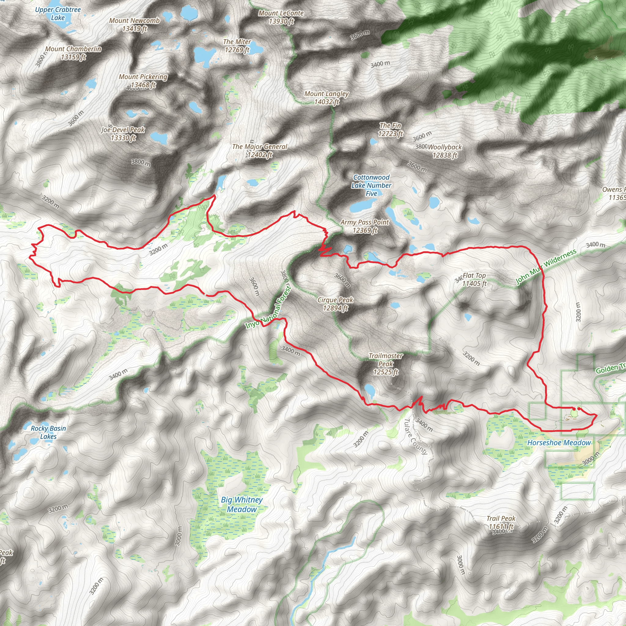
Embarking on the Cottonwood Lakes to Upper Rock Creek Loop, hikers will traverse a diverse landscape that showcases the stunning beauty of the Eastern Sierra Nevada. This approximately 45-kilometer (28-mile) journey begins near Inyo County, California, with a trailhead that's accessible by car. To reach the starting point, drivers should navigate towards Horseshoe Meadow Road, which leads to the Cottonwood Lakes Trailhead parking area. Public transportation options are limited in this remote region, so a personal vehicle is recommended.
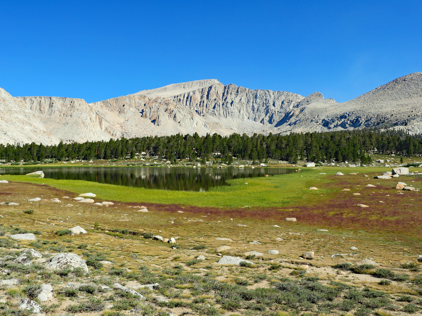
As you set out from the trailhead, you'll be greeted by the expansive meadows and towering pines characteristic of the area. The trail gradually ascends, offering a total elevation gain of around 1300 meters (4265 feet). The initial segment leads to the Cottonwood Lakes Basin, a series of pristine alpine lakes nestled beneath the imposing peaks of the Sierra Nevada. This area is a photographer's dream, with the reflective waters mirroring the sky and mountains.
Navigating the High Sierra
The trail is well-marked, but hikers should always carry a reliable navigation tool like HiiKER to ensure they stay on the correct path. As you progress, the route takes you through a series of switchbacks that climb towards New Army Pass. This section can be challenging, but the panoramic views from the pass are a worthy reward. From here, the trail descends into the Rock Creek watershed.
Landmarks and Natural Wonders
One of the highlights of this loop is the striking Cirque Peak, which hikers can choose to summit as a side trip. The peak offers a bird's-eye view of the surrounding wilderness, including the Miter Basin and Mount Langley, one of California's fourteeners. The trail continues through the Rock Creek area, where hikers can marvel at the stark beauty of the high desert landscape.
Wildlife and Flora
The region is home to a variety of wildlife, including mule deer, pikas, and the occasional black bear. Hikers should be bear-aware and practice proper food storage techniques. The trail also winds through areas rich in alpine flora, with wildflowers blooming in the summer months, adding splashes of color to the rugged terrain.
Historical Significance
The area is steeped in history, with the John Muir Wilderness nearby. It's named after the famed naturalist who played a crucial role in the establishment of the National Park Service. The region's trails have been used for centuries, first by indigenous peoples and later by explorers and miners during the California Gold Rush.
Preparation and Planning
Given the trail's medium difficulty rating, hikers should be in good physical condition and prepared for the altitude. Weather in the Sierra Nevada can change rapidly, so it's essential to pack layers and be prepared for all conditions. The best time to hike this loop is from June to September when the snow has typically melted, and the trails are more accessible.
Before setting out, ensure you have a valid wilderness permit, which is required for overnight trips in this area. It's also wise to check current trail conditions and weather forecasts. Remember to leave no trace, respecting the natural environment and preserving it for future generations.
By preparing adequately and respecting the wilderness, hikers can look forward to an unforgettable adventure on the Cottonwood Lakes to Upper Rock Creek Loop, filled with breathtaking vistas, challenging terrain, and the serene beauty of the High Sierra.
What to expect?
Activity types
Comments and Reviews
User comments, reviews and discussions about the Cottonwood Lakes to Upper Rock Creek Loop, California.
4.67
average rating out of 5
9 rating(s)

