Download
Preview
Add to list
More
275.0 km
~17 days
8446 m
Multi-Day
“Embark on the Tahoe to Yosemite Trail, a breathtaking odyssey through the Sierra Nevada's majestic wilderness.”
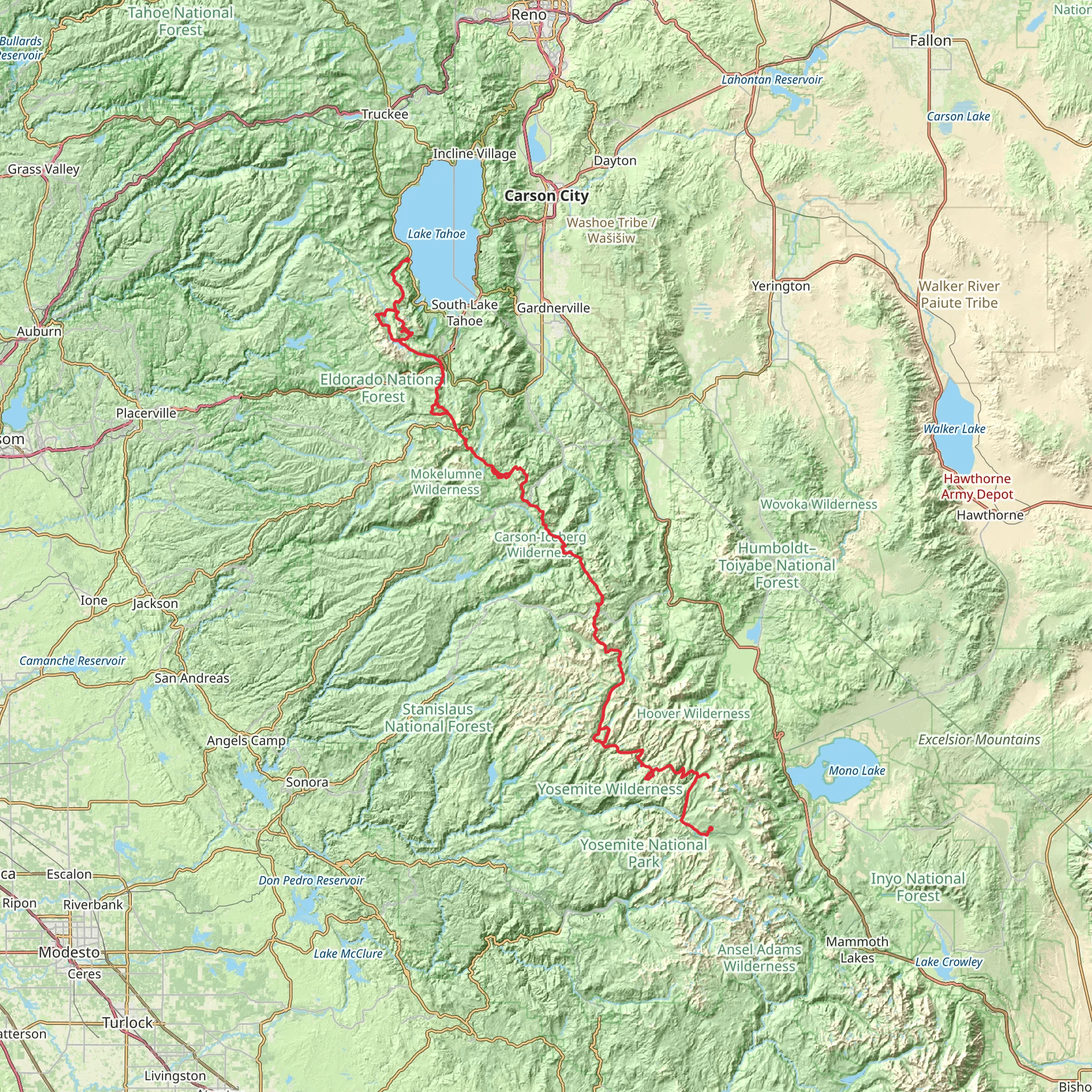
Spanning approximately 275 kilometers (170 miles) with an elevation gain of around 8400 meters (27,500 feet), the Tahoe to Yosemite Trail offers an immersive journey through the Sierra Nevada mountain range. This point-to-point trail begins near El Dorado County, California, and connects two of the most iconic natural landmarks in the United States: Lake Tahoe and Yosemite National Park.
Getting to the Trailhead
The trailhead is accessible by car, located near Meeks Bay on the western shore of Lake Tahoe. For those using public transportation, options are limited, but during the summer months, there are bus services that can get you close to the trailhead. Hikers often arrange for a shuttle or taxi service from nearby towns such as South Lake Tahoe to reach the starting point.
Navigating the Trail
Hikers can rely on the HiiKER app for detailed maps and navigation assistance throughout the journey. The trail is well-marked in most sections, but due to its length and remote nature, it's essential to have a reliable navigation tool, especially in areas where the trail may become less distinct.
Landmarks and Scenery
The trail meanders through a diverse range of landscapes, including alpine meadows, dense forests, and rugged mountain passes. Notable landmarks include the Desolation Wilderness, a starkly beautiful area characterized by granite peaks and crystal-clear lakes. Hikers will traverse the Mokelumne and Carson-Iceberg Wilderness areas, each offering unique geological features and a sense of solitude.
Wildlife and Nature
The region is home to a rich array of wildlife, including black bears, mule deer, and mountain lions. Birdwatchers may spot species such as the mountain bluebird and Clark's nutcracker. The trail also passes through habitats of the rare Sierra Nevada bighorn sheep. Hikers should be prepared for encounters with wildlife and know how to safely observe and coexist with the animals.
Historical Significance
The Tahoe to Yosemite Trail crosses paths with the Pacific Crest Trail and the John Muir Trail, both of which hold significant historical value for American hiking culture. The area is steeped in the history of the Native American tribes who originally inhabited the Sierra Nevada, as well as the later impacts of the Gold Rush and the development of the national parks.
Preparation and Planning
Given the trail's medium difficulty rating, hikers should be in good physical condition and have some backpacking experience. The best time to hike is from July to September when the snow has melted, and the weather is more stable. Hikers should plan for multiple days of trekking, with resupply points considered in towns such as Bridgeport or Tuolumne Meadows in Yosemite.
Water sources are generally plentiful, but all water should be treated before consumption. Hikers must also practice Leave No Trace principles to preserve the trail's pristine condition for future visitors.
Elevation and Distance
The trail's elevation gain is significant, with some passes exceeding 3,000 meters (10,000 feet). Acclimatization to altitude is important to prevent altitude sickness. The total distance of the trail requires a commitment of several weeks for most hikers, with an average of 15 to 25 kilometers (9 to 15 miles) covered per day, depending on individual pace and trail conditions.
Conclusion
The Tahoe to Yosemite Trail is a challenging yet rewarding experience for the seasoned hiker. With its breathtaking landscapes, diverse ecosystems, and historical significance, it offers an unforgettable adventure through the heart of the Sierra Nevada. Proper preparation, respect for the natural environment, and a spirit of adventure are key to a successful and enjoyable journey on this iconic trail.
What to expect?
Activity types
Comments and Reviews
User comments, reviews and discussions about the Tahoe To Yosemite Trail, California.
4.6
average rating out of 5
5 rating(s)

